
| Birth | : | 17 Mar 1915 Oneida, Nemaha County, Kansas, USA |
| Death | : | 28 May 2004 Sabetha, Nemaha County, Kansas, USA |
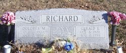
| Burial | : | Netawaka Cemetery, Netawaka, Jackson County, USA |
| Coordinate | : | 39.6075300, -95.7223700 |
| Description | : | GOFF-Theda M. Volz, 89, Sabetha, formerly of Goff, died Friday, May 28, 2004, at Sabetha Community Hospital. She was born March 17, 1915, in Oneida, the daughter of Charles and Grace Schafer Richard. She worked for the 1st National Bank in Goff for several years. She then managed the Goff Grain Co. from 1942 to 1968 and remained in Goff until 1997, when she moved to Sabetha. Mrs. Volz was a member of Goff United Methodist Church and the church WSCS. She was also a member of the Federated Woman's Club at Goff. She married Earl F. Volz on Feb.... Read More |
frequently asked questions (FAQ):
-
Where is Theda M Richard Volz's memorial?
Theda M Richard Volz's memorial is located at: Netawaka Cemetery, Netawaka, Jackson County, USA.
-
When did Theda M Richard Volz death?
Theda M Richard Volz death on 28 May 2004 in Sabetha, Nemaha County, Kansas, USA
-
Where are the coordinates of the Theda M Richard Volz's memorial?
Latitude: 39.6075300
Longitude: -95.7223700
Family Members:
Parent

Spouse
Siblings
Children
Flowers:


Nearby Cemetories:
1. Netawaka Cemetery
Netawaka, Jackson County, USA
Coordinate: 39.6075300, -95.7223700
2. Pleasant Grove Cemetery
Jackson County, USA
Coordinate: 39.5664000, -95.7789000
3. South Powhattan Cemetery
Powhattan, Brown County, USA
Coordinate: 39.6608009, -95.7596970
4. Wetmore Cemetery
Wetmore, Nemaha County, USA
Coordinate: 39.6396800, -95.8108400
5. Grant-Mjessepe Cemetery
Horton, Brown County, USA
Coordinate: 39.6663000, -95.6576000
6. Spring Hill Cemetery
Whiting, Jackson County, USA
Coordinate: 39.6021996, -95.6121979
7. Jessepe Indian Cemetery
Horton, Brown County, USA
Coordinate: 39.6715000, -95.6438000
8. Kennekuk Church Cemetery
Horton, Brown County, USA
Coordinate: 39.7074600, -95.6672300
9. Estes Cemetery
Jackson County, USA
Coordinate: 39.5346985, -95.6168976
10. Wolfley Cemetery
Goff, Nemaha County, USA
Coordinate: 39.6454400, -95.8633900
11. Carmel Cemetery
Circleville, Jackson County, USA
Coordinate: 39.4984400, -95.7967700
12. Wheatland Cemetery
Atchison County, USA
Coordinate: 39.6453018, -95.5633011
13. Ontario Cemetery
Nemaha County, USA
Coordinate: 39.5663795, -95.8885193
14. Wyant Family Cemetery
Holton, Jackson County, USA
Coordinate: 39.4778520, -95.6614440
15. Granada Cemetery
Granada, Nemaha County, USA
Coordinate: 39.7324982, -95.7988968
16. Thompson-Burns Cemetery
Whiting, Jackson County, USA
Coordinate: 39.5062100, -95.5980710
17. Mount Calvary Catholic Cemetery
Holton, Jackson County, USA
Coordinate: 39.4700012, -95.7702026
18. Bradley Family Cemetery
Holton, Jackson County, USA
Coordinate: 39.4644928, -95.6813889
19. Comet Cemetery
Powhattan Township, Brown County, USA
Coordinate: 39.7542600, -95.7340400
20. Holton Cemetery
Holton, Jackson County, USA
Coordinate: 39.4611015, -95.7583008
21. Saint Peters Cemetery
Mercier, Brown County, USA
Coordinate: 39.7247009, -95.6016998
22. Lutheran Cemetery
Mercier, Brown County, USA
Coordinate: 39.7250500, -95.6000710
23. Grasshopper Burial Ground
Powhattan Township, Brown County, USA
Coordinate: 39.7578020, -95.6949820
24. Barnes Cemetery
Goff, Nemaha County, USA
Coordinate: 39.6960983, -95.8824997