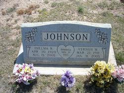
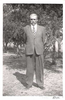
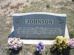
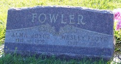
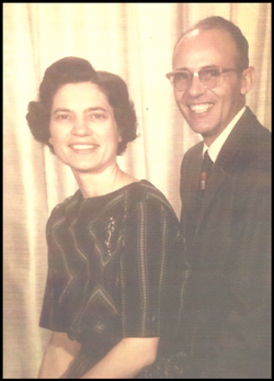
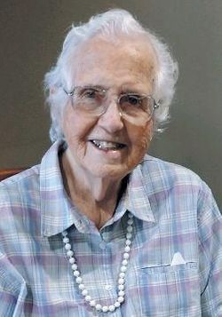
Thelma Rowena Fowler Johnson
| Birth | : | 30 Apr 1920 Crosbyton, Crosby County, Texas, USA |
| Death | : | 15 Aug 2005 Sterling, Rice County, Kansas, USA |
| Burial | : | Stockdale Cemetery, Big Sandy, Benton County, USA |
| Coordinate | : | 36.3243550, -88.0177690 |
frequently asked questions (FAQ):
-
Where is Thelma Rowena Fowler Johnson's memorial?
Thelma Rowena Fowler Johnson's memorial is located at: Stockdale Cemetery, Big Sandy, Benton County, USA.
-
When did Thelma Rowena Fowler Johnson death?
Thelma Rowena Fowler Johnson death on 15 Aug 2005 in Sterling, Rice County, Kansas, USA
-
Where are the coordinates of the Thelma Rowena Fowler Johnson's memorial?
Latitude: 36.3243550
Longitude: -88.0177690
Family Members:
Parent
Spouse
Siblings
Flowers:
Nearby Cemetories:
1. Stockdale Cemetery
Big Sandy, Benton County, USA
Coordinate: 36.3243550, -88.0177690
2. Lick Creek Church Cemetery
Big Sandy, Benton County, USA
Coordinate: 36.3214910, -88.0213010
3. Herndon Cemetery
Big Sandy, Benton County, USA
Coordinate: 36.3234460, -88.0032510
4. Daniel Cemetery
Benton County, USA
Coordinate: 36.3235970, -88.0031586
5. Ralls Cemetery
Lick Creek, Benton County, USA
Coordinate: 36.3398060, -88.0004690
6. Precinct Cemetery
Big Sandy, Benton County, USA
Coordinate: 36.3009500, -88.0284500
7. Oak Hill Church Cemetery
Benton County, USA
Coordinate: 36.3325890, -88.0643370
8. Mount Carmel Congregational Methodist Church Cemet
Big Sandy, Benton County, USA
Coordinate: 36.2869850, -88.0377230
9. Dortch Cemetery
Big Sandy, Benton County, USA
Coordinate: 36.3303010, -88.0764280
10. Grafried Cemetery
Houston County, USA
Coordinate: 36.3311005, -87.9591980
11. Liberty Cemetery
Lick Creek, Benton County, USA
Coordinate: 36.3436012, -88.0727997
12. Leegan Cemetery
Benton County, USA
Coordinate: 36.3292590, -88.0784920
13. Wilson Cemetery
Benton County, USA
Coordinate: 36.2844009, -87.9811020
14. Bomar Hill Cemetery
Stewart County, USA
Coordinate: 36.3633003, -87.9785995
15. Medlock Cemetery
Big Sandy, Benton County, USA
Coordinate: 36.3210000, -88.0799320
16. Mount Zion Cemetery
Henry County, USA
Coordinate: 36.3710830, -88.0424900
17. Cooper Cemetery
Big Sandy, Benton County, USA
Coordinate: 36.2783480, -88.0462480
18. Mathis Cemetery
Houston County, USA
Coordinate: 36.3208008, -87.9539032
19. John Bush Cemetery
McKinnon, Houston County, USA
Coordinate: 36.3415600, -87.9513400
20. Pierce Cemetery
Big Sandy, Benton County, USA
Coordinate: 36.2972060, -88.0789180
21. Cherry Cemetery
Houston County, USA
Coordinate: 36.3372002, -87.9452972
22. Evans Cemetery
Lick Creek, Benton County, USA
Coordinate: 36.3545670, -88.0823190
23. Crooked Creek Cemetery
Faxon, Benton County, USA
Coordinate: 36.2738300, -87.9768790
24. Lankford Cemetery
Big Sandy, Benton County, USA
Coordinate: 36.2738000, -87.9769000

