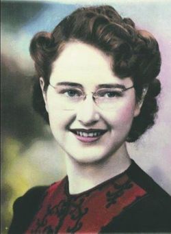
Thelma “Toots” Curtis Wells
| Birth | : | 1 Dec 1924 Brewster, Okanogan County, Washington, USA |
| Death | : | 13 Sep 2020 |
| Burial | : | Locust Grove Cemetery, Brewster, Okanogan County, USA |
| Coordinate | : | 48.1114006, -119.7746964 |
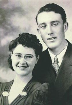
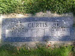
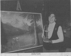
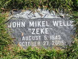
| Description | : | Thelma Wells, affectionately known as “Toots”, went to heaven on Sept. 13, 2020. Toots was born in Brewster, Washington on Dec. 1, 1924 to Avilda and Wes Curtis. On Nov. 24, 1946 she married Jack Wells in Coeur d’Alene, Idaho. They then started ranching at La Fleur, Washington. Toots was an avid seamstress and canned many years where she won hundreds of ribbons at the Waterville and Okanogan fairs. They moved to Bridgeport in 1957 so their two sons, Zeke and Melvin, could attend school. In 1963 they were voted cattlemen of the year.... Read More |
frequently asked questions (FAQ):
-
Where is Thelma “Toots” Curtis Wells's memorial?
Thelma “Toots” Curtis Wells's memorial is located at: Locust Grove Cemetery, Brewster, Okanogan County, USA.
-
When did Thelma “Toots” Curtis Wells death?
Thelma “Toots” Curtis Wells death on 13 Sep 2020 in
-
Where are the coordinates of the Thelma “Toots” Curtis Wells's memorial?
Latitude: 48.1114006
Longitude: -119.7746964
Family Members:
Parent
Spouse
Siblings
Children
Flowers:
Nearby Cemetories:
1. Locust Grove Cemetery
Brewster, Okanogan County, USA
Coordinate: 48.1114006, -119.7746964
2. Elizabeth Osborn Mikel Gravesite
Brewster, Okanogan County, USA
Coordinate: 48.1498900, -119.7514700
3. Paradise Hill Cemetery
Brewster, Okanogan County, USA
Coordinate: 48.1848980, -119.8411900
4. Fort Okanogan Memorial Cemetery
Okanogan, Okanogan County, USA
Coordinate: 48.1594009, -119.6632996
5. Packwood Memorial Cemetery
Dyer, Douglas County, USA
Coordinate: 48.0118305, -119.8178880
6. Pateros Cemetery
Pateros, Okanogan County, USA
Coordinate: 48.0516600, -119.9097300
7. Dick Family Cemetery
Okanogan County, USA
Coordinate: 48.0502700, -119.9241700
8. Miller Family Cemetery
Okanogan County, USA
Coordinate: 48.0530300, -119.9288000
9. Bridgeport Cemetery
Bridgeport, Douglas County, USA
Coordinate: 48.0050000, -119.6738800
10. Chiliwist Cemetery
Okanogan County, USA
Coordinate: 48.2630997, -119.7363968
11. Methow Cemetery
Methow, Okanogan County, USA
Coordinate: 48.1102982, -120.0124969
12. Malott Community Cemetery
Malott, Okanogan County, USA
Coordinate: 48.2925000, -119.7047300
13. Cameron Lake Pioneer Memorial Cemetery
Malott, Okanogan County, USA
Coordinate: 48.2708330, -119.5700000
14. Buckingham Cemetery
Douglas County, USA
Coordinate: 47.8669014, -119.6286011
15. Okanogan City Cemetery
Okanogan, Okanogan County, USA
Coordinate: 48.3546982, -119.6061020
16. Beaver Creek Cemetery
Twisp, Okanogan County, USA
Coordinate: 48.3272000, -120.0564000
17. Spring Coulee Family Cemetery
Okanogan County, USA
Coordinate: 48.3895950, -119.6289460
18. Chelan Fraternal Cemetery
Chelan, Chelan County, USA
Coordinate: 47.8502998, -120.0081024
19. Mount Olivet Cemetery
Chelan, Chelan County, USA
Coordinate: 47.8451000, -119.9946000
20. Okanogan Valley Memorial Gardens
Omak, Okanogan County, USA
Coordinate: 48.3911018, -119.5691986
21. Omak Memorial Cemetery
Okanogan, Okanogan County, USA
Coordinate: 48.3874000, -119.5565800
22. Mansfield Cemetery
Mansfield, Douglas County, USA
Coordinate: 47.8088880, -119.6508330
23. Riverview Cemetery
Chelan, Chelan County, USA
Coordinate: 47.8335991, -119.9944000
24. Saint Andrews Episcopal Church
Chelan, Chelan County, USA
Coordinate: 47.8397460, -120.0183780

