
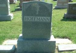

Theodore Joseph “Tade” Hoffmann
| Birth | : | 11 Mar 1876 Plymouth County, Iowa, USA |
| Death | : | 7 Jul 1947 Johnson Township, Plymouth County, Iowa, USA |
| Burial | : | San Joaquin Valley National Cemetery, Santa Nella, Merced County, USA |
| Coordinate | : | 37.1198170, -121.0738000 |
| Inscription | : | Father |
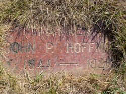
| Description | : | Theodore Hoffman Died Monday, July 7 At Farm Home Johnson Township Resident Ill For A Short Time Theodore Hoffman, Johnson Township farmer, died suddenly at his home, July 7, after only a few hours illness. Mr. Hoffman had recently taken over the care of seven orphaned grandchildren, whose father died two years ago, and whose mother, Mrs. Newman, a daughter of Mr. Hoffman, died last week. Theodore Hoffman was born March 11, 1876, in Plymouth County, the son of Mr. and Mrs. J. P. Hoffman and spent his entire life here. On February 3, 1904, he was married to Catherine... Read More |
frequently asked questions (FAQ):
-
Where is Theodore Joseph “Tade” Hoffmann's memorial?
Theodore Joseph “Tade” Hoffmann's memorial is located at: San Joaquin Valley National Cemetery, Santa Nella, Merced County, USA.
-
When did Theodore Joseph “Tade” Hoffmann death?
Theodore Joseph “Tade” Hoffmann death on 7 Jul 1947 in Johnson Township, Plymouth County, Iowa, USA
-
Where are the coordinates of the Theodore Joseph “Tade” Hoffmann's memorial?
Latitude: 37.1198170
Longitude: -121.0738000
Family Members:
Parent

Spouse

Siblings
Flowers:


Nearby Cemetories:
1. San Joaquin Valley National Cemetery
Santa Nella, Merced County, USA
Coordinate: 37.1198170, -121.0738000
2. Cottonwood Cemetery
Gustine, Merced County, USA
Coordinate: 37.1878128, -121.0403900
3. Harper Family Cemetery
Los Banos, Merced County, USA
Coordinate: 37.0215379, -121.1236853
4. Calvary Cemetery
Los Banos, Merced County, USA
Coordinate: 37.0486800, -120.8547000
5. Los Banos Cemetery
Los Banos, Merced County, USA
Coordinate: 37.0470200, -120.8547000
6. Hills Ferry Cemetery
Newman, Stanislaus County, USA
Coordinate: 37.3321991, -121.0496979
7. Stevinson Sunnyside Cemetery
Stevinson, Merced County, USA
Coordinate: 37.3292007, -120.9231033
8. Colonel James J Stevinson Cemetery
Stevinson, Merced County, USA
Coordinate: 37.3572044, -120.9112320
9. South Hilmar Cemetery
Hilmar, Merced County, USA
Coordinate: 37.3802681, -120.8868408
10. North Hilmar Cemetery
Hilmar, Merced County, USA
Coordinate: 37.4146614, -120.8864288
11. Calvary-Sacred Heart Cemetery
Hollister, San Benito County, USA
Coordinate: 36.8483009, -121.3767014
12. Saint Benedicts Columbarium
Hollister, San Benito County, USA
Coordinate: 36.8337440, -121.3667120
13. Dos Palos Cemetery
Dos Palos, Merced County, USA
Coordinate: 36.9831009, -120.6357651
14. Odd Fellows Cemetery
Hollister, San Benito County, USA
Coordinate: 36.8571210, -121.4104100
15. Paul Gerber Memorial Cemetery
Santa Clara County, USA
Coordinate: 37.3637830, -121.4857920
16. Turlock Memorial Park
Turlock, Stanislaus County, USA
Coordinate: 37.4937592, -120.8659821
17. Saint Mary Church Cemetery
Gilroy, Santa Clara County, USA
Coordinate: 37.0155970, -121.5765950
18. Patterson District Cemetery
Patterson, Stanislaus County, USA
Coordinate: 37.5268135, -121.1728287
19. Saint Mary Cemetery
Gilroy, Santa Clara County, USA
Coordinate: 37.0134300, -121.5882000
20. Saint Francis Episcopal Church Columbarium
Turlock, Stanislaus County, USA
Coordinate: 37.5014300, -120.8368400
21. Gavilan Hills Memorial Park
Gilroy, Santa Clara County, USA
Coordinate: 37.0124000, -121.5909200
22. Paicines Cemetery
Paicines, San Benito County, USA
Coordinate: 36.7088580, -121.2456330
23. Winton Cemetery
Winton, Merced County, USA
Coordinate: 37.3820267, -120.6260223
24. Grayson Cemetery
Grayson, Stanislaus County, USA
Coordinate: 37.5594559, -121.1802826