
| Memorials | : | 286 |
| Location | : | Gilroy, Santa Clara County, USA |
| Coordinate | : | 37.0155970, -121.5765950 |
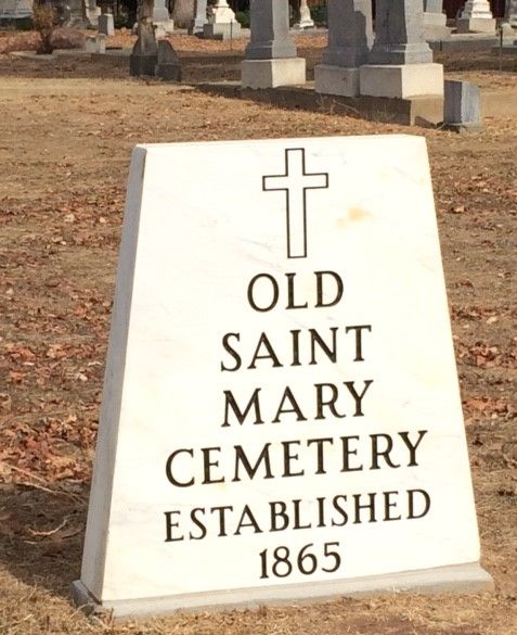
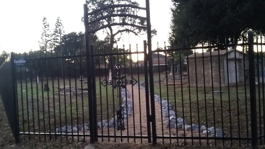
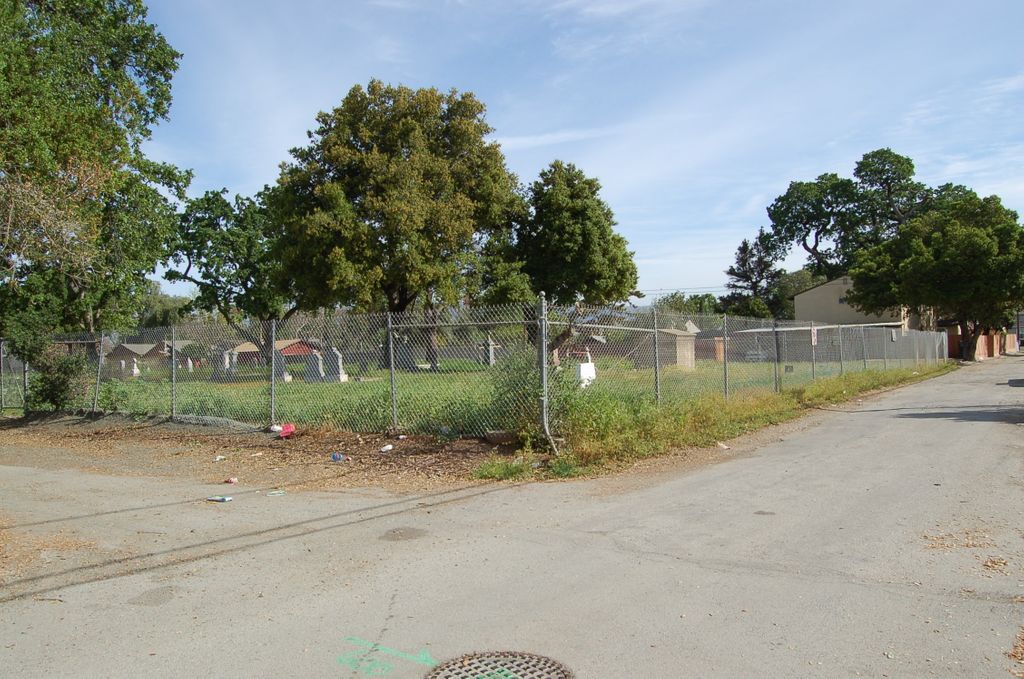
| Description | : | This is the original Saint Mary's Cemetery, referred to as the "Old" Saint Mary's Cemetery by the administrators at Saint Mary‘s Catholic Church. Sitting within a residential area, this small piece of land is located down an alley between Church and Hanna Streets, North of First Street. It was established in 1865, but the first burial took place in 1866. Many of the headstones are damaged or missing. The gates are locked and permission is needed to enter. There is a second, newer and much larger Saint Mary's Cemetery on First Street (Hecker Pass Road). |
frequently asked questions (FAQ):
-
Where is Saint Mary Church Cemetery?
Saint Mary Church Cemetery is located at Fronts an alley between Church and Hanna Streets, North of First Street Gilroy, Santa Clara County ,California , 95020USA.
-
Saint Mary Church Cemetery cemetery's updated grave count on graveviews.com?
286 memorials
-
Where are the coordinates of the Saint Mary Church Cemetery?
Latitude: 37.0155970
Longitude: -121.5765950
Nearby Cemetories:
1. Saint Mary Cemetery
Gilroy, Santa Clara County, USA
Coordinate: 37.0134300, -121.5882000
2. Gavilan Hills Memorial Park
Gilroy, Santa Clara County, USA
Coordinate: 37.0124000, -121.5909200
3. Mount Hope Cemetery
Morgan Hill, Santa Clara County, USA
Coordinate: 37.1195900, -121.6530000
4. Pajaro Valley Memorial Park
Watsonville, Santa Cruz County, USA
Coordinate: 36.9629669, -121.7219391
5. Valley Public Cemetery
Watsonville, Santa Cruz County, USA
Coordinate: 36.9418983, -121.7400513
6. Valley Catholic Cemetery
Watsonville, Santa Cruz County, USA
Coordinate: 36.9415932, -121.7405777
7. San Juan Bautista Cemetery
San Juan Bautista, San Benito County, USA
Coordinate: 36.8457985, -121.5438995
8. Mission San Juan Bautista Cemetery
San Juan Bautista, San Benito County, USA
Coordinate: 36.8460007, -121.5339966
9. Pioneer Cemetery
Watsonville, Santa Cruz County, USA
Coordinate: 36.9258560, -121.7642790
10. Watsonville Catholic Cemetery
Watsonville, Santa Cruz County, USA
Coordinate: 36.9278564, -121.7658463
11. All Saints Episcopal Church Memorial Garden
Watsonville, Santa Cruz County, USA
Coordinate: 36.9102310, -121.7568950
12. Hambey Cemetery
Monterey County, USA
Coordinate: 36.8372002, -121.6793976
13. Monterey Bay Loved Pet Cemetery
Monterey County, USA
Coordinate: 36.8326160, -121.6812820
14. Odd Fellows Cemetery
Hollister, San Benito County, USA
Coordinate: 36.8571210, -121.4104100
15. Saint Josephs Monastery Cemetery
Aptos, Santa Cruz County, USA
Coordinate: 36.9947200, -121.8361700
16. Day Valley Cemetery
Aptos, Santa Cruz County, USA
Coordinate: 36.9974050, -121.8503360
17. Calvary-Sacred Heart Cemetery
Hollister, San Benito County, USA
Coordinate: 36.8483009, -121.3767014
18. Christ Lutheran Church Columbarium
Aptos, Santa Cruz County, USA
Coordinate: 36.9700550, -121.8704370
19. Stephen Norriss Gravesite
Monterey County, USA
Coordinate: 36.8214110, -121.7601080
20. Saint Benedicts Columbarium
Hollister, San Benito County, USA
Coordinate: 36.8337440, -121.3667120
21. Hacienda Cemetery and Memorial Park
New Almaden, Santa Clara County, USA
Coordinate: 37.1741940, -121.8230920
22. Hidalgo Cemetery
San Jose, Santa Clara County, USA
Coordinate: 37.1707800, -121.8358700
23. Guadalupe Cemetery
New Almaden, Santa Clara County, USA
Coordinate: 37.1734690, -121.8402820
24. Queen of Heaven Cemetery
Prunedale, Monterey County, USA
Coordinate: 36.7602425, -121.6611252