

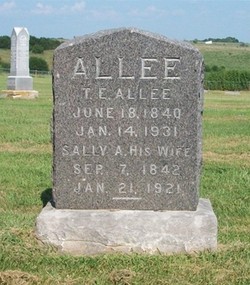
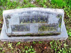
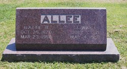
Thomas Edward Allee
| Birth | : | 18 Jun 1840 Clarksburg, Moniteau County, Missouri, USA |
| Death | : | 14 Jan 1931 Pilot Grove Township, Moniteau County, Missouri, USA |
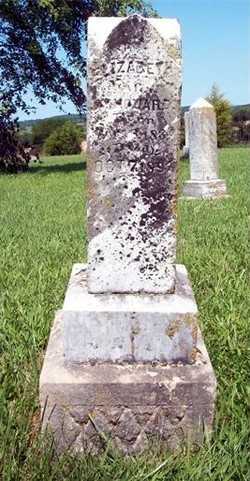
| Burial | : | Brooke Cemetery, Wellsburg, Brooke County, USA |
| Coordinate | : | 40.2874985, -80.6053009 |
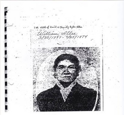
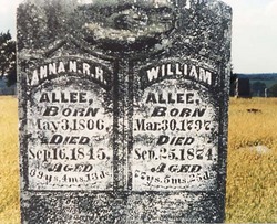
| Description | : | Thomas is the son of William & Annie (Hill) Allee. He married Sarah Ann "Sally" Birdsong on October 1, 1861 in Moniteau County, Missouri. The Eldon Advertiser (reprinted from the Moniteau County Herald), January 29, 1931 Thomas Edward Allee, a native born of one of the first families to settle in Moniteau County, died at his home on the Latham Road about 5 miles from California, Wednesday, January 14, 1931, ninety and a half years of age. He was born at the family home northwest of California, June 18, 1840. His grandfather, the Rev. David Allee, settled in that neighborhood... Read More |
frequently asked questions (FAQ):
-
Where is Thomas Edward Allee's memorial?
Thomas Edward Allee's memorial is located at: Brooke Cemetery, Wellsburg, Brooke County, USA.
-
When did Thomas Edward Allee death?
Thomas Edward Allee death on 14 Jan 1931 in Pilot Grove Township, Moniteau County, Missouri, USA
-
Where are the coordinates of the Thomas Edward Allee's memorial?
Latitude: 40.2874985
Longitude: -80.6053009
Family Members:
Parent
Spouse
Siblings

Children
Flowers:


Nearby Cemetories:
1. Brooke Cemetery
Wellsburg, Brooke County, USA
Coordinate: 40.2874985, -80.6053009
2. Knights of Saint George Cemetery
Wellsburg, Brooke County, USA
Coordinate: 40.2859920, -80.5989860
3. Brooke County Public Library Cremation Niches
Wellsburg, Brooke County, USA
Coordinate: 40.2725410, -80.6128480
4. Georges Run Cemetery
Steubenville, Jefferson County, USA
Coordinate: 40.3022920, -80.6189630
5. St John's Cemetery
Brooke County, USA
Coordinate: 40.2697156, -80.5840881
6. Cross Creek Cemetery
Brooke County, USA
Coordinate: 40.3060989, -80.5792007
7. Ebenezer Church Cemetery
Brooke County, USA
Coordinate: 40.3071090, -80.5622320
8. Saint Andrews Cemetery
Mingo Junction, Jefferson County, USA
Coordinate: 40.3250008, -80.6172028
9. Oakland Cemetery
Mingo Junction, Jefferson County, USA
Coordinate: 40.3285790, -80.6184240
10. Hill Cemetery
Steubenville, Jefferson County, USA
Coordinate: 40.3233490, -80.6353580
11. Oak Grove Cemetery
Follansbee, Brooke County, USA
Coordinate: 40.3274994, -80.5766983
12. Franklin Cemetery
Franklin, Brooke County, USA
Coordinate: 40.2758800, -80.5449300
13. Unidentified Cemetery
McKinleyville, Brooke County, USA
Coordinate: 40.2402083, -80.5980333
14. Buckingham Cemetery
Wells Township, Jefferson County, USA
Coordinate: 40.2739230, -80.6662180
15. New Alexandria Cemetery
New Alexandria, Jefferson County, USA
Coordinate: 40.2949982, -80.6781006
16. Everson Family Cemetery
Salt Run, Jefferson County, USA
Coordinate: 40.2492340, -80.6633810
17. McGee-Stringers Cemetery
Wells Township, Jefferson County, USA
Coordinate: 40.2431440, -80.6590810
18. Wells Cemetery
Beech Bottom, Brooke County, USA
Coordinate: 40.2221985, -80.6322021
19. Highland Hills Memorial Gardens
Follansbee, Brooke County, USA
Coordinate: 40.3579480, -80.6038500
20. Lower Buffalo Cemetery
Brooke County, USA
Coordinate: 40.2435989, -80.5297012
21. Saint John Cemetery Haven of Rest
Colliers, Brooke County, USA
Coordinate: 40.3486160, -80.5502720
22. Union Cemetery
Steubenville, Jefferson County, USA
Coordinate: 40.3636017, -80.6399994
23. Cross Creek United Presbyterian Church Cemetery
Colliers, Brooke County, USA
Coordinate: 40.3458430, -80.5316650
24. Mount Calvary Cemetery
Steubenville, Jefferson County, USA
Coordinate: 40.3643990, -80.6466980