
| Memorials | : | 0 |
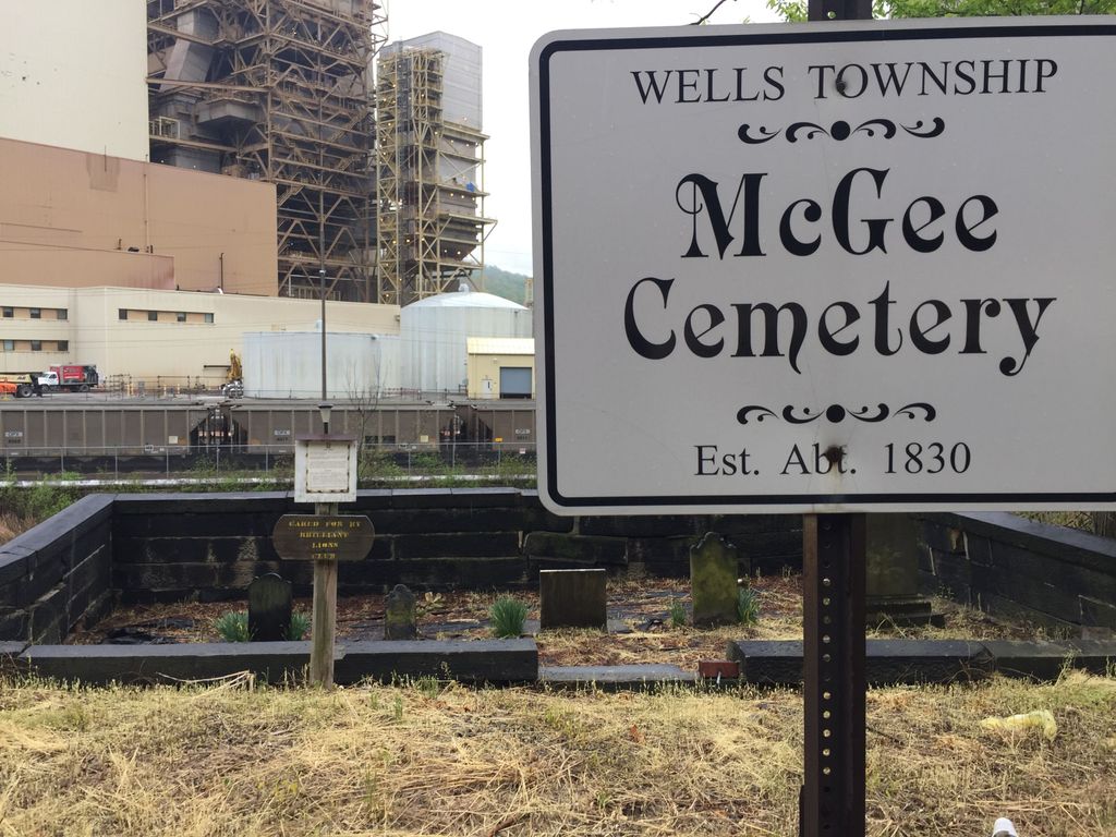
| Location | : | Wells Township, Jefferson County, USA |
| Coordinate | : | 40.2431440, -80.6590810 |
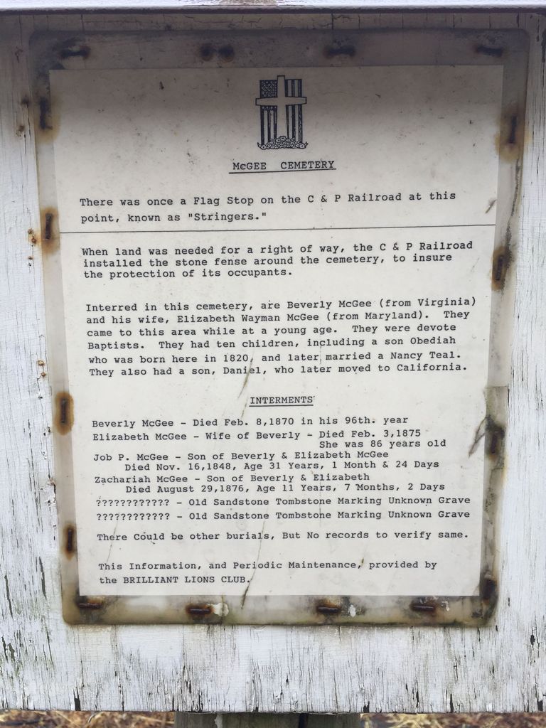
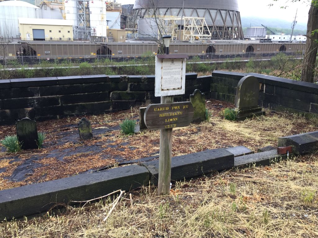
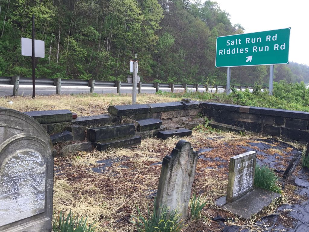
| Description | : | The cemetery is located between Ohio State Route 7 and the railroad tracks near Salt Run Road. The cemetery is located in Wells Township, Jefferson County, Ohio, and is # 6127 (McGee Cemetery / Stringers Cemetery) in “Ohio Cemeteries 1803-2003”, compiled by the Ohio Genealogical Society. |
frequently asked questions (FAQ):
-
Where is McGee-Stringers Cemetery?
McGee-Stringers Cemetery is located at Ohio River Scenic Byway (Ohio State Route 7) Wells Township, Jefferson County ,Ohio , 43943USA.
-
McGee-Stringers Cemetery cemetery's updated grave count on graveviews.com?
0 memorials
-
Where are the coordinates of the McGee-Stringers Cemetery?
Latitude: 40.2431440
Longitude: -80.6590810
Nearby Cemetories:
1. Everson Family Cemetery
Salt Run, Jefferson County, USA
Coordinate: 40.2492340, -80.6633810
2. Wells Cemetery
Beech Bottom, Brooke County, USA
Coordinate: 40.2221985, -80.6322021
3. Buckingham Cemetery
Wells Township, Jefferson County, USA
Coordinate: 40.2739230, -80.6662180
4. Clendenen Cemetery
Beech Bottom, Brooke County, USA
Coordinate: 40.2100870, -80.6591180
5. Kadesh Chapel Cemetery
Beech Bottom, Brooke County, USA
Coordinate: 40.2053000, -80.6293700
6. Hopewell Methodist Cemetery
Warren Township, Jefferson County, USA
Coordinate: 40.2236824, -80.7117462
7. Brooke County Public Library Cremation Niches
Wellsburg, Brooke County, USA
Coordinate: 40.2725410, -80.6128480
8. Unidentified Cemetery
McKinleyville, Brooke County, USA
Coordinate: 40.2402083, -80.5980333
9. Bayless Cemetery
Rayland, Jefferson County, USA
Coordinate: 40.2122930, -80.7123024
10. Oliver Cemetery
Wells Township, Jefferson County, USA
Coordinate: 40.2644005, -80.7217026
11. Warrenton Cemetery
Rayland, Jefferson County, USA
Coordinate: 40.1937700, -80.6838900
12. New Alexandria Cemetery
New Alexandria, Jefferson County, USA
Coordinate: 40.2949982, -80.6781006
13. Brooke Cemetery
Wellsburg, Brooke County, USA
Coordinate: 40.2874985, -80.6053009
14. Tent Church Cemetery
New Alexandria, Jefferson County, USA
Coordinate: 40.2832985, -80.7202988
15. Knights of Saint George Cemetery
Wellsburg, Brooke County, USA
Coordinate: 40.2859920, -80.5989860
16. St John's Cemetery
Brooke County, USA
Coordinate: 40.2697156, -80.5840881
17. Georges Run Cemetery
Steubenville, Jefferson County, USA
Coordinate: 40.3022920, -80.6189630
18. Mound Cemetery
Tiltonsville, Jefferson County, USA
Coordinate: 40.1744003, -80.6949997
19. Saint Adalbert Cemetery
Warren Township, Jefferson County, USA
Coordinate: 40.2033005, -80.7518997
20. Hill Cemetery
Steubenville, Jefferson County, USA
Coordinate: 40.3233490, -80.6353580
21. Wilson Cemetery
Clearview, Ohio County, USA
Coordinate: 40.1608009, -80.6813965
22. King Family Cemetery
Rayland, Jefferson County, USA
Coordinate: 40.1689423, -80.7109297
23. Short Creek Methodist Church Cemetery
West Liberty, Ohio County, USA
Coordinate: 40.1568985, -80.6389008
24. Cross Creek Cemetery
Brooke County, USA
Coordinate: 40.3060989, -80.5792007