
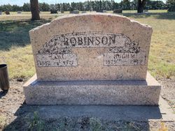
| Birth | : | 6 Dec 1856 Ephrata, Lancaster County, Pennsylvania, USA |
| Death | : | 7 Mar 1921 Franklin County, Nebraska, USA |
| Burial | : | Greenwood Cemetery, Franklin, Franklin County, USA |
| Coordinate | : | 40.1018982, -98.9443970 |
| Description | : | I found an obituary for this man in the Sherman county Kansas obit index and thought you would like to copy and paste it into his memorial: The Goodland Republic [Goodland, Sherman county, Kansas] March 17, 1921 OBITUARY--GETTLE Clipped from the Franklin County [Nebraska] News: "This community was sadly shocked Monday morning when the word came from Bloomington that Thos. Gettle, an old settler of this community, had died suddenly on the train while on the way to visit his children in Bird City, Kansas, with Mrs. Gettle, his death having been caused by heart failure. For the past fifteen... Read More |
frequently asked questions (FAQ):
-
Where is Thomas Harrison Gettle's memorial?
Thomas Harrison Gettle's memorial is located at: Greenwood Cemetery, Franklin, Franklin County, USA.
-
When did Thomas Harrison Gettle death?
Thomas Harrison Gettle death on 7 Mar 1921 in Franklin County, Nebraska, USA
-
Where are the coordinates of the Thomas Harrison Gettle's memorial?
Latitude: 40.1018982
Longitude: -98.9443970
Family Members:
Parent
Spouse

Siblings
Children
Flowers:


Nearby Cemetories:
1. Greenwood Cemetery
Franklin, Franklin County, USA
Coordinate: 40.1018982, -98.9443970
2. Maple Grove Cemetery
Bloomington, Franklin County, USA
Coordinate: 40.1018791, -99.0402832
3. Stevens Cemetery
Riverton, Franklin County, USA
Coordinate: 40.0977000, -98.8201500
4. Union Cemetery
Macon, Franklin County, USA
Coordinate: 40.2049000, -98.9439000
5. Bailey Cemetery
Franklin County, USA
Coordinate: 40.1828003, -99.0342026
6. Zion Lutheran Cemetery
Macon, Franklin County, USA
Coordinate: 40.2061500, -98.9718000
7. Fuller Cemetery
Riverton, Franklin County, USA
Coordinate: 40.0764000, -98.7925700
8. Mount Olive Cemetery
Kensington, Smith County, USA
Coordinate: 40.0014000, -99.0658035
9. Mount Pleasant Cemetery
Macon, Franklin County, USA
Coordinate: 40.2406616, -98.9908371
10. Riverton Cemetery
Riverton, Franklin County, USA
Coordinate: 40.0970993, -98.7530975
11. Pleasant Hill Cemetery
Reamsville, Smith County, USA
Coordinate: 39.9510994, -98.9175034
12. Naponee Cemetery
Naponee, Franklin County, USA
Coordinate: 40.0783997, -99.1456985
13. Reamsville Cemetery
Reamsville, Smith County, USA
Coordinate: 39.9441500, -98.8593500
14. Reamsville Methodist Church Cemetery
Reamsville, Smith County, USA
Coordinate: 39.9299500, -98.8693970
15. West Salem Cemetery
Franklin County, USA
Coordinate: 40.2775000, -99.0281000
16. Emmanuel Lutheran Cemetery
Hildreth, Franklin County, USA
Coordinate: 40.2782000, -99.0284000
17. Fairview Stone Cemetery
Kensington, Smith County, USA
Coordinate: 39.9304330, -99.0479270
18. Norwegian Zion Lutheran Cemetery
Inavale, Webster County, USA
Coordinate: 40.1913000, -98.7255000
19. Haskett Cemetery
Phillips County, USA
Coordinate: 39.9696860, -99.1234470
20. Eminence Cemetery
Thornburg, Smith County, USA
Coordinate: 39.9432983, -98.8005981
21. Upland Cemetery
Upland, Franklin County, USA
Coordinate: 40.3078003, -98.8974991
22. Chapman Cemetery
Woodruff, Phillips County, USA
Coordinate: 39.9930992, -99.1782990
23. Moline Cemetery
Hildreth, Franklin County, USA
Coordinate: 40.2630000, -99.1208000
24. Walnut Creek Cemetery
Inavale, Webster County, USA
Coordinate: 40.0463982, -98.6793976