
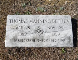
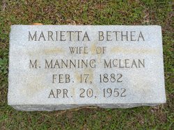
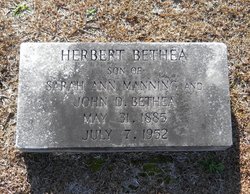
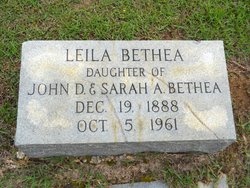
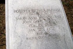
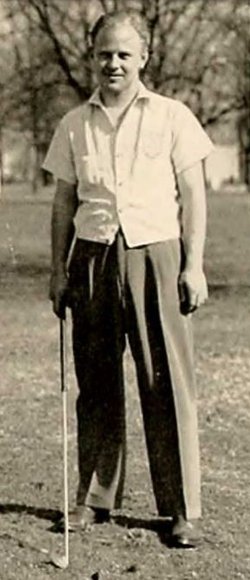
Thomas Manning Bethea
| Birth | : | 18 Mar 1889 Marion County, South Carolina, USA |
| Death | : | 29 Nov 1959 Florence, Florence County, South Carolina, USA |
| Burial | : | Fort Custer National Cemetery, Augusta, Kalamazoo County, USA |
| Coordinate | : | 42.3384514, -85.3191986 |
| Inscription | : | "Married Carrie Foxworth Dec. 4, 1917" |
| Description | : | Son of John and Sarah Manning Bethea. Tom married Carrie Foxworth on December 4, 1917. LATTA - Tom Manning Bethea Sr., 70, died Sunday afternoon at McLeod Infirmary in Florence after a heart attack. He was a son of the late John D. and Sarah Manning Bethea. Funeral services will be conducted Tuesday at 11 a.m. from Bethea Funeral Home in Latta by the Rev. A. M. Simpson. Burial will be in Magnolia Cemetery. Mr. Bethea was a Mason and a deacon in Latta Presbyterian Church. He worked six years with the South Carolina Highway Patrol, ten years with the Latta... Read More |
frequently asked questions (FAQ):
-
Where is Thomas Manning Bethea's memorial?
Thomas Manning Bethea's memorial is located at: Fort Custer National Cemetery, Augusta, Kalamazoo County, USA.
-
When did Thomas Manning Bethea death?
Thomas Manning Bethea death on 29 Nov 1959 in Florence, Florence County, South Carolina, USA
-
Where are the coordinates of the Thomas Manning Bethea's memorial?
Latitude: 42.3384514
Longitude: -85.3191986
Family Members:
Parent

Spouse
Siblings
Children
Flowers:


Nearby Cemetories:
1. Fort Custer National Cemetery
Augusta, Kalamazoo County, USA
Coordinate: 42.3384514, -85.3191986
2. Augusta Cemetery
Augusta, Kalamazoo County, USA
Coordinate: 42.3392240, -85.3566830
3. Harmonia Cemetery
Bedford, Calhoun County, USA
Coordinate: 42.3436012, -85.2782974
4. Lawler Cemetery
Augusta, Kalamazoo County, USA
Coordinate: 42.3050003, -85.3469009
5. Ross Center Cemetery
Augusta, Kalamazoo County, USA
Coordinate: 42.3760986, -85.3619003
6. Day Cemetery
Augusta, Kalamazoo County, USA
Coordinate: 42.3905983, -85.3285980
7. Howlandsburg Cemetery
Ross Township, Kalamazoo County, USA
Coordinate: 42.3344002, -85.3961029
8. Reese Cemetery
Springfield, Calhoun County, USA
Coordinate: 42.3196983, -85.2375031
9. Memorial Park Sunset Gardens
Battle Creek, Calhoun County, USA
Coordinate: 42.3010950, -85.2393690
10. Youngs Cemetery
Battle Creek, Calhoun County, USA
Coordinate: 42.3031693, -85.2358398
11. Memorial Park Cemetery
Battle Creek, Calhoun County, USA
Coordinate: 42.3005981, -85.2358017
12. Yorkville Cemetery
Yorkville, Kalamazoo County, USA
Coordinate: 42.3773190, -85.4048660
13. Oak Grove Cemetery
Galesburg, Kalamazoo County, USA
Coordinate: 42.3008003, -85.4152985
14. Haskell Home Cemetery
Battle Creek, Calhoun County, USA
Coordinate: 42.3350590, -85.2093310
15. Riverside Cemetery
Galesburg, Kalamazoo County, USA
Coordinate: 42.2831001, -85.4011002
16. Harmon Halladay Cemetery
Bedford, Calhoun County, USA
Coordinate: 42.3546982, -85.2061005
17. Roof Cemetery
Climax, Kalamazoo County, USA
Coordinate: 42.2538986, -85.3368988
18. Bedford Cemetery
Bedford Township, Calhoun County, USA
Coordinate: 42.3938103, -85.2306671
19. Galesburg City Cemetery
Galesburg, Kalamazoo County, USA
Coordinate: 42.2925491, -85.4193878
20. Shafter Cemetery
Galesburg, Kalamazoo County, USA
Coordinate: 42.2966995, -85.4261017
21. Beckley Cemetery
Battle Creek, Calhoun County, USA
Coordinate: 42.2633018, -85.2375031
22. Toad Hollow Cemetery
Galesburg, Kalamazoo County, USA
Coordinate: 42.2541885, -85.3854828
23. Prairie Home Cemetery
Climax, Kalamazoo County, USA
Coordinate: 42.2351189, -85.3364410
24. Prairie Home Cemetery
Richland, Kalamazoo County, USA
Coordinate: 42.3760470, -85.4507590