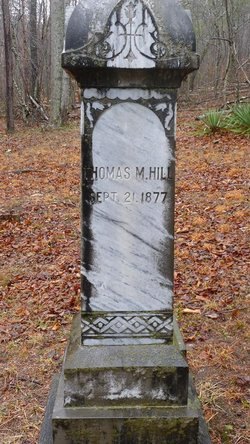
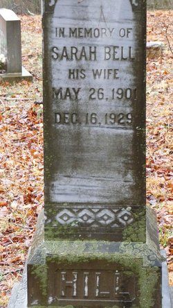
Thomas Matthew Hill
| Birth | : | 21 Sep 1877 Eagle Rock, Botetourt County, Virginia, USA |
| Death | : | 22 Mar 1955 Greenbrier County, West Virginia, USA |
| Burial | : | Brown Cemetery, Bethel Acres, Pottawatomie County, USA |
| Coordinate | : | 35.2613983, -97.0627975 |
| Description | : | son of Samuel F. Hill & Sarah Jane Pursley (parents and death date from contributor # 47729120) |
frequently asked questions (FAQ):
-
Where is Thomas Matthew Hill's memorial?
Thomas Matthew Hill's memorial is located at: Brown Cemetery, Bethel Acres, Pottawatomie County, USA.
-
When did Thomas Matthew Hill death?
Thomas Matthew Hill death on 22 Mar 1955 in Greenbrier County, West Virginia, USA
-
Where are the coordinates of the Thomas Matthew Hill's memorial?
Latitude: 35.2613983
Longitude: -97.0627975
Family Members:
Spouse
Flowers:
Nearby Cemetories:
1. Brown Cemetery
Bethel Acres, Pottawatomie County, USA
Coordinate: 35.2613983, -97.0627975
2. Plantz Family Cemetery
Bethel Acres, Pottawatomie County, USA
Coordinate: 35.2752650, -97.0711610
3. Mack Family Cemetery
Pottawatomie County, USA
Coordinate: 35.2327000, -97.0892000
4. Black Cemetery
Pink, Pottawatomie County, USA
Coordinate: 35.2752991, -97.1069031
5. Mount Zion Cemetery
Pottawatomie County, USA
Coordinate: 35.2174260, -97.0636430
6. Highland Cemetery
Pink, Pottawatomie County, USA
Coordinate: 35.2178001, -97.0539017
7. Brown Family Cemetery
Shawnee, Pottawatomie County, USA
Coordinate: 35.3039200, -97.0813800
8. Watson Family Cemetery
Pink, Pottawatomie County, USA
Coordinate: 35.2425700, -97.1158800
9. Absentee Shawnee Tribal Cemetery
Pottawatomie County, USA
Coordinate: 35.2461000, -97.1204000
10. Byers Family Cemetery
Shawnee, Pottawatomie County, USA
Coordinate: 35.2316000, -97.0127000
11. Hopewell Cemetery
Bethel Acres, Pottawatomie County, USA
Coordinate: 35.3041100, -97.0275400
12. Bethel United Methodist Church Cemetery
Bethel Acres, Pottawatomie County, USA
Coordinate: 35.3050500, -97.0275300
13. New Hope Cemetery
Tecumseh, Pottawatomie County, USA
Coordinate: 35.2759000, -96.9917000
14. Oak Grove Cemetery #2
Pottawatomie County, USA
Coordinate: 35.2317920, -96.9988380
15. Ray Cemetery
Pottawatomie County, USA
Coordinate: 35.3182600, -97.1075600
16. Knoles Cemetery
Little Axe, Cleveland County, USA
Coordinate: 35.2756000, -97.1602900
17. Blackburn Chapel Cemetery
Bethel Acres, Pottawatomie County, USA
Coordinate: 35.3330000, -97.0121000
18. Lone Star Cemetery
Brooksville, Pottawatomie County, USA
Coordinate: 35.1917000, -96.9750000
19. Brooksville Cemetery
Brooksville, Pottawatomie County, USA
Coordinate: 35.1917000, -96.9749985
20. Bowman Family Farm Cemetery
Macomb, Pottawatomie County, USA
Coordinate: 35.1746000, -97.1327000
21. Little Axe Family Cemetery
Cleveland County, USA
Coordinate: 35.2403000, -97.1965000
22. Mars Hill Cemetery
Saint Louis, Pottawatomie County, USA
Coordinate: 35.1603012, -97.1252975
23. Neash Family Cemetery
Little Axe, Cleveland County, USA
Coordinate: 35.2374900, -97.2005100
24. Citizen Potawatomi Nation Cemetery
Shawnee, Pottawatomie County, USA
Coordinate: 35.2979180, -96.9292110


