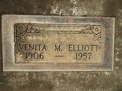
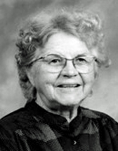
Venita Myrtle Vaughn Elliott
| Birth | : | 15 Oct 1906 Kansas, USA |
| Death | : | 2 Jun 1957 Butte County, California, USA |
| Burial | : | Walnut Mound Cemetery, Retreat, Vernon County, USA |
| Coordinate | : | 43.4463997, -91.0718994 |
| Plot | : | Sec 33 Lot 2728 |
| Description | : | Birth and death dates and locations, mother's maiden name Smith, from California Death Index Records. 51-year-old Venita Myrtle Elliott was interred, per the Chico Cemetery Association Records, in the plot noted, on June 7, 1957. |
frequently asked questions (FAQ):
-
Where is Venita Myrtle Vaughn Elliott's memorial?
Venita Myrtle Vaughn Elliott's memorial is located at: Walnut Mound Cemetery, Retreat, Vernon County, USA.
-
When did Venita Myrtle Vaughn Elliott death?
Venita Myrtle Vaughn Elliott death on 2 Jun 1957 in Butte County, California, USA
-
Where are the coordinates of the Venita Myrtle Vaughn Elliott's memorial?
Latitude: 43.4463997
Longitude: -91.0718994
Family Members:
Parent
Siblings
Flowers:
Nearby Cemetories:
1. Walnut Mound Cemetery
Retreat, Vernon County, USA
Coordinate: 43.4463997, -91.0718994
2. North West Prairie Cemetery
West Prairie, Vernon County, USA
Coordinate: 43.4661670, -91.0125000
3. Rush Creek Cemetery
Ferryville, Crawford County, USA
Coordinate: 43.3994330, -91.0911160
4. Fargo Cemetery
West Prairie, Vernon County, USA
Coordinate: 43.4562640, -91.0007000
5. Freeman Cemetery
Ferryville, Crawford County, USA
Coordinate: 43.3955300, -91.0429100
6. West Prairie Hauge Lutheran Cemetery
West Prairie, Vernon County, USA
Coordinate: 43.4346600, -90.9923320
7. South West Prairie Cemetery
Fargo, Vernon County, USA
Coordinate: 43.4262660, -90.9923500
8. De Soto Lutheran Cemetery
De Soto, Vernon County, USA
Coordinate: 43.4295700, -91.1753400
9. Bad Axe Independent Lutheran Cemetery
Purdy, Vernon County, USA
Coordinate: 43.5226330, -91.0448000
10. Pine Tree Cemetery
Genoa, Vernon County, USA
Coordinate: 43.5246980, -91.1070870
11. Lawrence Ridge Cemetery
De Soto, Crawford County, USA
Coordinate: 43.4078800, -91.1739700
12. Saint James Cemetery
Rising Sun, Crawford County, USA
Coordinate: 43.4104830, -90.9560660
13. De Soto Cemetery
De Soto, Vernon County, USA
Coordinate: 43.4293600, -91.1958200
14. Ferryville Cemetery
Ferryville, Crawford County, USA
Coordinate: 43.3414170, -91.0775000
15. Victory Cemetery
Victory, Vernon County, USA
Coordinate: 43.4873830, -91.2070170
16. Henderson Family Plot
Liberty Pole, Vernon County, USA
Coordinate: 43.4684500, -90.9266000
17. Carrie Thoreson Cemetery
Viroqua, Vernon County, USA
Coordinate: 43.5522000, -91.0427670
18. Osgood Family Plot
Viroqua, Vernon County, USA
Coordinate: 43.5164000, -90.9580300
19. German Cemetery
Victory, Vernon County, USA
Coordinate: 43.5167007, -91.1941986
20. Zion Lutheran Cemetery
Newton, Vernon County, USA
Coordinate: 43.5594830, -91.0405500
21. Eitsert Cemetery
Fairview, Crawford County, USA
Coordinate: 43.3602982, -90.9638977
22. Cade Family Plot
Liberty Pole, Vernon County, USA
Coordinate: 43.4869700, -90.9146300
23. Clawater Plot
Liberty Pole, Vernon County, USA
Coordinate: 43.4883190, -90.9135930
24. Romance Cemetery
Genoa, Vernon County, USA
Coordinate: 43.5551000, -91.1512400


