| Birth | : | 20 Dec 1892 |
| Death | : | 16 Dec 1940 Winner, Tripp County, South Dakota, USA |
| Burial | : | Sashabaw Cemetery, Clarkston, Oakland County, USA |
| Coordinate | : | 42.7194328, -83.3634644 |
| Plot | : | Block 25, Lot 6, Grave 4 |
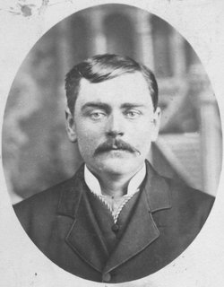
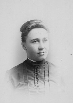
| Description | : | Son of Wright Whitten Law and Nellie Romain Stone Husband of Mable May Cover-married Jan. 20, 1917 in Valentine, Cherry County, Nebraska Divorced Mable Dec. 10, 1935 in Pennington County, S. Dakota Father of Shirley Elaine "Law" Flick- Born Aug. 18,1918 in Platte, S. Dakota Verne was the owner/proprietor of the Red & White Grocery Store in Winner, S.Dakota. Burial plot is located in Block 25, Lot 6, Space 4 |
frequently asked questions (FAQ):
-
Where is Verne Effie Law's memorial?
Verne Effie Law's memorial is located at: Sashabaw Cemetery, Clarkston, Oakland County, USA.
-
When did Verne Effie Law death?
Verne Effie Law death on 16 Dec 1940 in Winner, Tripp County, South Dakota, USA
-
Where are the coordinates of the Verne Effie Law's memorial?
Latitude: 42.7194328
Longitude: -83.3634644
Family Members:
Parent
Children
Flowers:
Nearby Cemetories:
1. Sashabaw Cemetery
Clarkston, Oakland County, USA
Coordinate: 42.7194328, -83.3634644
2. Ottawa Park Cemetery
Clarkston, Oakland County, USA
Coordinate: 42.7146988, -83.4056015
3. Waterford Village Cemetery
Waterford, Oakland County, USA
Coordinate: 42.7038193, -83.4029694
4. Drayton Plains Cemetery
Waterford, Oakland County, USA
Coordinate: 42.6894836, -83.3857880
5. Lakeview Cemetery
Clarkston, Oakland County, USA
Coordinate: 42.7263985, -83.4272003
6. Saint Andrew's Episcopal Church Memorial Garden
Waterford, Oakland County, USA
Coordinate: 42.6744070, -83.3935960
7. Crescent Hills Cemetery
Waterford, Oakland County, USA
Coordinate: 42.6692009, -83.3878021
8. All Saints Cemetery
Waterford, Oakland County, USA
Coordinate: 42.7016449, -83.4411697
9. Saint Marys-In-The-Hills Episcopal Memorial Garden
Lake Orion, Oakland County, USA
Coordinate: 42.7436630, -83.2839530
10. Oakland Cemetery
Pontiac, Oakland County, USA
Coordinate: 42.6610985, -83.3274994
11. Colombiere Center Cemetery
Clarkston, Oakland County, USA
Coordinate: 42.7333650, -83.4571700
12. Central United Methodist Church Memorial Garden
Waterford, Oakland County, USA
Coordinate: 42.6485748, -83.3627853
13. Case Cemetery
Clarkston, Oakland County, USA
Coordinate: 42.7916985, -83.3531036
14. Waterford Center Cemetery
Waterford, Oakland County, USA
Coordinate: 42.6523972, -83.4075775
15. Hillview Memorial Gardens
Clarkston, Oakland County, USA
Coordinate: 42.7086868, -83.4639664
16. Berridge Family Cemetery
Lake Orion, Oakland County, USA
Coordinate: 42.7513620, -83.2684670
17. Square Lake Cemetery
Lake Orion, Oakland County, USA
Coordinate: 42.7703018, -83.2827988
18. Springfield Plains Cemetery
Davisburg, Oakland County, USA
Coordinate: 42.7667007, -83.4630966
19. Bridge Lake Cemetery
Clarkston, Oakland County, USA
Coordinate: 42.7449989, -83.4774017
20. Seymour Lake Cemetery
Brandon Gardens, Oakland County, USA
Coordinate: 42.8074303, -83.3717117
21. Shurter Cemetery
Ortonville, Oakland County, USA
Coordinate: 42.8056400, -83.3928500
22. Andersonville Cemetery
Andersonville, Oakland County, USA
Coordinate: 42.7303696, -83.4873581
23. Perry Mount Park Cemetery
Pontiac, Oakland County, USA
Coordinate: 42.6563072, -83.2701950
24. Oak Hill Cemetery
Pontiac, Oakland County, USA
Coordinate: 42.6432991, -83.2842026


