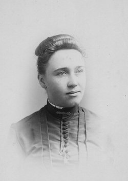
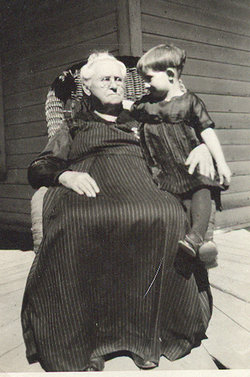
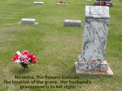
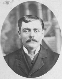
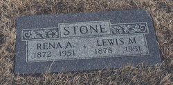
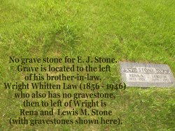
Nellie Romain Stone Law
| Birth | : | 16 Feb 1865 Fairbury, Livingston County, Illinois, USA |
| Death | : | 2 Oct 1929 Winner, Tripp County, South Dakota, USA |
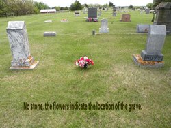
| Burial | : | St. Barnabas Church Burial Ground, Ranskill, Bassetlaw District, England |
| Coordinate | : | 53.3786660, -1.0138210 |
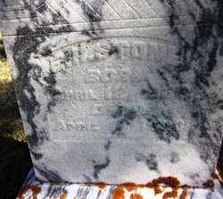
| Inscription | : | Nellie Law (no dates) |
| Description | : | Nellie Romain (Stone) Law was the daughter of Ephraim Harrison Stone (1836-1903) and Sarah Mariah (Wright) Stone (1839-1924). She married Wright Whitten Law (1856-1946) on Dec. 26, 1891 in Iowa City, Johnson County, Iowa. They had a son, Verne E. Law (1892-1940). |
frequently asked questions (FAQ):
-
Where is Nellie Romain Stone Law's memorial?
Nellie Romain Stone Law's memorial is located at: St. Barnabas Church Burial Ground, Ranskill, Bassetlaw District, England.
-
When did Nellie Romain Stone Law death?
Nellie Romain Stone Law death on 2 Oct 1929 in Winner, Tripp County, South Dakota, USA
-
Where are the coordinates of the Nellie Romain Stone Law's memorial?
Latitude: 53.3786660
Longitude: -1.0138210
Family Members:
Parent
Spouse
Siblings
Children
Flowers:
Nearby Cemetories:
1. St. Barnabas Church Burial Ground
Ranskill, Bassetlaw District, England
Coordinate: 53.3786660, -1.0138210
2. Blyth City Cemetery
Blyth, Bassetlaw District, England
Coordinate: 53.3729000, -1.0592000
3. St. Mary & St. Martin Churchyard
Blyth, Bassetlaw District, England
Coordinate: 53.3785000, -1.0642000
4. St. Bartholomew's Churchyard
Sutton cum Lound, Bassetlaw District, England
Coordinate: 53.3573000, -0.9784000
5. St. Wilfred Churchyard
Scrooby, Bassetlaw District, England
Coordinate: 53.4095670, -1.0204840
6. Mattersey Cemetery
Mattersey, Bassetlaw District, England
Coordinate: 53.3986220, -0.9691880
7. All Saints Churchyard
Mattersey, Bassetlaw District, England
Coordinate: 53.3963070, -0.9631660
8. Respect Green Burial Park
Bawtry, Metropolitan Borough of Doncaster, England
Coordinate: 53.4200210, -1.0250520
9. Everton Cemetery
Everton, Bassetlaw District, England
Coordinate: 53.4088639, -0.9625431
10. Holy Trinity Churchyard
Everton, Bassetlaw District, England
Coordinate: 53.4141740, -0.9614720
11. St. Nicholas' Churchyard
Bawtry, Metropolitan Borough of Doncaster, England
Coordinate: 53.4297900, -1.0183400
12. Harworth Cemetery
Harworth, Bassetlaw District, England
Coordinate: 53.4185060, -1.0733460
13. Styrrup Road Cemetery
Harworth, Bassetlaw District, England
Coordinate: 53.4160400, -1.0816770
14. All Saints Churchyard
Harworth, Bassetlaw District, England
Coordinate: 53.4187800, -1.0781900
15. Bawtry Cemetery
Bawtry, Metropolitan Borough of Doncaster, England
Coordinate: 53.4341255, -1.0192066
16. St Nicholas Chapel of All Souls Ancillary Cemetery
Bawtry, Metropolitan Borough of Doncaster, England
Coordinate: 53.4344798, -1.0211632
17. St Helen's Roman Catholic Churchyard
Nottingham, Nottingham Unitary Authority, England
Coordinate: 53.3903220, -1.1131860
18. Langold Cemetery
Worksop, Bassetlaw District, England
Coordinate: 53.3777600, -1.1170100
19. Retford Cemetery
Retford, Bassetlaw District, England
Coordinate: 53.3273420, -0.9565260
20. St. Peter's Churchyard
Clayworth, Bassetlaw District, England
Coordinate: 53.3877200, -0.9093960
21. All Saints Churchyard
Babworth, Bassetlaw District, England
Coordinate: 53.3201112, -0.9710090
22. St. Helena Churchyard
Austerfield, Metropolitan Borough of Doncaster, England
Coordinate: 53.4449200, -1.0062600
23. St. John the Evangelist Churchyard
Worksop, Bassetlaw District, England
Coordinate: 53.3161600, -1.0584800
24. St. Peter's Churchyard
Hayton, Bassetlaw District, England
Coordinate: 53.3494900, -0.9093700

