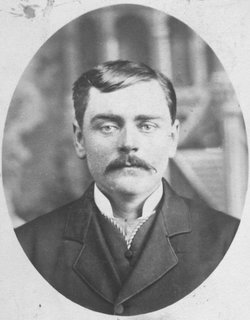
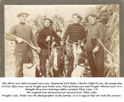
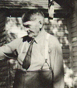
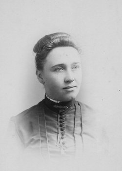
Wright Whitten Law
| Birth | : | 27 Sep 1856 Sterling, Whiteside County, Illinois, USA |
| Death | : | 17 Dec 1946 Bonesteel, Gregory County, South Dakota, USA |
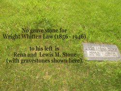
| Burial | : | Burks Falls Cemetery, Burks Falls, Parry Sound District, Canada |
| Coordinate | : | 45.6009200, -79.3979400 |
| Inscription | : | Wright Whitten Law 12 Dec 1946 (Note: S.D. Death Index 1950-1955 records his death as being 17 Dec 1946.) |
| Description | : | Wright Whitten Law was born on Sept. 27, 1856 in Sterling, Whiteside County, Illinois to Washington McKendree Law and Abigail Colcord. He married Emma Anna Grover, youngest daughter of William Eustace Grover and Matilda J. Emerson, on Aug. 13, 1877 in Rippey, Greene County, Iowa. Emma died on Oct. 20, 1891 in Rippey and is buried in the Rippey Cemetery. Wright marries for the 2nd time to Nellie Romain Stone Holverson on Dec. 26, 1891 in Iowa City, Johnson County, Iowa. Nellie was previously married to ? Holverson. Family lore has that their child Verne Effie... Read More |
frequently asked questions (FAQ):
-
Where is Wright Whitten Law's memorial?
Wright Whitten Law's memorial is located at: Burks Falls Cemetery, Burks Falls, Parry Sound District, Canada.
-
When did Wright Whitten Law death?
Wright Whitten Law death on 17 Dec 1946 in Bonesteel, Gregory County, South Dakota, USA
-
Where are the coordinates of the Wright Whitten Law's memorial?
Latitude: 45.6009200
Longitude: -79.3979400
Family Members:
Parent
Spouse
Siblings
Children
Flowers:
Nearby Cemetories:
1. Chetwynd Cemetery
Burks Falls, Parry Sound District, Canada
Coordinate: 45.6182050, -79.3371300
2. Royston Cemetery
Ryerson, Parry Sound District, Canada
Coordinate: 45.5632100, -79.4698000
3. St. Mark's Anglican Cemetery
Emsdale, Parry Sound District, Canada
Coordinate: 45.5245350, -79.3161830
4. St. Gerard Roman Catholic Cemetery
McMurrich, Parry Sound District, Canada
Coordinate: 45.5012900, -79.4152300
5. Midlothian Memorial Cemetery
Midlothian, Parry Sound District, Canada
Coordinate: 45.5969800, -79.5654300
6. Saint Pauls Cemetery
Sprucedale, Parry Sound District, Canada
Coordinate: 45.4903908, -79.4618149
7. St Patrick's Roman Catholic Church Cemetery
Kearney, Parry Sound District, Canada
Coordinate: 45.5566347, -79.2183030
8. Knox United Church Cemetery
Kearney, Parry Sound District, Canada
Coordinate: 45.5600000, -79.2111667
9. Strong Community Cemetery
Sundridge, Parry Sound District, Canada
Coordinate: 45.7767448, -79.4004288
10. Saint Andrew's United Church Cemetery
Novar, Parry Sound District, Canada
Coordinate: 45.4455800, -79.2678400
11. Haldane Hill Cemetery
McMurrich, Parry Sound District, Canada
Coordinate: 45.4212400, -79.4242000
12. Saint Andrew's Presbyterian Cemetery
Novar, Parry Sound District, Canada
Coordinate: 45.4491300, -79.2514100
13. Spence Community Cemetery
Spence, Parry Sound District, Canada
Coordinate: 45.6794395, -79.6414413
14. East Bear Lake Cemetery
Bear Lake, Parry Sound District, Canada
Coordinate: 45.4583600, -79.5731300
15. Chapman Community Cemetery
Chapman, Parry Sound District, Canada
Coordinate: 45.6943265, -79.6374739
16. Zion Lutheran Deer Lake Cemetery
Parry Sound, Parry Sound District, Canada
Coordinate: 45.7932440, -79.5596210
17. Yearley Cemetery
Yearley, Muskoka District Municipality, Canada
Coordinate: 45.3749600, -79.4508700
18. Dufferin Methodist Cemetery
Spence, Parry Sound District, Canada
Coordinate: 45.4846896, -79.6830158
19. South River Cemetery
South River, Parry Sound District, Canada
Coordinate: 45.8359500, -79.3982400
20. Salvation Army Cemetery
Huntsville, Muskoka District Municipality, Canada
Coordinate: 45.3834100, -79.2496300
21. Etwell Cemetery
Etwell, Muskoka District Municipality, Canada
Coordinate: 45.3526440, -79.3860950
22. Siloam Cemetery
South River, Parry Sound District, Canada
Coordinate: 45.8499800, -79.4176500
23. Ravenscliffe United Church Cemetery
Ravenscliffe, Muskoka District Municipality, Canada
Coordinate: 45.3676000, -79.2629700
24. St. John the Baptist Cemetery
Ravenscliffe, Muskoka District Municipality, Canada
Coordinate: 45.3628000, -79.2806500

