

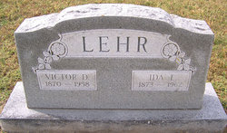
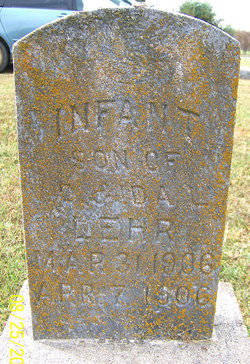
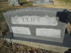
Victor Demuth Lehr
| Birth | : | 5 Nov 1870 Moniteau County, Missouri, USA |
| Death | : | 1 Nov 1958 Russellville, Cole County, Missouri, USA |
| Burial | : | Olean Cemetery, Olean, Miller County, USA |
| Coordinate | : | 38.4131012, -92.5413971 |
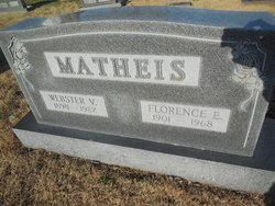
| Description | : | Jefferson City News and Tribune, Sunday, November 2, 1958, Jefferson City, Missouri, United States Of America Victor E. Lehr died at the home of a daughter, Mrs. Webster Matheis of near Russellville Saturday morning. He had been in ill health for four years. He was a retired farmer. Born at California, Mo., on Nov. 5, 1870, he was a son of the late Leo and Louise Lehr. He was married to Ida Schulpe on Nov. 6, 1895. Survivors include his wife; two daughters, Mrs. Matheis and Mrs. Stanley Neslie of Long Beach, Calif.; five sons, A.W. of... Read More |
frequently asked questions (FAQ):
-
Where is Victor Demuth Lehr's memorial?
Victor Demuth Lehr's memorial is located at: Olean Cemetery, Olean, Miller County, USA.
-
When did Victor Demuth Lehr death?
Victor Demuth Lehr death on 1 Nov 1958 in Russellville, Cole County, Missouri, USA
-
Where are the coordinates of the Victor Demuth Lehr's memorial?
Latitude: 38.4131012
Longitude: -92.5413971
Family Members:
Parent
Spouse
Siblings
Children
Flowers:


Nearby Cemetories:
1. Olean Cemetery
Olean, Miller County, USA
Coordinate: 38.4131012, -92.5413971
2. Green Ridge Baptist Church Cemetery
Eldon, Miller County, USA
Coordinate: 38.4116200, -92.5645700
3. Etter-Walker Cemetery
Burris Fork, Moniteau County, USA
Coordinate: 38.4333700, -92.5525400
4. Walker Cemetery
Moniteau County, USA
Coordinate: 38.4338989, -92.5522003
5. Farris Cemetery
Moniteau County, USA
Coordinate: 38.4369900, -92.5380000
6. Allen Cemetery
Olean, Miller County, USA
Coordinate: 38.4150009, -92.5008011
7. Jackson Chapel Methodist Church Cemetery
California, Moniteau County, USA
Coordinate: 38.4447900, -92.5286500
8. Gray Cemetery
Moniteau County, USA
Coordinate: 38.4536018, -92.5456009
9. Hite Cemetery
Miller County, USA
Coordinate: 38.4039001, -92.5935974
10. Mount Pleasant Cemetery
Eldon, Miller County, USA
Coordinate: 38.3667700, -92.5300800
11. Salem Cemetery
Saline Township, Miller County, USA
Coordinate: 38.3691232, -92.5697260
12. Salem Cemetery
Eldon, Miller County, USA
Coordinate: 38.3697014, -92.5714035
13. Mount Vernon Cemetery
Eldon, Miller County, USA
Coordinate: 38.3624992, -92.5606003
14. Bruce-Lewis-McGahan Cemetery
Enon, Moniteau County, USA
Coordinate: 38.4667500, -92.5172100
15. Rock Enon Cemetery
Miller County, USA
Coordinate: 38.4668400, -92.5170700
16. Eldon Cemetery
Eldon, Miller County, USA
Coordinate: 38.3642006, -92.5868988
17. Phillips Cemetery
High Point, Moniteau County, USA
Coordinate: 38.4430300, -92.6125300
18. Colburn Cemetery
Eldon, Miller County, USA
Coordinate: 38.4246300, -92.6275500
19. Depp Cemetery
High Point, Moniteau County, USA
Coordinate: 38.4776400, -92.5818500
20. High Point Cemetery
High Point, Moniteau County, USA
Coordinate: 38.4817009, -92.5757980
21. Phillips Cemetery
Barnett, Morgan County, USA
Coordinate: 38.4227982, -92.6367035
22. Matheis Cemetery
Russellville, Cole County, USA
Coordinate: 38.4571800, -92.4491600
23. United Baptist Church Cemetery
High Point, Moniteau County, USA
Coordinate: 38.4962200, -92.5856800
24. Karnes-Carney-Henderson Cemetery
Burris Fork, Moniteau County, USA
Coordinate: 38.4992100, -92.5007510