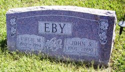
| Birth | : | 5 Feb 1931 Centralia, Nemaha County, Kansas, USA |
| Death | : | 16 Dec 2005 Broken Arrow, Tulsa County, Oklahoma, USA |
| Burial | : | Karoro Cemetery, Greymouth, Grey District, New Zealand |
| Coordinate | : | -42.4678260, 171.1893800 |
| Description | : | Viola F. Hogan, 74, formerly of Marysville, died December 16, 2005 at Broken Arrow, OK. She was born February 5, 1931, at Centralia, KS the daughter of Henry and Cenith Labbe. She graduated from Centralia High School in 1949. She married Orville Hogan on March 28, 1951. She lived in Marysville, KS from 1951 to 1974, she then moved to Great Bend where she worked at Howards clothing store. She also worked at Browns Clothing Store in Marysville and was Marysville municipal judge in the 1970's. Mrs Hogan moved to Broken Arrow, OK in... Read More |
frequently asked questions (FAQ):
-
Where is Viola Faye Labbe Hogan's memorial?
Viola Faye Labbe Hogan's memorial is located at: Karoro Cemetery, Greymouth, Grey District, New Zealand.
-
When did Viola Faye Labbe Hogan death?
Viola Faye Labbe Hogan death on 16 Dec 2005 in Broken Arrow, Tulsa County, Oklahoma, USA
-
Where are the coordinates of the Viola Faye Labbe Hogan's memorial?
Latitude: -42.4678260
Longitude: 171.1893800
Family Members:
Flowers:
Nearby Cemetories:
1. Karoro Cemetery
Greymouth, Grey District, New Zealand
Coordinate: -42.4678260, 171.1893800
2. St Pauls Methodist Church (Defunct)
Greymouth, Grey District, New Zealand
Coordinate: -42.4500880, 171.2114610
3. Cobden Cemetery
Greymouth, Grey District, New Zealand
Coordinate: -42.4371700, 171.2019000
4. Gladstone Cemetery
Greymouth, Grey District, New Zealand
Coordinate: -42.5381220, 171.1522540
5. Stillwater Cemetery
Greymouth, Grey District, New Zealand
Coordinate: -42.4394820, 171.3494380
6. Kumara Cemetery
Kumara, Westland District, New Zealand
Coordinate: -42.6464650, 171.1721970
7. Greenstone Cemetery
Kumara, Westland District, New Zealand
Coordinate: -42.6361450, 171.2751350
8. Blackball Cemetery
Greymouth, Grey District, New Zealand
Coordinate: -42.3757410, 171.4135760
9. Notown Cemetery
Dobson, Grey District, New Zealand
Coordinate: -42.4514530, 171.4465670
10. Old Stafford Cemetery
Hokitika, Westland District, New Zealand
Coordinate: -42.6662370, 171.0893140
11. Nelson Creek Cemetery
Ngahere, Grey District, New Zealand
Coordinate: -42.3865620, 171.4595500
12. Barrytown Cemetery
Barrytown, Grey District, New Zealand
Coordinate: -42.2455150, 171.3166710
13. Hokitika Municipal Cemetery
Hokitika, Westland District, New Zealand
Coordinate: -42.7102940, 170.9759800
14. Ahaura Cemetery
Ahaura, Grey District, New Zealand
Coordinate: -42.3516790, 171.5581700
15. Evans Grave
Arthurs Pass, Selwyn District, New Zealand
Coordinate: -42.7723610, 171.6249940
16. Ross Cemetery
Ross, Westland District, New Zealand
Coordinate: -42.8898440, 170.8226160
17. Ross Historic Cemetery
Ross, Westland District, New Zealand
Coordinate: -42.9023200, 170.8113230
18. Charleston Catholic Cemetery
Charleston, Buller District, New Zealand
Coordinate: -41.9093390, 171.4359110
19. Nile Hill Cemetery
Charleston, Buller District, New Zealand
Coordinate: -41.8991610, 171.4394080
20. Old Reefton Cemetery
Reefton, Buller District, New Zealand
Coordinate: -42.1115220, 171.8590850
21. Reefton Cemetery
Reefton, Buller District, New Zealand
Coordinate: -42.0856940, 171.8470730
22. Boatmans Cemetery
Cronadun, Buller District, New Zealand
Coordinate: -42.0391020, 171.8775660
23. Addison's Flat Cemetery
Westport, Buller District, New Zealand
Coordinate: -41.8462220, 171.5569580
24. Orowaiti Old Cemetery
Westport, Buller District, New Zealand
Coordinate: -41.7548580, 171.6311430


