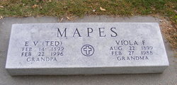
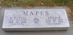
Viola Fern Sloan Mapes
| Birth | : | 22 Aug 1899 David City, Butler County, Nebraska, USA |
| Death | : | 27 Feb 1988 Aurora, Hamilton County, Nebraska, USA |
| Burial | : | Egmondville Cemetery, Egmondville, Huron County, Canada |
| Coordinate | : | 43.5398400, -81.4074380 |
| Description | : | Viola Mapes Funeral Services were held 11:00 A.M., Monday, February 29, 1988 at the Aurora First Christian Church. Interment was held in the Aurora Cemetery. OBITUARY: Viola Mapes Viola Fern Mapes, the daughter of Richard and Anna (Blevins) Sloan, was born at David City, Nebraska, on August 22, 1899, and passed away at Aurora, Nebraska, on February 27, 1988, at the age of 88 years, 6 months, and 7 days. She grew up in the central Nebraska area, and attended Aurora Schools. On December 23, 1918, she was united in marriage to E.V. "Ted" Mapes, at Grand Island, and they had... Read More |
frequently asked questions (FAQ):
-
Where is Viola Fern Sloan Mapes's memorial?
Viola Fern Sloan Mapes's memorial is located at: Egmondville Cemetery, Egmondville, Huron County, Canada.
-
When did Viola Fern Sloan Mapes death?
Viola Fern Sloan Mapes death on 27 Feb 1988 in Aurora, Hamilton County, Nebraska, USA
-
Where are the coordinates of the Viola Fern Sloan Mapes's memorial?
Latitude: 43.5398400
Longitude: -81.4074380
Family Members:
Parent
Spouse
Siblings
Flowers:
Nearby Cemetories:
1. Egmondville Cemetery
Egmondville, Huron County, Canada
Coordinate: 43.5398400, -81.4074380
2. Harpurhey Presbyterian Cemetery
Harpurhey, Huron County, Canada
Coordinate: 43.5601460, -81.4149820
3. Saint James Cemetery
Seaforth, Huron County, Canada
Coordinate: 43.5479180, -81.3798530
4. Maitlandbank Cemetery
Seaforth, Huron County, Canada
Coordinate: 43.5740600, -81.3906500
5. Saint Columban Roman Catholic Cemetery
Saint-Columban, Huron County, Canada
Coordinate: 43.5180000, -81.3348330
6. Turners Cemetery
Tuckersmith Township, Huron County, Canada
Coordinate: 43.5734540, -81.4893110
7. Ross United Presbyterian Cemetery
Brucefield, Huron County, Canada
Coordinate: 43.5216200, -81.5169800
8. Ross Free Presbyterian Cemetery
Brucefield, Huron County, Canada
Coordinate: 43.5118590, -81.5139350
9. Kinburn United Cemetery
Kinburn, Huron County, Canada
Coordinate: 43.6307870, -81.4226600
10. Saint Patrick's Cemetery
Dublin, Perth County, Canada
Coordinate: 43.5000687, -81.2868118
11. Grimoldby Family Cemetery
Seaforth, Huron County, Canada
Coordinate: 43.5978620, -81.2970350
12. Staffa Cemetery
Staffa, Perth County, Canada
Coordinate: 43.4397100, -81.3412500
13. Baird's Cemetery
Brucefield, Huron County, Canada
Coordinate: 43.5387800, -81.5678100
14. Cromarty Presbyterian Cemetery
Cromarty, Perth County, Canada
Coordinate: 43.4277106, -81.3534830
15. McTaggarts Cemetery
Usborne Township, Huron County, Canada
Coordinate: 43.4228400, -81.4414710
16. Salem Cemetery
West Perth Township, Perth County, Canada
Coordinate: 43.4477000, -81.2983120
17. Saint Joseph's Roman Catholic Cemetery
Hullett Township, Huron County, Canada
Coordinate: 43.6421190, -81.4980580
18. McKillop Zion Church Cemetery
Huron East, Huron County, Canada
Coordinate: 43.5731940, -81.2407420
19. Clinton Public Cemetery
Clinton, Huron County, Canada
Coordinate: 43.6351790, -81.5293200
20. Burns United Church Cemetery
Hullett Township, Huron County, Canada
Coordinate: 43.6720600, -81.4192660
21. Hensall Union Cemetery
Hensall, Huron County, Canada
Coordinate: 43.4174710, -81.4817870
22. Old Cromarty Presbyterian Cemetery
Cromarty, Perth County, Canada
Coordinate: 43.4176179, -81.3298534
23. Varna United-Memorial Cemetery
Stanley Township, Huron County, Canada
Coordinate: 43.5347640, -81.5950790
24. Saint Peter's Lutheran Cemetery
Brodhagen, Perth County, Canada
Coordinate: 43.5543020, -81.1982350

