

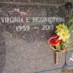
Virginia Eileen “Ginger” O'Malley Higginbotham
| Birth | : | 21 Aug 1959 Walnut Creek, Contra Costa County, California, USA |
| Death | : | 14 Sep 2013 Pollock Pines, El Dorado County, California, USA |
| Burial | : | Queen of Heaven Cemetery, Lafayette, Contra Costa County, USA |
| Coordinate | : | 37.9446983, -122.1057968 |
| Plot | : | Holy Family Garden number 4029 |
| Description | : | Mountain Democrat (Placerville CA) Friday, September 20, 2013 Virginia "Ginger" Higginbotham Aug. 21, 1959 - Sep. 14, 2013 Virginia "Ginger" Higginbotham, 54, passed away peacefully at home in Pollock Pines, Calif., following a courageous two-year battle with cancer. Born in Walnut Creek, Calif., she attended Carondelet High School in Concord and graduated from California State University, Chico. A part-time substitute teacher, she will be remembered for her gentle spirit, her devotion to her family, her loyalty to her friends and her special affection for the community in which she lived. Ginger is survived by her husband, Terry... Read More |
frequently asked questions (FAQ):
-
Where is Virginia Eileen “Ginger” O'Malley Higginbotham's memorial?
Virginia Eileen “Ginger” O'Malley Higginbotham's memorial is located at: Queen of Heaven Cemetery, Lafayette, Contra Costa County, USA.
-
When did Virginia Eileen “Ginger” O'Malley Higginbotham death?
Virginia Eileen “Ginger” O'Malley Higginbotham death on 14 Sep 2013 in Pollock Pines, El Dorado County, California, USA
-
Where are the coordinates of the Virginia Eileen “Ginger” O'Malley Higginbotham's memorial?
Latitude: 37.9446983
Longitude: -122.1057968
Family Members:
Parent


Flowers:


Nearby Cemetories:
1. Queen of Heaven Cemetery
Lafayette, Contra Costa County, USA
Coordinate: 37.9446983, -122.1057968
2. Oakmont Memorial Park
Lafayette, Contra Costa County, USA
Coordinate: 37.9475746, -122.0988770
3. Muir-Strentzel Hanna Cemetery
Martinez, Contra Costa County, USA
Coordinate: 37.9784393, -122.1232681
4. Lafayette Cemetery
Lafayette, Contra Costa County, USA
Coordinate: 37.8964005, -122.0986023
5. Saint Pauls Episcopal Columbarium
Walnut Creek, Contra Costa County, USA
Coordinate: 37.9014310, -122.0682560
6. Hulls Walnut Creek Chapel Columbarium
Walnut Creek, Contra Costa County, USA
Coordinate: 37.8955350, -122.0782110
7. Pacheco Cemetery and Crematory
Pacheco, Contra Costa County, USA
Coordinate: 37.9994011, -122.0729980
8. Saint Stephen's Cemetery
Concord, Contra Costa County, USA
Coordinate: 37.9625015, -122.0306015
9. Mount Diablo Unitarian Universalist Church Memoria
Walnut Creek, Contra Costa County, USA
Coordinate: 37.8993750, -122.0456600
10. Fales Cemetery - Defunct
Walnut Creek, Contra Costa County, USA
Coordinate: 37.8873232, -122.0618906
11. Saint Stephens Episcopal Church Memorial Garden
Orinda, Contra Costa County, USA
Coordinate: 37.8982650, -122.1729170
12. Saint Anselms Episcopal Church Columbarium
Lafayette, Contra Costa County, USA
Coordinate: 37.8737230, -122.0933820
13. Lafayette-Orinda Presbyterian Church Garden
Contra Costa County, USA
Coordinate: 37.8866040, -122.1606950
14. Gan Shalom Cemetery
Contra Costa County, USA
Coordinate: 37.9528122, -122.1975098
15. Saint Catherine of Siena Cemetery
Martinez, Contra Costa County, USA
Coordinate: 38.0172005, -122.1446991
16. Alhambra Cemetery
Martinez, Contra Costa County, USA
Coordinate: 38.0182991, -122.1442032
17. Memory Gardens Cemetery
Concord, Contra Costa County, USA
Coordinate: 38.0093994, -122.0381012
18. Live Oak Cemetery
Concord, Contra Costa County, USA
Coordinate: 37.9491997, -121.9725037
19. Benicia Army Cemetery
Benicia, Solano County, USA
Coordinate: 38.0510820, -122.1419030
20. Saint Dominics Catholic Cemetery
Benicia, Solano County, USA
Coordinate: 38.0583730, -122.1402900
21. Benicia City Cemetery
Benicia, Solano County, USA
Coordinate: 38.0576610, -122.1535930
22. Port Chicago Naval Magazine National Memorial
Concord, Contra Costa County, USA
Coordinate: 38.0574610, -122.0296950
23. Alamo Cemetery
Alamo, Contra Costa County, USA
Coordinate: 37.8361015, -122.0149994
24. Northbrae Community Church Columbarium
Berkeley, Alameda County, USA
Coordinate: 37.8905500, -122.2763200