
| Birth | : | 29 Jun 1931 Norfolk, Madison County, Nebraska, USA |
| Death | : | 16 May 1999 Holdrege, Phelps County, Nebraska, USA |
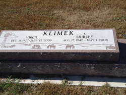
| Burial | : | Harmony Grove Cemetery, Dennis, Labette County, USA |
| Coordinate | : | 37.3255997, -95.4580994 |
| Plot | : | H 132 |
| Description | : | Married 21 July 1955 |
frequently asked questions (FAQ):
-
Where is Wallace Herman “Wally” Bernstrauch's memorial?
Wallace Herman “Wally” Bernstrauch's memorial is located at: Harmony Grove Cemetery, Dennis, Labette County, USA.
-
When did Wallace Herman “Wally” Bernstrauch death?
Wallace Herman “Wally” Bernstrauch death on 16 May 1999 in Holdrege, Phelps County, Nebraska, USA
-
Where are the coordinates of the Wallace Herman “Wally” Bernstrauch's memorial?
Latitude: 37.3255997
Longitude: -95.4580994
Family Members:
Parent

Spouse
Siblings
Flowers:


Nearby Cemetories:
1. Harmony Grove Cemetery
Dennis, Labette County, USA
Coordinate: 37.3255997, -95.4580994
2. Pleasant Hill Cemetery
Dennis, Labette County, USA
Coordinate: 37.3185997, -95.3957977
3. Morehead Cemetery
Morehead, Neosho County, USA
Coordinate: 37.3849983, -95.5246964
4. Fairview Cemetery
Cherryvale, Montgomery County, USA
Coordinate: 37.2722015, -95.5344009
5. Spindletop Cemetery
Cherryvale, Montgomery County, USA
Coordinate: 37.2958400, -95.5570700
6. Griffith Cemetery
Labette County, USA
Coordinate: 37.2463989, -95.4981003
7. Pleasant Dale Cemetery
Cherryvale, Montgomery County, USA
Coordinate: 37.3139700, -95.5860700
8. Hopewell Cemetery
Mound Valley, Labette County, USA
Coordinate: 37.2453003, -95.3741989
9. South Center Cemetery
Thayer, Neosho County, USA
Coordinate: 37.4305992, -95.4713974
10. Valley Cemetery
Galesburg, Neosho County, USA
Coordinate: 37.3986500, -95.3522400
11. Hiltz Cemetery
Montgomery County, USA
Coordinate: 37.3549995, -95.5939026
12. Saint Francis Xavier Cemetery
Cherryvale, Montgomery County, USA
Coordinate: 37.2633018, -95.5753021
13. Wilsonton Cemetery
Parsons, Labette County, USA
Coordinate: 37.2597700, -95.3397800
14. Centennial Cemetery
Cherryvale, Montgomery County, USA
Coordinate: 37.2296982, -95.5466995
15. Plainfield Cemetery
Neosho County, USA
Coordinate: 37.4525108, -95.5061264
16. Mound Valley Cemetery
Mound Valley, Labette County, USA
Coordinate: 37.1998770, -95.3990600
17. Russell Cemetery
Mound Valley, Labette County, USA
Coordinate: 37.1900490, -95.4763840
18. Ladore Cemetery
Ladore Township, Neosho County, USA
Coordinate: 37.4059000, -95.3169500
19. Mount Olivet Roman Catholic Cemetery
Parsons, Labette County, USA
Coordinate: 37.2998500, -95.2857500
20. Lucken Cemetery
Parsons, Labette County, USA
Coordinate: 37.3547870, -95.2854960
21. Pefley Cemetery
Parsons, Labette County, USA
Coordinate: 37.3564900, -95.2856000
22. Parsons State Hospital Cemetery
Parsons, Labette County, USA
Coordinate: 37.3571060, -95.2856310
23. Calvary Cemetery
Parsons, Labette County, USA
Coordinate: 37.3578100, -95.2855000
24. Memorial Lawn Cemetery
Parsons, Labette County, USA
Coordinate: 37.3013992, -95.2833023