
| Memorials | : | 37 |
| Location | : | Parsons, Labette County, USA |
| Website | : | www.kdads.ks.gov/state-hospitals-and-institutions/parsons-state-hospital-and-training-center |
| Coordinate | : | 37.3571060, -95.2856310 |
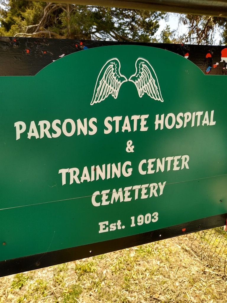
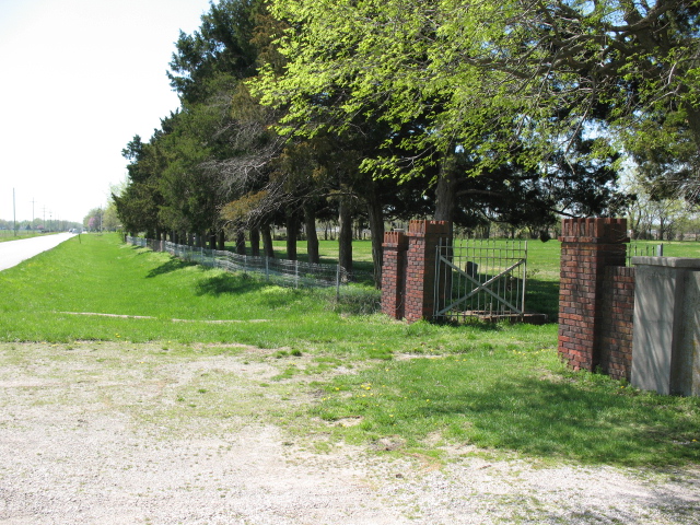
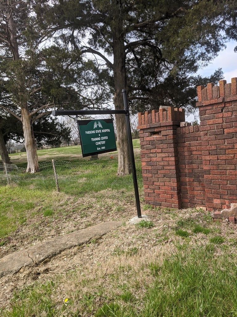
| Description | : | Cemetery is located on 32nd Street, about 1 1/2 miles north of Main Street. Located Next to Mt. Calvary Cemetery. There is no sign for the State Hospital Cemetgery, just a gate with red-brick columns. Few headstones, most graves marked with metal plate, many with no names. These names were transcribed from a list that is at the Parsons City Library. The list contains Grave No.; Deceased Name; Date of Death. Parsons State Hospital opened in 1903 as a State Hospital for Epileptics. In 1957, the Hospital was renamed Parsons State Hospital and Training Center and began providing programs... Read More |
frequently asked questions (FAQ):
-
Where is Parsons State Hospital Cemetery?
Parsons State Hospital Cemetery is located at Parsons, Labette County ,Kansas ,USA.
-
Parsons State Hospital Cemetery cemetery's updated grave count on graveviews.com?
36 memorials
-
Where are the coordinates of the Parsons State Hospital Cemetery?
Latitude: 37.3571060
Longitude: -95.2856310
Nearby Cemetories:
1. Pefley Cemetery
Parsons, Labette County, USA
Coordinate: 37.3564900, -95.2856000
2. Calvary Cemetery
Parsons, Labette County, USA
Coordinate: 37.3578100, -95.2855000
3. Lucken Cemetery
Parsons, Labette County, USA
Coordinate: 37.3547870, -95.2854960
4. Oakwood Cemetery
Parsons, Labette County, USA
Coordinate: 37.3375500, -95.2402800
5. West Bethany Cemetery
Neosho County, USA
Coordinate: 37.3983002, -95.2699966
6. East Bethany Cemetery
Neosho County, USA
Coordinate: 37.3983002, -95.2692032
7. Ladore Cemetery
Ladore Township, Neosho County, USA
Coordinate: 37.4059000, -95.3169500
8. Memorial Lawn Cemetery
Parsons, Labette County, USA
Coordinate: 37.3013992, -95.2833023
9. Mount Olivet Roman Catholic Cemetery
Parsons, Labette County, USA
Coordinate: 37.2998500, -95.2857500
10. Valley Cemetery
Galesburg, Neosho County, USA
Coordinate: 37.3986500, -95.3522400
11. Spring Hill Cemetery
Parsons, Labette County, USA
Coordinate: 37.2882000, -95.2497500
12. Evergreen Cemetery
Neosho County, USA
Coordinate: 37.4008446, -95.2063217
13. South Mound Cemetery
South Mound, Neosho County, USA
Coordinate: 37.4349800, -95.2245400
14. Pleasant Hill Cemetery
Dennis, Labette County, USA
Coordinate: 37.3185997, -95.3957977
15. Franklin Cemetery
Montana, Labette County, USA
Coordinate: 37.3182983, -95.1746979
16. Oak Grove Cemetery
Neosho County, USA
Coordinate: 37.3968925, -95.1700974
17. Center Cemetery
Labette County, USA
Coordinate: 37.3396730, -95.1576630
18. Wilsonton Cemetery
Parsons, Labette County, USA
Coordinate: 37.2597700, -95.3397800
19. Old Oak Grove Cemetery
Neosho County, USA
Coordinate: 37.4050751, -95.1635742
20. Brown Cemetery
Neosho County, USA
Coordinate: 37.4244003, -95.1725006
21. Mount Hope Cemetery
Galesburg, Neosho County, USA
Coordinate: 37.4592018, -95.3514023
22. Swayze Family Cemetery
Erie, Neosho County, USA
Coordinate: 37.4839200, -95.2585400
23. Fairview Cemetery
Parsons, Labette County, USA
Coordinate: 37.2963700, -95.1408800
24. Hopewell Cemetery
Mound Valley, Labette County, USA
Coordinate: 37.2453003, -95.3741989