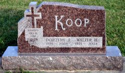
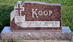
Walter Henry Koop
| Birth | : | 15 Jun 1921 Austinville, Butler County, Iowa, USA |
| Death | : | 25 Nov 2004 Ackley, Hardin County, Iowa, USA |
| Burial | : | Union Hill Friends Church Cemetery, Red Brush, Surry County, USA |
| Coordinate | : | 36.4714410, -80.6956890 |
| Plot | : | B - 35 |
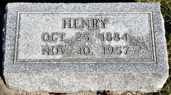
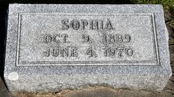
| Description | : | APLINGTON - Walter Henry Koop, 83, of Ackley, formerly of Aplington, died Thursday, November 25, 2004 at Presbyterian Village of natural causes. He was born June 15, 1921 on a farm northwest of Austinville in Butler County. His parents were Henry and Sophie (Meyer) Koop. Walter graduated from Pleasant Prairie Academy in German Valley, Illinois (high school) in 1943 and attended Central College in Pella, then Hope College in Holland, Michigan. He worked as a carpenter for Whitney Meyer and also as a factory plant supervisor at Ackley Canning Factory. He married Dorothy Frerichs on July... Read More |
frequently asked questions (FAQ):
-
Where is Walter Henry Koop's memorial?
Walter Henry Koop's memorial is located at: Union Hill Friends Church Cemetery, Red Brush, Surry County, USA.
-
When did Walter Henry Koop death?
Walter Henry Koop death on 25 Nov 2004 in Ackley, Hardin County, Iowa, USA
-
Where are the coordinates of the Walter Henry Koop's memorial?
Latitude: 36.4714410
Longitude: -80.6956890
Family Members:
Parent
Spouse
Siblings
Flowers:
Nearby Cemetories:
1. Union Hill Friends Church Cemetery
Red Brush, Surry County, USA
Coordinate: 36.4714410, -80.6956890
2. Community Baptist Church Cemetery
Red Brush, Surry County, USA
Coordinate: 36.4713593, -80.7171097
3. Mosley Family Cemetery
Mount Airy, Surry County, USA
Coordinate: 36.4670770, -80.6681230
4. Tucker Cemetery
Pine Ridge, Surry County, USA
Coordinate: 36.4908889, -80.7153056
5. Tucker Cemetery
Mount Airy, Surry County, USA
Coordinate: 36.4908905, -80.7153091
6. Laurel Springs Primitive Baptist Church Cemetery
Pine Ridge, Surry County, USA
Coordinate: 36.4821930, -80.7263031
7. Dunbar Cemetery
Mount Airy, Surry County, USA
Coordinate: 36.4690010, -80.6567720
8. Antioch Baptist Church Cemetery
Toast, Surry County, USA
Coordinate: 36.5038872, -80.6841660
9. Pine Ridge Baptist Church Cemetery
Pine Ridge, Surry County, USA
Coordinate: 36.4995842, -80.7190552
10. Westside Baptist Church Cemetery
Toast, Surry County, USA
Coordinate: 36.4859720, -80.6574720
11. Blues Grove Baptist Church Cemetery
Red Brush, Surry County, USA
Coordinate: 36.4382210, -80.7058334
12. Surry County Veterans Cemetery
Toast, Surry County, USA
Coordinate: 36.5052800, -80.6835300
13. Semper Fi Cemetery
Pine Ridge, Surry County, USA
Coordinate: 36.5010540, -80.7216920
14. Johnson Family Cemetery
Mount Airy, Surry County, USA
Coordinate: 36.5037500, -80.6698330
15. Masadona Cemetery
Dobson, Surry County, USA
Coordinate: 36.4321940, -80.6973270
16. Creed Family Cemetery
Mount Airy, Surry County, USA
Coordinate: 36.4905280, -80.6525830
17. Old Fisher River Church Cemetery
Dobson, Surry County, USA
Coordinate: 36.4304420, -80.6992580
18. Whitlock Family Cemetery
Mount Airy, Surry County, USA
Coordinate: 36.4813056, -80.6422222
19. Genesis Full Gospel Church Cemetery
Toast, Surry County, USA
Coordinate: 36.5120010, -80.6711960
20. Oak Grove Baptist Church Cemetery
Oak Grove (Bottom), Surry County, USA
Coordinate: 36.4788770, -80.7540890
21. Gordon Cemetery
Mount Airy, Surry County, USA
Coordinate: 36.4234440, -80.6966390
22. Copeland Home Graveyard
Dobson, Surry County, USA
Coordinate: 36.4223490, -80.7089350
23. McCraw Cemetery
Beulah, Surry County, USA
Coordinate: 36.4671370, -80.7626220
24. County Home Cemetery
New Hope, Surry County, USA
Coordinate: 36.4192840, -80.7152490

