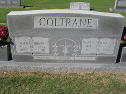
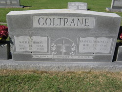
Walter Thomas “Tom” Coltrane
| Birth | : | 14 Aug 1934 Alamance County, North Carolina, USA |
| Death | : | 22 Apr 2001 Greensboro, Guilford County, North Carolina, USA |
| Burial | : | Red Cross Baptist Church Cemetery, Redcross, Randolph County, USA |
| Coordinate | : | 35.8715591, -79.6995850 |
| Description | : | CLIMAX - Walter Thomas "Tom" Coltrane, 66, of Providence Church Road, died Sunday, April 22, 2001, at Moses H. Cone Memorial Hospital, Greensboro. Funeral service will be 2 p.m. Wednesday at Red Cross Baptist Church, where he was a member, with the Rev. Bud Rowe and the Rev. Ken Goins officiating. Burial will be in the church cemetery. He was a native of Alamance County, a graduate of Liberty High School and was retired from Southern Bell Company after more than 38 years. Surviving are wife, Darlene Cox Coltrane of the home; daughters, Cindy Cox of Asheboro, Myra Lynn Hargett of Climax and... Read More |
frequently asked questions (FAQ):
-
Where is Walter Thomas “Tom” Coltrane's memorial?
Walter Thomas “Tom” Coltrane's memorial is located at: Red Cross Baptist Church Cemetery, Redcross, Randolph County, USA.
-
When did Walter Thomas “Tom” Coltrane death?
Walter Thomas “Tom” Coltrane death on 22 Apr 2001 in Greensboro, Guilford County, North Carolina, USA
-
Where are the coordinates of the Walter Thomas “Tom” Coltrane's memorial?
Latitude: 35.8715591
Longitude: -79.6995850
Family Members:
Spouse
Children
Nearby Cemetories:
1. Red Cross Baptist Church Cemetery
Redcross, Randolph County, USA
Coordinate: 35.8715591, -79.6995850
2. Bethel United Methodist Church Cemetery
Randolph County, USA
Coordinate: 35.8779190, -79.7051540
3. Providence Cemetery
Randolph County, USA
Coordinate: 35.8737030, -79.7382820
4. Shiloh United Methodist Church Cemetery
Liberty, Randolph County, USA
Coordinate: 35.8915430, -79.6594990
5. Saint John Baptist Church Cemetery
Climax, Guilford County, USA
Coordinate: 35.9154560, -79.7094780
6. Bethlehem United Methodist Church Cemetery
Climax, Guilford County, USA
Coordinate: 35.9155600, -79.7219500
7. Dr. Clyde M. Gilmore Memorial Park
Julian, Guilford County, USA
Coordinate: 35.9108009, -79.6622009
8. Melanchthon Lutheran Church Cemetery
Liberty, Randolph County, USA
Coordinate: 35.8451630, -79.6440640
9. Grays Chapel Cemetery
Grays Chapel, Randolph County, USA
Coordinate: 35.8183570, -79.6986060
10. Cool Springs Baptist Church Cemetery
Franklinville, Randolph County, USA
Coordinate: 35.8072420, -79.6805660
11. Sandy Creek Baptist Church Cemetery
Liberty, Randolph County, USA
Coordinate: 35.8235550, -79.6429050
12. Sandy Creek Primitive Baptist Church Cemetery
Liberty, Randolph County, USA
Coordinate: 35.8239020, -79.6406560
13. Branson Mill Baptist Church Cemetery
Randolph County, USA
Coordinate: 35.9062540, -79.7822510
14. New Salem United Methodist Church Cemetery
Randleman, Randolph County, USA
Coordinate: 35.8406311, -79.7853233
15. Macedonia Baptist Church Cemetery
Liberty, Randolph County, USA
Coordinate: 35.8960090, -79.6075490
16. Whites Memorial Baptist Church Cemetery
Franklinville, Randolph County, USA
Coordinate: 35.7939680, -79.7149760
17. Saint Peter United Methodist Church Cemetery
Randleman Township, Randolph County, USA
Coordinate: 35.8601570, -79.7956300
18. Saint Peters UMC Cemetery
Randleman, Randolph County, USA
Coordinate: 35.8601310, -79.7956760
19. Faith Temple Baptist Church Cemetery
Franklinville, Randolph County, USA
Coordinate: 35.8023770, -79.7460950
20. Bethany United Methodist Church Cemetery #1
Franklinville, Randolph County, USA
Coordinate: 35.8101300, -79.7606200
21. Odell Trogdon Cemetery
Grays Chapel, Randolph County, USA
Coordinate: 35.7947200, -79.7300200
22. Love Baptist Church Cemetery
Julian, Guilford County, USA
Coordinate: 35.9523070, -79.6700890
23. Level Cross United Methodist Church Cemetery
Randleman, Randolph County, USA
Coordinate: 35.8871100, -79.8066620
24. Level Cross Baptist Church Cemetery
Randleman, Randolph County, USA
Coordinate: 35.8879530, -79.8081950


