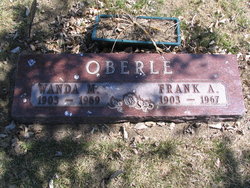
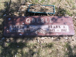
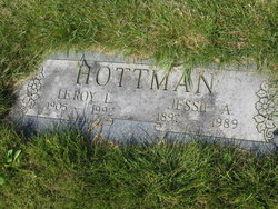
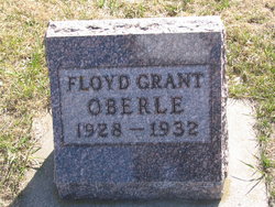
Wanda Minerva Hottman Oberle
| Birth | : | 4 Jun 1903 Mellette, Spink County, South Dakota, USA |
| Death | : | 11 Nov 1989 Mellette, Spink County, South Dakota, USA |
| Burial | : | St. Mary's Churchyard, Long Sutton, South Holland District, England |
| Coordinate | : | 52.7844700, 0.1221800 |
| Plot | : | Blk D Lot 54 grave 2 |
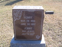
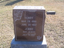
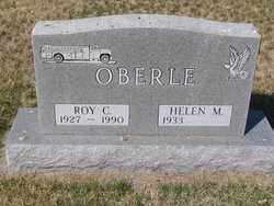
| Description | : | Wanda Minerva Hottman Oberle died at the age of 86yrs from heart failure. She was buried 4 Dec 1989. She was the daughter of Henry and Jennie Johnson . She attended school in Mellette. She married Frank Oberle aig 1920. She was postmaster of Mellette for 30 yrs before she retired in 1973. She was a member of the United Methodist Church, American Legion Auxiliary, Veterans of Foreign Wars Auxiliary, Mellette Senior Citizens, National Association of Postmasters and National Association of Retired Federal Employees. Survivors include two sons Ike and Roy Oberle both... Read More |
frequently asked questions (FAQ):
-
Where is Wanda Minerva Hottman Oberle's memorial?
Wanda Minerva Hottman Oberle's memorial is located at: St. Mary's Churchyard, Long Sutton, South Holland District, England.
-
When did Wanda Minerva Hottman Oberle death?
Wanda Minerva Hottman Oberle death on 11 Nov 1989 in Mellette, Spink County, South Dakota, USA
-
Where are the coordinates of the Wanda Minerva Hottman Oberle's memorial?
Latitude: 52.7844700
Longitude: 0.1221800
Family Members:
Parent
Spouse
Siblings
Children
Flowers:
Nearby Cemetories:
1. St. Mary's Churchyard
Long Sutton, South Holland District, England
Coordinate: 52.7844700, 0.1221800
2. Long Sutton Baptist Churchyard
Long Sutton, South Holland District, England
Coordinate: 52.7837460, 0.1204960
3. Long Sutton Cemetery
Long Sutton, South Holland District, England
Coordinate: 52.7848300, 0.1272300
4. St Nicholas Churchyard
Lutton, South Holland District, England
Coordinate: 52.8085300, 0.1246500
5. St Mary Magdalene Churchyard
Gedney, South Holland District, England
Coordinate: 52.7984900, 0.0791600
6. St. Mary Magdalene Churchyard
Fleet, South Holland District, England
Coordinate: 52.7928490, 0.0582900
7. St. Mary Churchyard
Tydd St Mary, South Holland District, England
Coordinate: 52.7456600, 0.1404600
8. St. Matthew's Churchyard
Sutton Bridge, South Holland District, England
Coordinate: 52.7682100, 0.1903100
9. St. Luke's Churchyard
Holbeach Hurn, South Holland District, England
Coordinate: 52.8231700, 0.0653600
10. St. Giles' Churchyard
Tydd St Giles, Fenland District, England
Coordinate: 52.7269470, 0.1118120
11. Gedney Dawsmere Cemetery
Gedney, South Holland District, England
Coordinate: 52.8487200, 0.1428700
12. Christs Church Churchyard
Dawsmere, South Holland District, England
Coordinate: 52.8493100, 0.1398000
13. Gedney Drove End Churchyard
Gedney, South Holland District, England
Coordinate: 52.8493470, 0.1405420
14. Holbeach Cemetery
Holbeach, South Holland District, England
Coordinate: 52.8062100, 0.0171500
15. All Saints Churchyard
Holbeach, South Holland District, England
Coordinate: 52.8036140, 0.0142530
16. Walpole St Andrew - Extension
Walpole, Kings Lynn and West Norfolk Borough, England
Coordinate: 52.7314600, 0.2162800
17. Walpole St Andrew
Walpole, Kings Lynn and West Norfolk Borough, England
Coordinate: 52.7349520, 0.2227630
18. St. Peter's Churchyard
Walpole, Kings Lynn and West Norfolk Borough, England
Coordinate: 52.7284200, 0.2219100
19. St. John's Churchyard
Holbeach, South Holland District, England
Coordinate: 52.7457510, -0.0024000
20. Whaplode Cemetery
Whaplode, South Holland District, England
Coordinate: 52.8016190, -0.0281347
21. St. Mary's Churchyard
Whaplode, South Holland District, England
Coordinate: 52.7974840, -0.0385520
22. St Paul Churchyard
Gorefield, Fenland District, England
Coordinate: 52.6873400, 0.0944700
23. Gorefield Congregational Churchyard
Gorefield, Fenland District, England
Coordinate: 52.6865500, 0.0968700
24. Terrington Saint Clement Methodist Cemetery
Terrington St Clement, Kings Lynn and West Norfolk Borough, England
Coordinate: 52.7589440, 0.2899360

