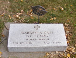
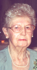
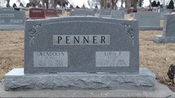
Warren Allen Cass
| Birth | : | 17 Apr 1906 Aurora, Hamilton County, Nebraska, USA |
| Death | : | 4 Oct 1993 Grand Island, Hall County, Nebraska, USA |
| Burial | : | Friendship United Methodist Church Cemetery, Rock Hill, York County, USA |
| Coordinate | : | 34.9066457, -80.9084393 |
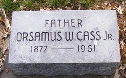
| Description | : | Warren Allen Cass, the son of Orsamus and Belle (Myers) Cass, was born at Aurora, Nebraska, on April 17, 1906, and died at the Veteran's Administration Hospital, in Grand Island, Nebraska, on October 4, 1993, at the age of 87 years, 5 months, and 17 days. He grew up at Aurora, and attended Aurora High School. He then worked was a farm hand, and was employed at the Farmers Union Creamery. He served his country during World War II in the U.S. Army from September 11, 1942, until his discharge on January 27, 1945. On September 24, 1954,... Read More |
frequently asked questions (FAQ):
-
Where is Warren Allen Cass's memorial?
Warren Allen Cass's memorial is located at: Friendship United Methodist Church Cemetery, Rock Hill, York County, USA.
-
When did Warren Allen Cass death?
Warren Allen Cass death on 4 Oct 1993 in Grand Island, Hall County, Nebraska, USA
-
Where are the coordinates of the Warren Allen Cass's memorial?
Latitude: 34.9066457
Longitude: -80.9084393
Family Members:
Parent
Spouse
Siblings
Flowers:
Nearby Cemetories:
1. Friendship United Methodist Church Cemetery
Rock Hill, York County, USA
Coordinate: 34.9066457, -80.9084393
2. Providence Baptist Church Cemetery
Rock Hill, York County, USA
Coordinate: 34.9082480, -80.9071590
3. Church of Jesus Christ of Latter-day Sts Cemetery
Catawba, York County, USA
Coordinate: 34.9071007, -80.9012985
4. Foundation AME Zion Church Cemetery
Rock Hill, York County, USA
Coordinate: 34.9194412, -80.9269409
5. Catawba Indian Nation Cemetery
Rock Hill, York County, USA
Coordinate: 34.9043999, -80.8824005
6. Tabernacle AME Zion Church Cemetery
Rock Hill, York County, USA
Coordinate: 34.8749847, -80.9308090
7. Mount Hebron Baptist Church Cemetery
Rock Hill, York County, USA
Coordinate: 34.8943270, -80.9506690
8. Macedonia Baptist Church
Indian Land, Lancaster County, USA
Coordinate: 34.8975580, -80.8555820
9. Catawba Baptist Church Cemetery
Rock Hill, York County, USA
Coordinate: 34.9066887, -80.9643478
10. Gold Hill AME Zion Church Cemetery
Van Wyck, Lancaster County, USA
Coordinate: 34.9094340, -80.8472940
11. Hopewell Presbyterian Church Cemetery
Lesslie, York County, USA
Coordinate: 34.8835320, -80.9648800
12. Catawba Chapel A.M.E. Zion Church Cemetery
Catawba, York County, USA
Coordinate: 34.8555500, -80.9262500
13. Catawba Methodist Church Cemetery
Catawba, York County, USA
Coordinate: 34.8506851, -80.9131012
14. Neely's Creek ARP Church Cemetery
Rock Hill, York County, USA
Coordinate: 34.8673260, -80.9651080
15. Indian Land Baptist Church Cemetery
Indian Land, Lancaster County, USA
Coordinate: 34.9318840, -80.8367260
16. Six Mile Cemetery
Indian Land, Lancaster County, USA
Coordinate: 34.9308014, -80.8319016
17. Belair Methodist Church Cemetery
Lancaster County, USA
Coordinate: 34.9509964, -80.8433228
18. Rock Grove AME Zion Church Cemetery
Rock Hill, York County, USA
Coordinate: 34.9106910, -80.9970110
19. Van Wyck Presbyterian Church
Van Wyck, Lancaster County, USA
Coordinate: 34.8537520, -80.8471870
20. Van Wyck United Methodist Church Cemetery
Van Wyck, Lancaster County, USA
Coordinate: 34.8563970, -80.8403790
21. White Oak AME Zion Church Cemetery
Van Wyck, Lancaster County, USA
Coordinate: 34.8487570, -80.8484340
22. Higher Ground Church Cemetery
Indian Land, Lancaster County, USA
Coordinate: 34.9713300, -80.8597020
23. Center Grove Memorial Park
Indian Land, Lancaster County, USA
Coordinate: 34.9205500, -80.8122100
24. Edwards Cemetery
Indian Land, Lancaster County, USA
Coordinate: 34.9770010, -80.8607570

