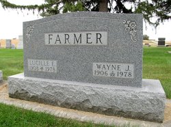
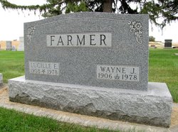
Wayne James Farmer
| Birth | : | 22 Nov 1906 Edgewood, Clayton County, Iowa, USA |
| Death | : | 31 Dec 1978 Van Horne, Benton County, Iowa, USA |
| Burial | : | Ridge Valley Cemetery, Sellersville, Bucks County, USA |
| Coordinate | : | 40.3741989, -75.3786011 |
| Description | : | Son of Willard J. and Nettie E. (Hockaday) Farmer. He married Lillian E. Grote. Their daughter, Ann Lucille, was born in 1937, and 2 years later they moved to the family farm east of Van Horn. Information courtesy of Colette Harrison. |
frequently asked questions (FAQ):
-
Where is Wayne James Farmer's memorial?
Wayne James Farmer's memorial is located at: Ridge Valley Cemetery, Sellersville, Bucks County, USA.
-
When did Wayne James Farmer death?
Wayne James Farmer death on 31 Dec 1978 in Van Horne, Benton County, Iowa, USA
-
Where are the coordinates of the Wayne James Farmer's memorial?
Latitude: 40.3741989
Longitude: -75.3786011
Family Members:
Spouse
Flowers:
Nearby Cemetories:
1. Ridge Valley Cemetery
Sellersville, Bucks County, USA
Coordinate: 40.3741989, -75.3786011
2. Jerusalem Union Cemetery
Almont, Bucks County, USA
Coordinate: 40.3685188, -75.3345108
3. Finland Mennonite Cemetery
Finland, Bucks County, USA
Coordinate: 40.3835000, -75.4242960
4. Stricker Cemetery
Trumbauersville, Bucks County, USA
Coordinate: 40.4082985, -75.3981018
5. Christ Church Old Section Cemetery
Trumbauersville, Bucks County, USA
Coordinate: 40.4127400, -75.3808100
6. Christ Union Cemetery
Trumbauersville, Bucks County, USA
Coordinate: 40.4134300, -75.3837600
7. Little Zion Lutheran Church Cemetery
Earlington, Montgomery County, USA
Coordinate: 40.3256000, -75.3621000
8. Saint Agnes Cemetery
Sellersville, Bucks County, USA
Coordinate: 40.3661000, -75.3113000
9. Sellersville Cemetery
Sellersville, Bucks County, USA
Coordinate: 40.3628006, -75.3094025
10. Christ Reformed Church of Indian Creek Cemetery
Telford, Montgomery County, USA
Coordinate: 40.3227615, -75.3459320
11. Fuhrman's Graveyard
Telford, Montgomery County, USA
Coordinate: 40.3201170, -75.3487760
12. Zion Memorial Gardens
Telford, Montgomery County, USA
Coordinate: 40.3193321, -75.3503876
13. Rockhill Mennonite Church Cemetery
Rock Hill, Bucks County, USA
Coordinate: 40.3366000, -75.3183000
14. Trinity Cemetery
Telford, Bucks County, USA
Coordinate: 40.3288994, -75.3266983
15. Perkasie Mausoleum
Perkasie, Bucks County, USA
Coordinate: 40.3754000, -75.2993000
16. Trinity Lutheran Cemetery
Perkasie, Bucks County, USA
Coordinate: 40.3763000, -75.2990000
17. Saint Stephens UCC Cemetery
Perkasie, Bucks County, USA
Coordinate: 40.3770000, -75.2990000
18. Stout Graveyard
Perkasie, Bucks County, USA
Coordinate: 40.3740000, -75.2984000
19. Saint Paul's Lutheran Church Cemetery
Telford, Montgomery County, USA
Coordinate: 40.3208008, -75.3383026
20. Richland Friends Meeting Burial Ground
Quakertown, Bucks County, USA
Coordinate: 40.4376000, -75.3532000
21. Rocky Ridge Mennonite Cemetery
Quakertown, Bucks County, USA
Coordinate: 40.4218750, -75.3151040
22. Franconia Mennonite Church Cemetery
Telford, Montgomery County, USA
Coordinate: 40.3054199, -75.3656693
23. Saint Johns Lutheran Cemetery
Quakertown, Bucks County, USA
Coordinate: 40.4403000, -75.3471000
24. Indian Creek Mennonite Cemetery
Franconia, Montgomery County, USA
Coordinate: 40.3032532, -75.3679428


