
| Memorials | : | 0 |
| Location | : | Franconia, Montgomery County, USA |
| Coordinate | : | 40.3032532, -75.3679428 |
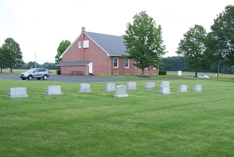
| Description | : | The Indian Creek Mennonite meetinghouse and cemetery are located along Rte 113 in Franconia Twp, Montgomery County, PA. The grounds are just west of the older and much larger Franconia Mennonite Church. The conservative Indian Creek Mennonite congregation also maintains a small school situated between the two churches. |
frequently asked questions (FAQ):
-
Where is Indian Creek Mennonite Cemetery?
Indian Creek Mennonite Cemetery is located at Franconia, Montgomery County ,Pennsylvania ,USA.
-
Indian Creek Mennonite Cemetery cemetery's updated grave count on graveviews.com?
0 memorials
-
Where are the coordinates of the Indian Creek Mennonite Cemetery?
Latitude: 40.3032532
Longitude: -75.3679428
Nearby Cemetories:
1. Franconia Mennonite Church Cemetery
Telford, Montgomery County, USA
Coordinate: 40.3054199, -75.3656693
2. Living Faith Fellowship Cemetery
Franconia, Montgomery County, USA
Coordinate: 40.2964516, -75.3674164
3. Delps Cemetery
Harleysville, Montgomery County, USA
Coordinate: 40.2971992, -75.3806000
4. Harley Family Cemetery
Harleysville, Montgomery County, USA
Coordinate: 40.2919006, -75.3750000
5. Zion Memorial Gardens
Telford, Montgomery County, USA
Coordinate: 40.3193321, -75.3503876
6. Fuhrman's Graveyard
Telford, Montgomery County, USA
Coordinate: 40.3201170, -75.3487760
7. Little Zion Lutheran Church Cemetery
Earlington, Montgomery County, USA
Coordinate: 40.3256000, -75.3621000
8. Christ Reformed Church of Indian Creek Cemetery
Telford, Montgomery County, USA
Coordinate: 40.3227615, -75.3459320
9. Saint Paul's Lutheran Church Cemetery
Telford, Montgomery County, USA
Coordinate: 40.3208008, -75.3383026
10. Indian Creek Church of Brethren Cemetery
Harleysville, Montgomery County, USA
Coordinate: 40.2940102, -75.4046478
11. Souderton Mennonite Church Cemetery
Souderton, Montgomery County, USA
Coordinate: 40.3088417, -75.3258209
12. Price Cemetery
Harleysville, Montgomery County, USA
Coordinate: 40.2896996, -75.4075012
13. Immanuel Leidys Church Cemetery
Souderton, Montgomery County, USA
Coordinate: 40.2994308, -75.3211517
14. Hillside Cemetery
Souderton, Montgomery County, USA
Coordinate: 40.3126373, -75.3215866
15. Salford Schwenkfelder Cemetery
Harleysville, Montgomery County, USA
Coordinate: 40.2698326, -75.3479843
16. Lower Salford Mennonite Cemetery
Harleysville, Montgomery County, USA
Coordinate: 40.2762489, -75.4020920
17. Trinity Cemetery
Telford, Bucks County, USA
Coordinate: 40.3288994, -75.3266983
18. Haman Cemetery
Schwenksville, Montgomery County, USA
Coordinate: 40.2789116, -75.4203186
19. Rockhill Mennonite Church Cemetery
Rock Hill, Bucks County, USA
Coordinate: 40.3366000, -75.3183000
20. Tennis-Lukens Cemetery
Hatboro, Montgomery County, USA
Coordinate: 40.2613640, -75.3296661
21. Lederach Burial Ground
Lower Salford Township, Montgomery County, USA
Coordinate: 40.2583930, -75.4008600
22. Christ Lutheran Church Cemetery
Kulpsville, Montgomery County, USA
Coordinate: 40.2522392, -75.3527908
23. United Church of Christ Cemetery
Kulpsville, Montgomery County, USA
Coordinate: 40.2512970, -75.3530807
24. Church of the Holy Spirit Memorial Garden
Harleysville, Montgomery County, USA
Coordinate: 40.3134910, -75.4363990