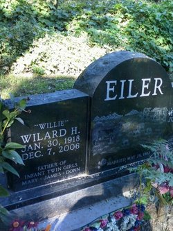
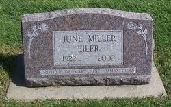
Wilard H “Willie” Eiler
| Birth | : | 30 Jan 1918 Cedar County, Iowa, USA |
| Death | : | 7 Dec 2006 Iowa City, Johnson County, Iowa, USA |
| Burial | : | St John the Evangelist Cemetery, Bath, Bath and North East Somerset Unitary Authority, England |
| Coordinate | : | 51.3696700, -2.3487400 |
| Description | : | December 08, 2006 Quad City Times TIPTON, Iowa -- Willard H. Eiler, of 1664 Snaggy Ridge Road, Tipton, Iowa, died on Thursday morning, December 7, 2006, at Mercy Hospital in Iowa City following a lengthy illness. Funeral services will be 10:30 a.m. Monday, December 11, 2006, at the First United Church of Christ in Tipton. Visitation will be from 4 to 7 p.m. Sunday at the Fry Funeral Home, Tipton. Private family inurnment will be at a later date. Willard is survived by his wife, Mildred; a daughter, two sons, two stepdaughters, two stepsons, five grandchi1dren, six great-grandchildren; nine... Read More |
frequently asked questions (FAQ):
-
Where is Wilard H “Willie” Eiler's memorial?
Wilard H “Willie” Eiler's memorial is located at: St John the Evangelist Cemetery, Bath, Bath and North East Somerset Unitary Authority, England.
-
When did Wilard H “Willie” Eiler death?
Wilard H “Willie” Eiler death on 7 Dec 2006 in Iowa City, Johnson County, Iowa, USA
-
Where are the coordinates of the Wilard H “Willie” Eiler's memorial?
Latitude: 51.3696700
Longitude: -2.3487400
Family Members:
Parent
Spouse
Siblings
Children
Flowers:
Nearby Cemetories:
1. St John the Evangelist Cemetery
Bath, Bath and North East Somerset Unitary Authority, England
Coordinate: 51.3696700, -2.3487400
2. Bath Abbey Cemetery
Widcombe, Bath and North East Somerset Unitary Authority, England
Coordinate: 51.3712850, -2.3483060
3. Unitarian Chapel Burial Ground
Widcombe, Bath and North East Somerset Unitary Authority, England
Coordinate: 51.3704650, -2.3539270
4. St Thomas à Becket's Church
Widcombe, Bath and North East Somerset Unitary Authority, England
Coordinate: 51.3734250, -2.3465560
5. Quaker Burial Ground
Widcombe, Bath and North East Somerset Unitary Authority, England
Coordinate: 51.3744350, -2.3498460
6. Prior Park College
Bath, Bath and North East Somerset Unitary Authority, England
Coordinate: 51.3645990, -2.3442400
7. Abbey & St James' Graveyard for the Poor
Widcombe, Bath and North East Somerset Unitary Authority, England
Coordinate: 51.3753550, -2.3545640
8. Old Baptist Burial Ground
Walcot, Bath and North East Somerset Unitary Authority, England
Coordinate: 51.3755070, -2.3544360
9. Smallcombe Vale Cemetery
Bathwick, Bath and North East Somerset Unitary Authority, England
Coordinate: 51.3757400, -2.3429400
10. St. Mary The Virgin Churchyard
Bathwick, Bath and North East Somerset Unitary Authority, England
Coordinate: 51.3759930, -2.3411930
11. Baptist Burial Ground
Widcombe, Bath and North East Somerset Unitary Authority, England
Coordinate: 51.3764216, -2.3556947
12. Saint Mark's Churchyard
Widcombe, Bath and North East Somerset Unitary Authority, England
Coordinate: 51.3766660, -2.3588010
13. Jewish Burial Ground
Combe Down, Bath and North East Somerset Unitary Authority, England
Coordinate: 51.3599170, -2.3534670
14. Union Chapel
Combe Down, Bath and North East Somerset Unitary Authority, England
Coordinate: 51.3594751, -2.3443662
15. St Mary Magdalen Chapel
Widcombe, Bath and North East Somerset Unitary Authority, England
Coordinate: 51.3760486, -2.3643405
16. Old Orchard Street Catholic Burial Vault
Bath, Bath and North East Somerset Unitary Authority, England
Coordinate: 51.3800370, -2.3579910
17. St James Old Burial Ground
Bath, Bath and North East Somerset Unitary Authority, England
Coordinate: 51.3798600, -2.3610100
18. Bath Abbey
Bath, Bath and North East Somerset Unitary Authority, England
Coordinate: 51.3815310, -2.3586640
19. St. Mary de Stall Churchyard (Defunct)
Bath, Bath and North East Somerset Unitary Authority, England
Coordinate: 51.3813350, -2.3600353
20. Quaker Meeting House
Bath, Bath and North East Somerset Unitary Authority, England
Coordinate: 51.3823280, -2.3604380
21. Bath General Hospital Burial Ground
Bath and North East Somerset Unitary Authority, England
Coordinate: 51.3824715, -2.3614742
22. Ss Michael & Paul Churchyard
Bath, Bath and North East Somerset Unitary Authority, England
Coordinate: 51.3834970, -2.3596980
23. St. Michael's Burial Ground
Bath, Bath and North East Somerset Unitary Authority, England
Coordinate: 51.3838810, -2.3594090
24. St Mary's Chapel, Queens Square
Bath, Bath and North East Somerset Unitary Authority, England
Coordinate: 51.3827790, -2.3649790


