| Birth | : | 1825 Randolph County, North Carolina, USA |
| Death | : | 1865 Randolph County, North Carolina, USA |
| Burial | : | Franklinville United Methodist Church Cemetery, Franklinville, Randolph County, USA |
| Coordinate | : | 35.7462900, -79.7037500 |
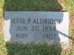
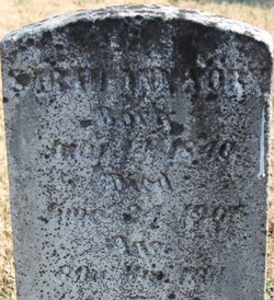
| Plot | : | This should be considered a Cenotaph to honor William ALDRIDGE |
| Description | : | William ALDRIDGE is the son of Balaam ALDRIDGE and his wife Tabitha SAVAGE. William ALDRIDGE appears to have married in 1845 to Lourenna LANE with two children per the 1850 US Census of Randolph County, North Carolina: 1. William W. ALDRIDGE, b. 1846, Randolph County, North Carolina 2. Lane ALDRIDGE, b. 1847, Randolph County, North Carolina William was living alone with his father in the 1860 US Census of Randolph County before his estimated death in 1865 perhaps killed in the civil war. NOTE: This is an apparent conflict with when Lourenna LANE went to Georgia... Read More |
frequently asked questions (FAQ):
-
Where is William Aldridge's memorial?
William Aldridge's memorial is located at: Franklinville United Methodist Church Cemetery, Franklinville, Randolph County, USA.
-
When did William Aldridge death?
William Aldridge death on 1865 in Randolph County, North Carolina, USA
-
Where are the coordinates of the William Aldridge's memorial?
Latitude: 35.7462900
Longitude: -79.7037500
Family Members:
Parent
Spouse
Siblings
Flowers:
Nearby Cemetories:
1. Franklinville United Methodist Church Cemetery
Franklinville, Randolph County, USA
Coordinate: 35.7462900, -79.7037500
2. First Baptist Church Cemetery
Franklinville, Randolph County, USA
Coordinate: 35.7482230, -79.6908630
3. Billy Trogdon Cemetery
Asheboro, Randolph County, USA
Coordinate: 35.7392800, -79.7219100
4. Clear View Baptist Church Cemetery
Franklinville, Randolph County, USA
Coordinate: 35.7530800, -79.7234300
5. Old Salem Cemetery
Franklinville, Randolph County, USA
Coordinate: 35.7414017, -79.6742020
6. Cedar Falls United Methodist Church Cemetery
Asheboro, Randolph County, USA
Coordinate: 35.7472920, -79.7338990
7. Cedar Falls Baptist Church Cemetery
Cedar Falls, Randolph County, USA
Coordinate: 35.7480800, -79.7357800
8. Pleasant Cross Christian Church Cemetery
Asheboro, Randolph County, USA
Coordinate: 35.7254000, -79.7268740
9. Providence Baptist Church Cemetery
Asheboro, Randolph County, USA
Coordinate: 35.7231400, -79.7237930
10. Shady Grove Community Cemetery
Asheboro, Randolph County, USA
Coordinate: 35.7192180, -79.7287920
11. Ramseur Wesleyan Church Cemetery
Ramseur, Randolph County, USA
Coordinate: 35.7305670, -79.6593030
12. Sunset Knoll Cemetery
Ramseur, Randolph County, USA
Coordinate: 35.7313995, -79.6500015
13. Whites Memorial Baptist Church Cemetery
Franklinville, Randolph County, USA
Coordinate: 35.7939680, -79.7149760
14. Friendship AME Church Cemetery
Ramseur, Randolph County, USA
Coordinate: 35.7463280, -79.6437970
15. Patterson Grove Christian Church Cemetery
Ramseur, Randolph County, USA
Coordinate: 35.7743940, -79.6536550
16. Pleasant Ridge Christian Church Cemetery
Ramseur, Randolph County, USA
Coordinate: 35.7046860, -79.6670060
17. Odell Trogdon Cemetery
Grays Chapel, Randolph County, USA
Coordinate: 35.7947200, -79.7300200
18. Harmony Baptist Church Cemetery
Ramseur, Randolph County, USA
Coordinate: 35.7241680, -79.6418910
19. Giles Chapel United Methodist Church Cemetery
Asheboro, Randolph County, USA
Coordinate: 35.7462270, -79.7752450
20. Parks-Stout Cemetery
Randolph County, USA
Coordinate: 35.7205460, -79.6373740
21. Mount Tabor Community Church Cemetery
Asheboro, Randolph County, USA
Coordinate: 35.6892900, -79.7318400
22. Whites Chapel United Methodist Church Cemetery
Liberty, Randolph County, USA
Coordinate: 35.7850520, -79.6422990
23. Cool Springs Baptist Church Cemetery
Franklinville, Randolph County, USA
Coordinate: 35.8072420, -79.6805660
24. Faith Temple Baptist Church Cemetery
Franklinville, Randolph County, USA
Coordinate: 35.8023770, -79.7460950


