| Birth | : | 23 Feb 1940 Des Moines, Polk County, Iowa, USA |
| Death | : | 31 Jan 2006 Butte, Silver Bow County, Montana, USA |
| Burial | : | Boulder Cemetery, Boulder, Jefferson County, USA |
| Coordinate | : | 46.2393990, -112.1074982 |
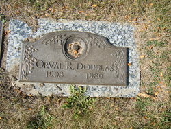
| Description | : | William Edward "Bill" Douglas died Tuesday evening, Jan. 31, 2005, at St. James Healthcare. He was born in Des Moines, Iowa, on Feb. 23, 1940, to Orval and Elizabeth (Brugman) Douglas. In 1946, he moved to Montana with his parents and lived in Anaconda for four years. His parents then moved to the Deer Lodge Valley, which was then called the Race Track Valley. He attended school in the Deer Lodge area and Powell County High School. He also attended the Yellowstone Bible College in Billings where he received his pastoral ministries and was licensed to teach and preach the word of... Read More |
frequently asked questions (FAQ):
-
Where is William Edward “Bill” Douglas's memorial?
William Edward “Bill” Douglas's memorial is located at: Boulder Cemetery, Boulder, Jefferson County, USA.
-
When did William Edward “Bill” Douglas death?
William Edward “Bill” Douglas death on 31 Jan 2006 in Butte, Silver Bow County, Montana, USA
-
Where are the coordinates of the William Edward “Bill” Douglas's memorial?
Latitude: 46.2393990
Longitude: -112.1074982
Family Members:
Parent
Flowers:
Nearby Cemetories:
1. Boulder Cemetery
Boulder, Jefferson County, USA
Coordinate: 46.2393990, -112.1074982
2. Rainville Memorial Cemetery
Basin, Jefferson County, USA
Coordinate: 46.2736630, -112.2514180
3. Elkhorn Cemetery
Elkhorn, Jefferson County, USA
Coordinate: 46.2683450, -111.9480010
4. Saint John the Evangelist Catholic Church Cemetery
Boulder, Jefferson County, USA
Coordinate: 46.1234000, -111.9505000
5. Jefferson City Cemetery
Jefferson City, Jefferson County, USA
Coordinate: 46.3913000, -112.0308000
6. John Montgomery Gravesite
Unionville, Lewis and Clark County, USA
Coordinate: 46.5170000, -112.0845000
7. Old Whitehall Cemetery
Whitehall, Jefferson County, USA
Coordinate: 45.9077988, -112.1038971
8. Turner Cemetery
Jefferson County, USA
Coordinate: 46.5306015, -111.8486023
9. Old Catholic Cemetery
Helena, Lewis and Clark County, USA
Coordinate: 46.5779120, -112.0183220
10. Plymouth Congregational Church Columbarium
Helena, Lewis and Clark County, USA
Coordinate: 46.5804000, -112.0109000
11. Parker Cemetery
Broadwater County, USA
Coordinate: 46.1760000, -111.6130000
12. Radersburg Cemetery
Radersburg, Broadwater County, USA
Coordinate: 46.1765990, -111.6126290
13. City Cemetery (Defunct)
Helena, Lewis and Clark County, USA
Coordinate: 46.5896660, -112.0360010
14. Cathedral of the Sacred Hearts of Jesus and Mary
Helena, Lewis and Clark County, USA
Coordinate: 46.5902550, -112.0339480
15. Saint Peters Episcopal Cathedral Columbarium
Helena, Lewis and Clark County, USA
Coordinate: 46.5925598, -112.0400925
16. Potters Field
Butte, Silver Bow County, USA
Coordinate: 45.9894470, -112.4773280
17. Macomber Field Cemetery
Radersburg, Broadwater County, USA
Coordinate: 46.1744100, -111.5986100
18. Calvary Cemetery
Lewis and Clark County, USA
Coordinate: 46.5997009, -112.0714035
19. Old Saint Marys Catholic Cemetery
Helena, Lewis and Clark County, USA
Coordinate: 46.5958150, -112.0105560
20. Charity Jane Dillon Gravesite
Townsend, Broadwater County, USA
Coordinate: 46.2947200, -111.5875770
21. Benton Avenue Cemetery
Helena, Lewis and Clark County, USA
Coordinate: 46.6045265, -112.0415497
22. Whitehall Cemetery
Whitehall, Jefferson County, USA
Coordinate: 45.8716050, -112.0875190
23. Saint Anns Cemetery
East Helena, Lewis and Clark County, USA
Coordinate: 46.5867004, -111.9013977
24. Montana State Veterans Cemetery
Helena, Lewis and Clark County, USA
Coordinate: 46.6151886, -112.0993042


