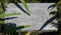
| Birth | : | 3 Dec 1936 West Point, Lee County, Iowa, USA |
| Death | : | 27 Apr 1992 Vinton, Benton County, Iowa, USA |
| Burial | : | Sand Lake Cemetery, Sand Lake, Kent County, USA |
| Coordinate | : | 43.2861480, -85.5313380 |
| Description | : | Published in Cedar Valley Times on April 28, 1992 William F "Bill" Bower, 55, died Monday morning, April 27, 1992, at his Vinton residence from complications of ALS (Lou Gehrig Disease). He was born December 3, 1936, at West Point. IA, to William James and Ethel (Wheeler) Bower. His family later moved to Vinton where he received his education. He served his nation with the U.S Marine Corps. On December 31, 1969, he married Zelda Geater at Sioux Falls, SD. Mr. Bower was formerly employed as a tuckpointer. He is survived by his wife, Zelda Bower, Vinton: one son, Blaine and one daughter,... Read More |
frequently asked questions (FAQ):
-
Where is William Franklin “Bill” Bower's memorial?
William Franklin “Bill” Bower's memorial is located at: Sand Lake Cemetery, Sand Lake, Kent County, USA.
-
When did William Franklin “Bill” Bower death?
William Franklin “Bill” Bower death on 27 Apr 1992 in Vinton, Benton County, Iowa, USA
-
Where are the coordinates of the William Franklin “Bill” Bower's memorial?
Latitude: 43.2861480
Longitude: -85.5313380
Family Members:
Parent
Spouse
Siblings
Flowers:
Nearby Cemetories:
1. Sand Lake Cemetery
Sand Lake, Kent County, USA
Coordinate: 43.2861480, -85.5313380
2. Saint Mary's Cemetery
Sand Lake, Kent County, USA
Coordinate: 43.2717018, -85.4969025
3. Punches Cemetery
Cedar Springs, Kent County, USA
Coordinate: 43.2467003, -85.5317001
4. Crandall Cemetery
Ensley Center, Newaygo County, USA
Coordinate: 43.2938995, -85.5939026
5. Pierson Township Cemetery
Pierson, Montcalm County, USA
Coordinate: 43.3381004, -85.5006027
6. East Nelson Cemetery
Cedar Springs, Kent County, USA
Coordinate: 43.2355995, -85.4561005
7. Elmwood Cemetery
Cedar Springs, Kent County, USA
Coordinate: 43.2118988, -85.5532990
8. Solon Township Cemetery
Cedar Springs, Kent County, USA
Coordinate: 43.2344589, -85.6100235
9. North Ensley Cemetery
Ensley Center, Newaygo County, USA
Coordinate: 43.3671989, -85.5935974
10. Saint Johns Catholic Cemetery
Ensley Center, Newaygo County, USA
Coordinate: 43.3664017, -85.5969009
11. DeGraw Family Cemetery
Cedar Springs, Kent County, USA
Coordinate: 43.2066585, -85.4283281
12. Saint Margarets Catholic Cemetery
Spencer Township, Kent County, USA
Coordinate: 43.2063890, -85.4169440
13. Coral Cemetery
Coral, Montcalm County, USA
Coordinate: 43.3671989, -85.4060974
14. Trufant Cemetery
Maple Valley Township, Montcalm County, USA
Coordinate: 43.3083000, -85.3653030
15. Maple Valley Cemetery
Maple Valley Township, Montcalm County, USA
Coordinate: 43.3358002, -85.3724976
16. Coady Cemetery
Maple Valley Township, Montcalm County, USA
Coordinate: 43.3540520, -85.3825890
17. Reynolds Township Cemetery
Howard City, Montcalm County, USA
Coordinate: 43.4101300, -85.4767100
18. Christian Plains Cemetery
Croton Township, Newaygo County, USA
Coordinate: 43.4100200, -85.6028200
19. Courtland Township Cemetery
Rockford, Kent County, USA
Coordinate: 43.1521988, -85.4897003
20. Horton Cemetery
Oakfield Township, Kent County, USA
Coordinate: 43.1767006, -85.4111023
21. Spencer Mills Cemetery
Spencer Township, Kent County, USA
Coordinate: 43.2209920, -85.3556680
22. Bouton Family Farm Burial Site
Reynolds Township, Montcalm County, USA
Coordinate: 43.4294960, -85.5555570
23. Oak Grove Cemetery
Croton Township, Newaygo County, USA
Coordinate: 43.4061012, -85.6430969
24. Algoma Township Cemetery
Rockford, Kent County, USA
Coordinate: 43.1563988, -85.6252975


