
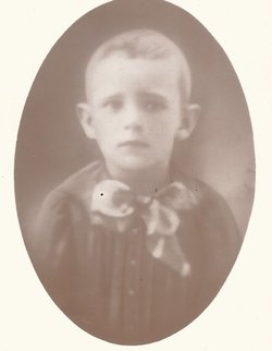
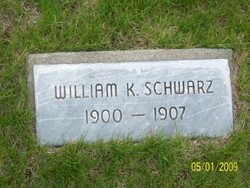
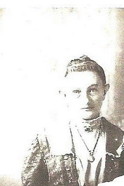
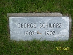
William Karl Schwarz
| Birth | : | 26 Feb 1900 Smithfield, Gosper County, Nebraska, USA |
| Death | : | 24 Aug 1907 Smithfield, Gosper County, Nebraska, USA |
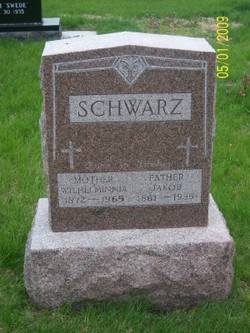
| Burial | : | Hope Lutheran Cemetery, Smithfield, Gosper County, USA |
| Coordinate | : | 40.5667500, -99.6800000 |
| Description | : | A sad accident occurred near Smithfield Saturday evening about 6 o'clock resulting in the death of the 8 year old boy of Jacob Schwarz. the lad and his father were hauling home a load of corn from the farm of Nels Bernstson, the boy walking on one side of the wagon holding the lines, while the father was on the opoosite side brushing the flies off the horses. In some manner, Schwarz did not see and does not know how the boy fell under the wheels, which passed over the top and back of his head, crushing it. He was... Read More |
frequently asked questions (FAQ):
-
Where is William Karl Schwarz's memorial?
William Karl Schwarz's memorial is located at: Hope Lutheran Cemetery, Smithfield, Gosper County, USA.
-
When did William Karl Schwarz death?
William Karl Schwarz death on 24 Aug 1907 in Smithfield, Gosper County, Nebraska, USA
-
Where are the coordinates of the William Karl Schwarz's memorial?
Latitude: 40.5667500
Longitude: -99.6800000
Family Members:
Parent
Siblings


Flowers:


Nearby Cemetories:
1. Hope Lutheran Cemetery
Smithfield, Gosper County, USA
Coordinate: 40.5667500, -99.6800000
2. Keely Cemetery
Smithfield, Gosper County, USA
Coordinate: 40.5727500, -99.6563500
3. Immanuel Cemetery
Bertrand, Phelps County, USA
Coordinate: 40.5682983, -99.6283035
4. Highland Cemetery
Bertrand, Phelps County, USA
Coordinate: 40.5194016, -99.6430969
5. Yoder Cemetery
Smithfield, Gosper County, USA
Coordinate: 40.4957000, -99.6845500
6. Sandstrom Cemetery
Phelps County, USA
Coordinate: 40.5983009, -99.5661011
7. Adullam Cemetery
Bertrand, Phelps County, USA
Coordinate: 40.6265000, -99.5856000
8. Robb Cemetery
Smithfield, Gosper County, USA
Coordinate: 40.6710691, -99.6996001
9. Quakerville Cemetery
Gosper County, USA
Coordinate: 40.6189003, -99.8097000
10. Fairfield Cemetery
Gosper County, USA
Coordinate: 40.4672012, -99.7549973
11. Plum Creek Massacre Cemetery
Phelps County, USA
Coordinate: 40.6726840, -99.6058220
12. Elwood Cemetery
Elwood, Gosper County, USA
Coordinate: 40.5999300, -99.8397300
13. Loomis Cemetery
Loomis, Phelps County, USA
Coordinate: 40.4801860, -99.5128300
14. Platte Valley Cemetery
Phelps County, USA
Coordinate: 40.6425018, -99.5028000
15. Shaw Cemetery
Phelps County, USA
Coordinate: 40.4303017, -99.5781021
16. Zion Cemetery
Gosper County, USA
Coordinate: 40.4085999, -99.7005997
17. Homerville Cemetery
Gosper County, USA
Coordinate: 40.4668999, -99.8593979
18. Williamsburg Cemetery
Phelps County, USA
Coordinate: 40.6490290, -99.4543150
19. McGuire Cemetery
Gosper County, USA
Coordinate: 40.4380989, -99.8664017
20. Moses Hill Cemetery
Loomis, Phelps County, USA
Coordinate: 40.5104490, -99.4388600
21. Evergreen Cemetery
Lexington, Dawson County, USA
Coordinate: 40.7639008, -99.6791992
22. Overton Cemetery
Overton, Dawson County, USA
Coordinate: 40.7317009, -99.5222015
23. Immanuel Lutheran Cemetery
Elwood, Gosper County, USA
Coordinate: 40.4206500, -99.8672000
24. Pleasant Grove Cemetery
Gosper County, USA
Coordinate: 40.4664001, -99.9250031