Rosa Karoline Josephine Schwarz Woodside
| Birth | : | 9 Mar 1911 Smithfield, Gosper County, Nebraska, USA |
| Death | : | 14 Jan 1991 Lexington, Dawson County, Nebraska, USA |
| Burial | : | St. Mary Magdalene, Stoke Talmage, South Oxfordshire District, England |
| Coordinate | : | 51.6878240, -1.0183240 |
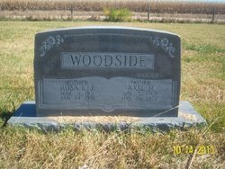
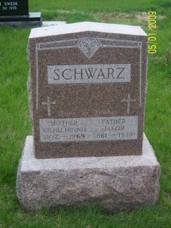
| Description | : | Rosa K. Woodside, 79, of Lexington, died Monday, Jan. 14, 1991, at Tri-County Hospital. Visitation will be Wednesday, Jan. 16, from 7-9 p.m. at Reynolds-Love Chapel in Lexington. Services will be Thursday, January 17, at 10 a.m., at Trinity Lutheran Church with Pastor Duane Maas officating. Burial will be in Grace Cemetery, northwest of Lexington. She was born March9, 1911, at Smithfield, to Jacob and Wilhemina (Karsten) Schwarz. She married A. Harold Woodside May 1, 1929, at Smithfield. He preceded her in death on May 26, 1977. Mrs. Woodside was a member of the Trinity Lutheran Church in Lexington. She is survived by five... Read More |
frequently asked questions (FAQ):
-
Where is Rosa Karoline Josephine Schwarz Woodside's memorial?
Rosa Karoline Josephine Schwarz Woodside's memorial is located at: St. Mary Magdalene, Stoke Talmage, South Oxfordshire District, England.
-
When did Rosa Karoline Josephine Schwarz Woodside death?
Rosa Karoline Josephine Schwarz Woodside death on 14 Jan 1991 in Lexington, Dawson County, Nebraska, USA
-
Where are the coordinates of the Rosa Karoline Josephine Schwarz Woodside's memorial?
Latitude: 51.6878240
Longitude: -1.0183240
Family Members:
Parent
Spouse
Siblings
Children
Flowers:
Nearby Cemetories:
1. St. Mary Magdalene
Stoke Talmage, South Oxfordshire District, England
Coordinate: 51.6878240, -1.0183240
2. St. Andrew's Churchyard
Wheatfield, South Oxfordshire District, England
Coordinate: 51.6879720, -1.0050930
3. St. Mary's Churchyard
Adwell, South Oxfordshire District, England
Coordinate: 51.6906560, -0.9938380
4. St Giles Churchyard
Tetsworth, South Oxfordshire District, England
Coordinate: 51.7085800, -1.0086700
5. St Peter Churchyard
Easington, South Oxfordshire District, England
Coordinate: 51.6684300, -1.0443070
6. St Mary Churchyard
Pyrton, South Oxfordshire District, England
Coordinate: 51.6558520, -1.0076830
7. All Saints Churchyard
Shirburn, South Oxfordshire District, England
Coordinate: 51.6577000, -0.9945000
8. St Margarets Churchyard
Lewknor, South Oxfordshire District, England
Coordinate: 51.6730340, -0.9663030
9. Holy Rood Churchyard
Cuxham, South Oxfordshire District, England
Coordinate: 51.6516250, -1.0376070
10. St Peter Churchyard
Great Haseley, South Oxfordshire District, England
Coordinate: 51.7102600, -1.0693200
11. St. Leonard's Churchyard
Watlington, South Oxfordshire District, England
Coordinate: 51.6474030, -1.0117420
12. St. Peter and St. Paul's Church Cemetery
Aston Rowant, South Oxfordshire District, England
Coordinate: 51.6851100, -0.9502900
13. Watlington War Memorial
Watlington, South Oxfordshire District, England
Coordinate: 51.6456450, -1.0065781
14. Brightwell Baldwin St Bartholomews Churchyard
Brightwell Baldwin, South Oxfordshire District, England
Coordinate: 51.6500670, -1.0569610
15. St Mary's Church Cemetery
Chalgrove, South Oxfordshire District, England
Coordinate: 51.6641000, -1.0802000
16. Rycote Chapel
Great Haseley, South Oxfordshire District, England
Coordinate: 51.7366100, -1.0355370
17. St Nicholas Churchyard
Britwell Salome, South Oxfordshire District, England
Coordinate: 51.6376983, -1.0262075
18. Thame Park Chapel
Thame, South Oxfordshire District, England
Coordinate: 51.7290130, -0.9650540
19. St Mary's Churchyard
Sydenham, South Oxfordshire District, England
Coordinate: 51.7112360, -0.9398460
20. St Mary the Virgin Churchyard
Great Milton, South Oxfordshire District, England
Coordinate: 51.7170320, -1.0921100
21. North Weston Chapel
Thame, South Oxfordshire District, England
Coordinate: 51.7433420, -1.0153490
22. St Helen Churchyard
Albury, South Oxfordshire District, England
Coordinate: 51.7406280, -1.0519520
23. Nativity of the Blessed Virgin Mary Churchyard
Crowell, South Oxfordshire District, England
Coordinate: 51.6921610, -0.9268631
24. St James Churchyard
Little Milton, South Oxfordshire District, England
Coordinate: 51.7019280, -1.1072800

