
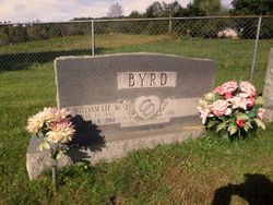
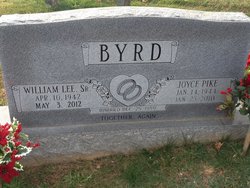
William Lee “Bill” Byrd Sr.
| Birth | : | 10 Apr 1942 Surry County, North Carolina, USA |
| Death | : | 3 May 2012 Mount Airy, Surry County, North Carolina, USA |
| Burial | : | Slate Mountain Baptist Church Cemetery, Slate Mountain, Surry County, USA |
| Coordinate | : | 36.5389010, -80.5067890 |
| Description | : | Mr. William Lee "Bill" Byrd, Sr., 70, of 349 White Pines Country Club Road, Mount Airy, passed away Thursday morning, May 3, 2012, at Northern Hospital of Surry County. Mr. Byrd was born April 10, 1942, in Surry County, the son of the late Howard William and Lola Mae Hall Byrd. Bill served our country in the United States Army in the late 1950s. He worked as an assistant superintendent in commercial construction for many years and was a member of New Charity Baptist Church. He is survived by a son and daughter-in-law, Billy and Lynn Byrd of Mount Airy;... Read More |
frequently asked questions (FAQ):
-
Where is William Lee “Bill” Byrd Sr.'s memorial?
William Lee “Bill” Byrd Sr.'s memorial is located at: Slate Mountain Baptist Church Cemetery, Slate Mountain, Surry County, USA.
-
When did William Lee “Bill” Byrd Sr. death?
William Lee “Bill” Byrd Sr. death on 3 May 2012 in Mount Airy, Surry County, North Carolina, USA
-
Where are the coordinates of the William Lee “Bill” Byrd Sr.'s memorial?
Latitude: 36.5389010
Longitude: -80.5067890
Family Members:
Parent

Spouse
Siblings
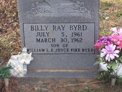
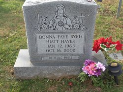
Children
Flowers:


Nearby Cemetories:
1. Slate Mountain Baptist Church Cemetery
Slate Mountain, Surry County, USA
Coordinate: 36.5389010, -80.5067890
2. Burkhart Family Cemetery
Slate Mountain, Surry County, USA
Coordinate: 36.5376440, -80.5048940
3. Goins Family Cemetery
Westfield Township, Surry County, USA
Coordinate: 36.5357780, -80.4993890
4. McArthur-Strickland Family Cemetery
Slate Mountain, Surry County, USA
Coordinate: 36.5204735, -80.5130005
5. Center Church
Ararat, Patrick County, USA
Coordinate: 36.5626780, -80.5153010
6. Calvary Gospel Light Baptist Church Cemetery
Ararat, Patrick County, USA
Coordinate: 36.5627510, -80.5153190
7. Goins Family Cemetery
Claudville, Patrick County, USA
Coordinate: 36.5590130, -80.5285190
8. God's Family House of Prayer Cemetery
Claudville, Patrick County, USA
Coordinate: 36.5552400, -80.4801500
9. Love Family Cemetery
Claudville, Patrick County, USA
Coordinate: 36.5546200, -80.4775810
10. Chestnut Ridge Primitive Baptist Cemetery
Mount Airy, Surry County, USA
Coordinate: 36.5100849, -80.5071676
11. Blue Hollow Baptist Church Cemetery
Slate Mountain, Surry County, USA
Coordinate: 36.5167160, -80.5297910
12. Mount Herman United Methodist Church Cemetery
Mount Herman, Surry County, USA
Coordinate: 36.5342216, -80.4710541
13. Hicks Family Cemetery
Mount Airy, Surry County, USA
Coordinate: 36.5228043, -80.5402527
14. New Venture Baptist Church Cemetery
Flat Rock, Surry County, USA
Coordinate: 36.5211372, -80.5454407
15. Hatchers Chapel United Methodist Church Cemetery
Claudville, Patrick County, USA
Coordinate: 36.5592080, -80.4639930
16. McBride Family Cemetery
Flat Rock, Surry County, USA
Coordinate: 36.5498800, -80.5556100
17. Bobby and Arbra Inman Family Cemetery
Mount Airy, Surry County, USA
Coordinate: 36.4974900, -80.5075100
18. Mountain View Pentecostal Holiness Church Cemetery
Claudville, Patrick County, USA
Coordinate: 36.5579510, -80.4603620
19. Korner's Grove Primitive Baptist Church Cemetery
Flat Rock, Surry County, USA
Coordinate: 36.5359726, -80.5588913
20. Stephen Pinkney Smith Family Cemetery
Ararat, Patrick County, USA
Coordinate: 36.5768000, -80.5316670
21. Laurel Hill Cemetery
Ararat, Patrick County, USA
Coordinate: 36.5614884, -80.5524226
22. Pedigo Cemetery
Ararat, Patrick County, USA
Coordinate: 36.5657997, -80.5505981
23. Believers Baptist Church Cemetery
Ararat, Patrick County, USA
Coordinate: 36.5817720, -80.4904290
24. Bowman-Puckett Cemetery
Ararat, Patrick County, USA
Coordinate: 36.5734120, -80.5425690