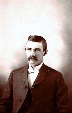
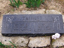
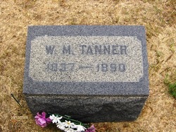
William Martin Tanner
| Birth | : | 25 Mar 1879 Lassen County, California, USA |
| Death | : | 17 Jul 1953 Susanville, Lassen County, California, USA |
| Burial | : | Rose Hill Burial Park, Springfield, Clark County, USA |
| Coordinate | : | 39.8903008, -83.7192001 |
| Description | : | Lassen Advocate July 21, 1953 Susanville, CA William Tanner Services Wednesday Services for William Tanner, 74, who died at a local hospital on Sunday morning after an extended illness, will be held from the Owen Chapel tomorrow afternoon at two o'clock with interment following in the Janesville cemetery. The deceased was a native of the Standish community. Most of his lifetime was spent at farming. He is survived by his wife, O'Rissia; two sons, Bernard, Standish, and Eugene, Downing, and one daughter, Verna Haley, North Sacramento. |
frequently asked questions (FAQ):
-
Where is William Martin Tanner's memorial?
William Martin Tanner's memorial is located at: Rose Hill Burial Park, Springfield, Clark County, USA.
-
When did William Martin Tanner death?
William Martin Tanner death on 17 Jul 1953 in Susanville, Lassen County, California, USA
-
Where are the coordinates of the William Martin Tanner's memorial?
Latitude: 39.8903008
Longitude: -83.7192001
Family Members:
Parent
Spouse
Children
Flowers:
Nearby Cemetories:
1. Rose Hill Burial Park
Springfield, Clark County, USA
Coordinate: 39.8903008, -83.7192001
2. Fletcher Chapel Cemetery
Harmony, Clark County, USA
Coordinate: 39.8936005, -83.6956024
3. Calvary Cemetery
Springfield, Clark County, USA
Coordinate: 39.8843994, -83.7585983
4. Yale Cemetery
Clark County, USA
Coordinate: 39.9258003, -83.7257996
5. Yale Cemetery
Springfield, Clark County, USA
Coordinate: 39.9258935, -83.7257592
6. Titus Cemetery
Clark County, USA
Coordinate: 39.9155998, -83.6836014
7. Laybourn Cemetery
Clark County, USA
Coordinate: 39.9157740, -83.6832810
8. Sinking Creek Cemetery
Clark County, USA
Coordinate: 39.9290000, -83.7250000
9. Wraggs Cemetery
Clark County, USA
Coordinate: 39.9028015, -83.6667023
10. Tuttle Cemetery
Clark County, USA
Coordinate: 39.9331017, -83.7213974
11. Steele Cemetery
Springfield, Clark County, USA
Coordinate: 39.8702510, -83.7698680
12. Pleasant Grove Baptist Cemetery
Clark County, USA
Coordinate: 39.8457200, -83.7292900
13. Garlough Cemetery
Pitchin, Clark County, USA
Coordinate: 39.8563995, -83.7592010
14. Hinkle Cemetery
Springfield, Clark County, USA
Coordinate: 39.8817177, -83.7870636
15. Buffenbarger Cemetery
Pitchin, Clark County, USA
Coordinate: 39.8372002, -83.7121964
16. Goodfellow Cemetery
Harmony, Clark County, USA
Coordinate: 39.9146620, -83.6556300
17. Pitchin Methodist Church Cemetery
Pitchin, Clark County, USA
Coordinate: 39.8408160, -83.7591690
18. Greenmount Cemetery
Springfield, Clark County, USA
Coordinate: 39.9211006, -83.7889023
19. Saint Raphael's Cemetery
Springfield, Clark County, USA
Coordinate: 39.9305992, -83.7869034
20. Lisbon Cemetery
Lisbon, Clark County, USA
Coordinate: 39.8591995, -83.6393967
21. Newcomers Cemetery
Springfield, Clark County, USA
Coordinate: 39.9500008, -83.7668991
22. Graybill Cemetery
Clark County, USA
Coordinate: 39.9574550, -83.7468100
23. Christ Episcopal Church Columbarium
Springfield, Clark County, USA
Coordinate: 39.9226150, -83.8037060
24. Columbia Street Cemetery
Springfield, Clark County, USA
Coordinate: 39.9263992, -83.8131027


