
| Birth | : | 12 Dec 1898 Looneyville, Roane County, West Virginia, USA |
| Death | : | 21 Nov 1974 Procious, Clay County, West Virginia, USA |
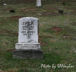
| Burial | : | Elmwood Cemetery, Beloit, Mitchell County, USA |
| Coordinate | : | 39.4693985, -98.1014023 |
| Description | : | unknown newspaper Retired Clay Minister Dies William P. Hershberger, 75, of Procious, Clay County, a retired Church of Christ minister, died Thursday at home. He was a member of the Masonic lodge and a former employe (sic) of the State Road Commission, now the Department of Highways. Surviving: wife, Goldie; daughters, Mrs. Juanita McClanahan of Cuyahoga Falls, Ohio, Mrs. Blanche Lanham of Canton, Ohio, Mrs. Lucille Conrad of Valleyfork, Mrs. Betty Groves of Procious; sons, Earl of Ellet, Ohio, Basil of Procious, Fred of Akron, Ohio, Robert of Valleyfork; stepdaughters, Mrs. Nell Jean Boggs of... Read More |
frequently asked questions (FAQ):
-
Where is William Peter “Bill” Hershberger's memorial?
William Peter “Bill” Hershberger's memorial is located at: Elmwood Cemetery, Beloit, Mitchell County, USA.
-
When did William Peter “Bill” Hershberger death?
William Peter “Bill” Hershberger death on 21 Nov 1974 in Procious, Clay County, West Virginia, USA
-
Where are the coordinates of the William Peter “Bill” Hershberger's memorial?
Latitude: 39.4693985
Longitude: -98.1014023
Family Members:
Parent
Spouse

Siblings
Children
Flowers:


Nearby Cemetories:
1. Elmwood Cemetery
Beloit, Mitchell County, USA
Coordinate: 39.4693985, -98.1014023
2. Saint Johns Cemetery
Beloit, Mitchell County, USA
Coordinate: 39.4667015, -98.1018982
3. Beloit Industrial School Cemetery
Beloit, Mitchell County, USA
Coordinate: 39.4755000, -98.1105810
4. Pleasant Valley Cemetery
Beloit, Mitchell County, USA
Coordinate: 39.4555900, -98.1722200
5. Smith Cemetery
Asherville, Mitchell County, USA
Coordinate: 39.4516690, -98.0098850
6. McBride Cemetery
Beloit, Mitchell County, USA
Coordinate: 39.4808006, -97.9907990
7. Bell-Bogardus Cemetery
Asherville, Mitchell County, USA
Coordinate: 39.4242410, -97.9919970
8. Glendale Cemetery
Solomon Rapids, Mitchell County, USA
Coordinate: 39.5537300, -98.1813000
9. West Asher Cemetery
Scottsville, Mitchell County, USA
Coordinate: 39.4815000, -97.9661600
10. Asherville Cemetery
Asherville, Mitchell County, USA
Coordinate: 39.4205000, -97.9672900
11. Shiloh Cemetery
Beloit, Mitchell County, USA
Coordinate: 39.3574982, -98.0594025
12. New Hope Cemetery
Beloit, Mitchell County, USA
Coordinate: 39.3502998, -98.0875015
13. Honey Creek Cemetery
Solomon Rapids, Mitchell County, USA
Coordinate: 39.4328003, -98.2517014
14. Star Cemetery
Jewell, Jewell County, USA
Coordinate: 39.5882500, -98.1379400
15. Hopewell Cemetery
Beloit, Mitchell County, USA
Coordinate: 39.3800011, -98.2097015
16. Pleasant Prairie Cemetery
Randall, Jewell County, USA
Coordinate: 39.5896988, -98.0627975
17. Browns Creek Cemetery
Solomon Rapids, Mitchell County, USA
Coordinate: 39.5393982, -98.2463989
18. Atkins Union Cemetery
Jewell, Jewell County, USA
Coordinate: 39.5956000, -98.1733000
19. Pleasant View Cemetery
Beloit, Mitchell County, USA
Coordinate: 39.3360939, -98.1519852
20. Scottsville Cemetery
Scottsville, Mitchell County, USA
Coordinate: 39.5468102, -97.9474945
21. Glenwood Cemetery
Glen Elder, Mitchell County, USA
Coordinate: 39.5052986, -98.2818985
22. West Hope Cemetery
Jewell County, USA
Coordinate: 39.5896988, -97.9871979
23. Summit Cemetery #3
Macyville, Cloud County, USA
Coordinate: 39.5258330, -97.9194440
24. Fairview Cemetery South
Glen Elder, Mitchell County, USA
Coordinate: 39.4667015, -98.3063965