
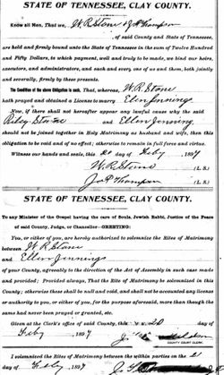
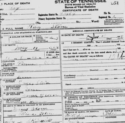
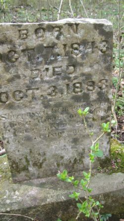
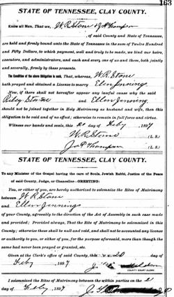
William Riley Stone
| Birth | : | 19 May 1864 |
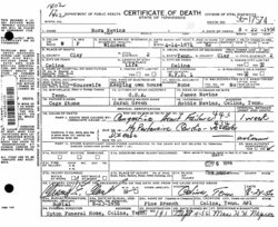
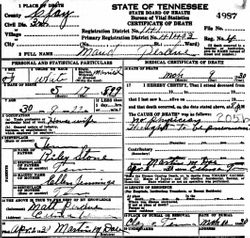
| Death | : | 13 Feb 1925 |
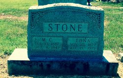
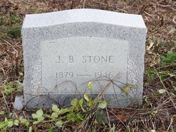
| Burial | : | Rock Springs Cemetery, Celina, Clay County, USA |
| Coordinate | : | 36.6096992, -85.4167023 |
| Description | : | William Riley Stone is the son of Micajah Cage Stone & Sarah Elizabeth Green, of Celina, Overton County, Tennessee Note: Clay County was created in 1870 by redrawing the county lines from Overton and Jackson Counties in Tennessee. William Riley Stone's father was previously married resulting in him having three step sisters and brother: Martha Susan Stone 1854-1935 Elizabeth A Stone 1856- Willett Martin Stone 1858-1951 William R Stone's natural brothers and sister are: Margaret Ruth Stone 1864-1935 Nancy C. Stone 1866- Archie Richard "Dick" Stone 1869-1907 Parmelia Stone 1872-1956 Nora Stone 1874-1956 Darthulia Belle Stone 1876-1956 Micajah Cage Stone Jr 1878-1949 William R Stone was a farmer in Celina,... Read More |
frequently asked questions (FAQ):
-
Where is William Riley Stone's memorial?
William Riley Stone's memorial is located at: Rock Springs Cemetery, Celina, Clay County, USA.
-
When did William Riley Stone death?
William Riley Stone death on 13 Feb 1925 in
-
Where are the coordinates of the William Riley Stone's memorial?
Latitude: 36.6096992
Longitude: -85.4167023
Family Members:
Parent
Spouse
Siblings

Children
Flowers:


Nearby Cemetories:
1. Rock Springs Cemetery
Celina, Clay County, USA
Coordinate: 36.6096992, -85.4167023
2. Thompson Webb Cemetery
Celina, Clay County, USA
Coordinate: 36.6090110, -85.4202270
3. Crossroads Cemetery
Clay County, USA
Coordinate: 36.6074982, -85.4210968
4. Williams Cemetery
Pea Ridge, Clay County, USA
Coordinate: 36.6150017, -85.4169006
5. Ashlock Cemetery
Ashlock, Cumberland County, USA
Coordinate: 36.6208380, -85.4283620
6. Hattie's Houses Cemetery
Pea Ridge, Clay County, USA
Coordinate: 36.6159200, -85.4360040
7. Mullins - Kerr Cemetery
Pea Ridge, Clay County, USA
Coordinate: 36.5951330, -85.4317470
8. Killman Cemetery
Ashlock, Cumberland County, USA
Coordinate: 36.6325850, -85.4256430
9. Donaldson Cemetery
Pea Ridge, Clay County, USA
Coordinate: 36.5952988, -85.4424973
10. Lester and Winnie Spears Cemetery
Burkesville, Cumberland County, USA
Coordinate: 36.6304420, -85.3829600
11. Bowe Cemetery
Pea Ridge, Clay County, USA
Coordinate: 36.5833015, -85.4439011
12. Smith Cemetery
Monroe County, USA
Coordinate: 36.6439881, -85.4203414
13. Key Cemetery
Pea Ridge, Clay County, USA
Coordinate: 36.5875015, -85.4518967
14. Grover Rich Cemetery
Pea Ridge, Clay County, USA
Coordinate: 36.5946370, -85.4602970
15. Dulworth Cemetery
Cumberland County, USA
Coordinate: 36.6292100, -85.3757900
16. Short's Chapel Cemetery
Monroe County, USA
Coordinate: 36.6281013, -85.4589005
17. Thompson Cemetery
Clay County, USA
Coordinate: 36.6123700, -85.4666600
18. Ray Williams Cemetery
Pea Ridge, Clay County, USA
Coordinate: 36.5856130, -85.4598120
19. Riley Cemetery
Littrell, Cumberland County, USA
Coordinate: 36.6509768, -85.3853975
20. Peyton Spear Cemetery
Peytonsburg, Cumberland County, USA
Coordinate: 36.6481590, -85.3778400
21. Capps-Key Cemetery
Burkesville, Cumberland County, USA
Coordinate: 36.6605280, -85.4129330
22. Pruitt Cemetery
Peytonsburg, Cumberland County, USA
Coordinate: 36.6571270, -85.3874590
23. Spears Chapel Cemetery
Peytonsburg, Cumberland County, USA
Coordinate: 36.6495790, -85.3714410
24. Poplar Grove Cemetery
Kettle, Cumberland County, USA
Coordinate: 36.6680090, -85.4074180