
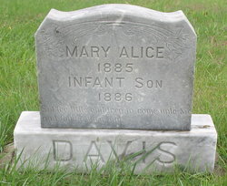
| Birth | : | 23 Jul 1860 Nettle Hill, Greene County, Pennsylvania, USA |
| Death | : | 7 Nov 1917 Highland Township, Clay County, Kansas, USA |
| Burial | : | Broughton Cemetery, Clay Center, Clay County, USA |
| Coordinate | : | 39.3306007, -97.0535965 |
| Description | : | * Note: William Davis' year of death is incorrect on the stone. Per multiple newspaper obituaries, his date of death was November 7, 1916. Contributor: A.W. Bauer (49122991) • |
frequently asked questions (FAQ):
-
Where is William “Will” Davis's memorial?
William “Will” Davis's memorial is located at: Broughton Cemetery, Clay Center, Clay County, USA.
-
When did William “Will” Davis death?
William “Will” Davis death on 7 Nov 1917 in Highland Township, Clay County, Kansas, USA
-
Where are the coordinates of the William “Will” Davis's memorial?
Latitude: 39.3306007
Longitude: -97.0535965
Family Members:
Spouse

Children

Flowers:


Nearby Cemetories:
1. Broughton Cemetery
Clay Center, Clay County, USA
Coordinate: 39.3306007, -97.0535965
2. Milo Chapman Gravesite
Broughton, Clay County, USA
Coordinate: 39.2888500, -97.0724400
3. Gilbert Cemetery
Clay County, USA
Coordinate: 39.2853012, -97.0625000
4. Clay County Poor Farm Cemetery
Clay Center, Clay County, USA
Coordinate: 39.3772700, -97.0727000
5. Gatesville Cemetery
Wakefield, Clay County, USA
Coordinate: 39.2721460, -97.0041380
6. Ebenezer Cemetery
Green, Clay County, USA
Coordinate: 39.3866997, -96.9974976
7. Republican City Cemetery
Clay Center, Clay County, USA
Coordinate: 39.3431015, -97.1628036
8. Zion Lutheran Cemetery
Clay County, USA
Coordinate: 39.2928009, -97.1557999
9. Saint Peter and Saint Pauls Catholic Cemetery
Clay Center, Clay County, USA
Coordinate: 39.4005450, -97.1236680
10. Greenwood Cemetery
Clay Center, Clay County, USA
Coordinate: 39.4011002, -97.1275024
11. Bala Cemetery
Bala, Riley County, USA
Coordinate: 39.3053017, -96.9341965
12. Uniondale Cemetery
Wakefield, Clay County, USA
Coordinate: 39.2382800, -97.0918400
13. Green Cemetery
Green, Clay County, USA
Coordinate: 39.4235992, -96.9882965
14. Saint John's Episcopal Cemetery
Clay County, USA
Coordinate: 39.2193985, -97.0744019
15. Pleasant Ridge Cemetery
Clay County, USA
Coordinate: 39.2789001, -97.1841965
16. Highland Cemetery
Wakefield, Clay County, USA
Coordinate: 39.2190247, -97.0133667
17. Wilson Cemetery
Clay County, USA
Coordinate: 39.3800011, -97.1896973
18. Lasita Cemetery
Leonardville, Riley County, USA
Coordinate: 39.4092900, -96.9422900
19. Hayes Cemetery
Clay County, USA
Coordinate: 39.4516983, -97.0811005
20. Timber Creek Cemetery
Wakefield, Clay County, USA
Coordinate: 39.2182999, -96.9805984
21. Mizpah Cemetery
Clay County, USA
Coordinate: 39.2057800, -97.1238500
22. Pleasant Hill Cemetery
Leonardville, Riley County, USA
Coordinate: 39.4371210, -96.9426730
23. Fancy Creek Cemetery
Green, Clay County, USA
Coordinate: 39.4668999, -96.9969025
24. Madura Cemetery
Wakefield, Clay County, USA
Coordinate: 39.1842003, -97.0117035