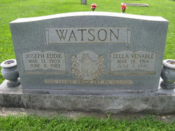
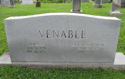
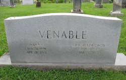
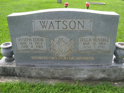
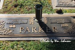
Zella Irene Venable Watson
| Birth | : | 15 Mar 1914 Surry County, North Carolina, USA |
| Death | : | 5 Jun 1997 King, Stokes County, North Carolina, USA |
| Burial | : | Hutchens-Venable Family Cemetery, Mount Airy, Surry County, USA |
| Coordinate | : | 36.4309170, -80.6131390 |
frequently asked questions (FAQ):
-
Where is Zella Irene Venable Watson's memorial?
Zella Irene Venable Watson's memorial is located at: Hutchens-Venable Family Cemetery, Mount Airy, Surry County, USA.
-
When did Zella Irene Venable Watson death?
Zella Irene Venable Watson death on 5 Jun 1997 in King, Stokes County, North Carolina, USA
-
Where are the coordinates of the Zella Irene Venable Watson's memorial?
Latitude: 36.4309170
Longitude: -80.6131390
Family Members:
Parent
Spouse
Siblings
Children
Flowers:
Nearby Cemetories:
1. Hutchens-Venable Family Cemetery
Mount Airy, Surry County, USA
Coordinate: 36.4309170, -80.6131390
2. Little Mountain Baptist Church Cemetery
Ararat, Surry County, USA
Coordinate: 36.4213066, -80.6090012
3. Dover Baptist Church Cemetery
White Plains, Surry County, USA
Coordinate: 36.4376678, -80.6373901
4. White Plains Friends Meeting Cemetery
White Plains, Surry County, USA
Coordinate: 36.4478607, -80.6326141
5. Charles Beck Family Cemetery
Ararat, Surry County, USA
Coordinate: 36.4147800, -80.5909700
6. Doss Cemetery
Mount Airy, Surry County, USA
Coordinate: 36.4553337, -80.6131363
7. Watson Cemetery
Ararat, Surry County, USA
Coordinate: 36.4254140, -80.5822060
8. White Plains Baptist Church Cemetery
White Plains, Surry County, USA
Coordinate: 36.4534820, -80.6296600
9. Lawson and Sawyers Family Cemetery
Ararat, Surry County, USA
Coordinate: 36.4144700, -80.5837500
10. Johnson Family Cemetery
Ararat, Surry County, USA
Coordinate: 36.4050833, -80.5928333
11. W.C. Hiatt Cemetery
Mount Airy, Surry County, USA
Coordinate: 36.4484329, -80.5796204
12. Blackwater United Methodist Church Cemetery
Black Water, Surry County, USA
Coordinate: 36.3976220, -80.6236920
13. The Community Church Cemetery
Mount Airy, Surry County, USA
Coordinate: 36.3986860, -80.6312360
14. Community Church Cemetery
Black Water, Surry County, USA
Coordinate: 36.3986300, -80.6312750
15. Blackwater Community Church Cemetery
Black Water, Surry County, USA
Coordinate: 36.4019720, -80.6393330
16. Venable Family Cemetery
Surry County, USA
Coordinate: 36.4045315, -80.6444179
17. Bryant-Simpson Cemetery
Eldora Township, Surry County, USA
Coordinate: 36.3991900, -80.5871100
18. Bryant Chapel Baptist Church Cemetery
Ararat, Surry County, USA
Coordinate: 36.4106840, -80.5728080
19. Harrell-Lewis Family Cemetery
Mount Airy, Surry County, USA
Coordinate: 36.4148120, -80.6607750
20. McGee Cemetery
Mount Airy, Surry County, USA
Coordinate: 36.4550800, -80.5700400
21. Marion Family Cemetery
Dobson, Surry County, USA
Coordinate: 36.4101530, -80.6633480
22. Mount Zion Baptist Church Cemetery
Ash Hill, Surry County, USA
Coordinate: 36.3949432, -80.5725021
23. Skyline Memory Gardens
Mount Airy, Surry County, USA
Coordinate: 36.4745610, -80.5856500
24. Union Primitive Baptist Church Cemetery
Black Water, Surry County, USA
Coordinate: 36.3821983, -80.6282425

