
| Memorials | : | 8 |
| Location | : | London, City of London, England |
| Coordinate | : | 51.5099720, -0.0900440 |
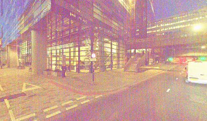
| Description | : | All Hallows the Great was a church in the City of London, within the walls, located on what is now Upper Thames Street, at the northeast corner of All Hallows Lane. First mentioned in 1235, it was destroyed in 1666 by the Great Fire of London. After the church's destruction by the Great Fire, the parish was combined with that of All Hallows the Less, and in 1669, the joint parishes erected a temporary structure in the churchyard of All Hallows the Great. The church was restored between 1677-1684, rebuilt by the office of Sir Christopher Wren. However, by the... Read More |
frequently asked questions (FAQ):
-
Where is All Hallows the Great?
All Hallows the Great is located at London, City of London ,Greater London ,England.
-
All Hallows the Great cemetery's updated grave count on graveviews.com?
8 memorials
-
Where are the coordinates of the All Hallows the Great?
Latitude: 51.5099720
Longitude: -0.0900440
Nearby Cemetories:
1. All Hallows the Less
London, City of London, England
Coordinate: 51.5099000, -0.0893000
2. St Laurence Pountney Churchyard
London, City of London, England
Coordinate: 51.5106100, -0.0885930
3. Saint Mary Bothaw (Defunct)
London, City of London, England
Coordinate: 51.5114000, -0.0900800
4. Saint Swithin London Stone Churchyard
London, City of London, England
Coordinate: 51.5115800, -0.0894340
5. St Martin Orgar Church
London, City of London, England
Coordinate: 51.5107520, -0.0875220
6. St Michael Bassishaw Crooked Lane
London, City of London, England
Coordinate: 51.5107000, -0.0872800
7. St Mary Magdalene (Defunct)
London, City of London, England
Coordinate: 51.5100480, -0.0862540
8. St. Magnus the Martyr Churchyard
London, City of London, England
Coordinate: 51.5092500, -0.0862880
9. St Clement's Eastcheap
London, City of London, England
Coordinate: 51.5114010, -0.0867810
10. Great Fire of London Monument
London, City of London, England
Coordinate: 51.5101100, -0.0859990
11. St James Garlickhythe Churchyard
London, City of London, England
Coordinate: 51.5111070, -0.0937560
12. St. Leonard's Churchyard
Bridge, City of London, England
Coordinate: 51.5105870, -0.0855570
13. St Antholin's Church
London, City of London, England
Coordinate: 51.5126895, -0.0915805
14. St Mary Woolnoth Churchyard
London, City of London, England
Coordinate: 51.5127650, -0.0881070
15. St. George's Botolph Lane
Billingsgate, City of London, England
Coordinate: 51.5101840, -0.0847730
16. St Botolph Billingsgate Churchyard (Defunct)
London, City of London, England
Coordinate: 51.5096860, -0.0847310
17. St. Benet Sherehog Churchyard (Defunct)
London, City of London, England
Coordinate: 51.5132700, -0.0912020
18. Holy Trinity the Less Churchyard (Defunct)
London, City of London, England
Coordinate: 51.5119670, -0.0944820
19. St Mary Aldermary
London, City of London, England
Coordinate: 51.5127900, -0.0933800
20. Saint Pancras Soper Lane (Defunct)
London, City of London, England
Coordinate: 51.5132830, -0.0918850
21. St Mary Colechurch (Defunct)
London, City of London, England
Coordinate: 51.5136110, -0.0911110
22. All Hallows Lombard Street
London, City of London, England
Coordinate: 51.5123000, -0.0854000
23. St. Benet's Churchyard
Bridge, City of London, England
Coordinate: 51.5115240, -0.0846030
24. Southwark Cathedral
Southwark, London Borough of Southwark, England
Coordinate: 51.5061417, -0.0895970