
| Memorials | : | 3 |
| Location | : | London, City of London, England |
| Coordinate | : | 51.5114000, -0.0900800 |
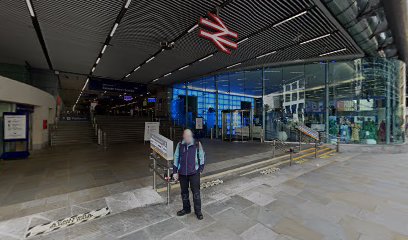
| Description | : | St Mary Bothaw was a parish church in the Walbrook ward of the City of London. It stood in a narrow lane just to the south of Candlewick Street (now Cannon Street). The dedication is generally believed derived from "boat-haw", meaning "boat house" St Mary's was one of the 13 'peculiars' within the City under the patronage of the dean and chapter of Canterbury Cathedral. The church was in existence by 1279, when William de Hamkynton is recorded as becoming rector following the death of Adam Lambyn. English historian and antiquarian John Stow, in his 1598 Survey of London, described it... Read More |
frequently asked questions (FAQ):
-
Where is Saint Mary Bothaw (Defunct)?
Saint Mary Bothaw (Defunct) is located at Cannon Street, between Dowgate Hill and Bush Lane London, City of London ,Greater London ,England.
-
Saint Mary Bothaw (Defunct) cemetery's updated grave count on graveviews.com?
3 memorials
-
Where are the coordinates of the Saint Mary Bothaw (Defunct)?
Latitude: 51.5114000
Longitude: -0.0900800
Nearby Cemetories:
1. Saint Swithin London Stone Churchyard
London, City of London, England
Coordinate: 51.5115800, -0.0894340
2. St Laurence Pountney Churchyard
London, City of London, England
Coordinate: 51.5106100, -0.0885930
3. All Hallows the Great
London, City of London, England
Coordinate: 51.5099720, -0.0900440
4. All Hallows the Less
London, City of London, England
Coordinate: 51.5099000, -0.0893000
5. St Antholin's Church
London, City of London, England
Coordinate: 51.5126895, -0.0915805
6. St Martin Orgar Church
London, City of London, England
Coordinate: 51.5107520, -0.0875220
7. St Mary Woolnoth Churchyard
London, City of London, England
Coordinate: 51.5127650, -0.0881070
8. St Michael Bassishaw Crooked Lane
London, City of London, England
Coordinate: 51.5107000, -0.0872800
9. St. Benet Sherehog Churchyard (Defunct)
London, City of London, England
Coordinate: 51.5132700, -0.0912020
10. St Clement's Eastcheap
London, City of London, England
Coordinate: 51.5114010, -0.0867810
11. Saint Pancras Soper Lane (Defunct)
London, City of London, England
Coordinate: 51.5132830, -0.0918850
12. St Mary Colechurch (Defunct)
London, City of London, England
Coordinate: 51.5136110, -0.0911110
13. St James Garlickhythe Churchyard
London, City of London, England
Coordinate: 51.5111070, -0.0937560
14. St Mary Aldermary
London, City of London, England
Coordinate: 51.5127900, -0.0933800
15. St Mary Magdalene (Defunct)
London, City of London, England
Coordinate: 51.5100480, -0.0862540
16. Holy Trinity the Less Churchyard (Defunct)
London, City of London, England
Coordinate: 51.5119670, -0.0944820
17. Great Fire of London Monument
London, City of London, England
Coordinate: 51.5101100, -0.0859990
18. Church of Saint Mary Magdalen Milk Street
London, City of London, England
Coordinate: 51.5136110, -0.0930560
19. St. Leonard's Churchyard
Bridge, City of London, England
Coordinate: 51.5105870, -0.0855570
20. St Christopher le Stocks
London, City of London, England
Coordinate: 51.5142000, -0.0886000
21. Mercers Chapel
London, City of London, England
Coordinate: 51.5141490, -0.0919390
22. All Hallows Lombard Street
London, City of London, England
Coordinate: 51.5123000, -0.0854000
23. St Mary-le-Bow
London, City of London, England
Coordinate: 51.5137100, -0.0935517
24. St. Magnus the Martyr Churchyard
London, City of London, England
Coordinate: 51.5092500, -0.0862880