
| Memorials | : | 1 |
| Location | : | Pakefield, Waveney District, England |
| Coordinate | : | 52.4533520, 1.7344150 |
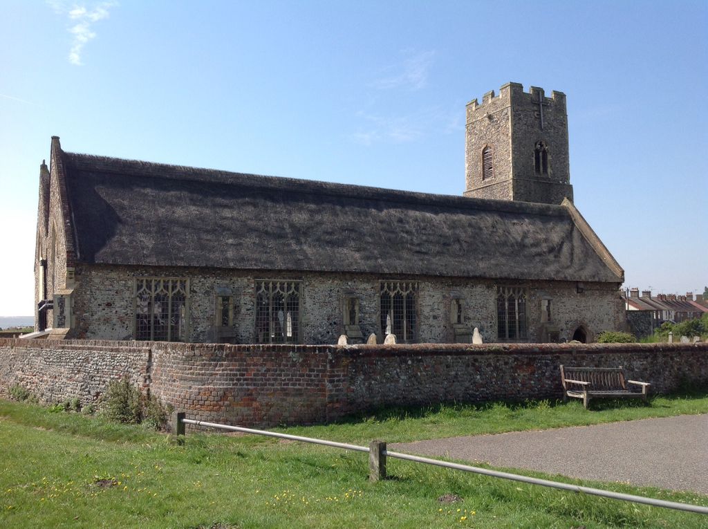
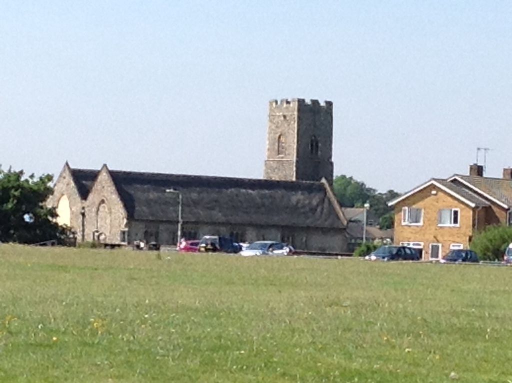
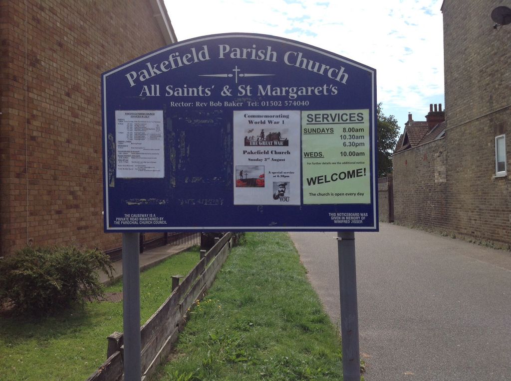
| Description | : | The church stands at the edge of the land next to the beach and North Sea in Pakefield, Lowestoft, Suffolk. Entering through the main entrance on the north side of the church is what was the Parish Church of St. Margaret; beyond the arches which divide the church is what was the Parish Church of All Saints'. |
frequently asked questions (FAQ):
-
Where is All Saints & St Margaret Churchyard?
All Saints & St Margaret Churchyard is located at Pakefield, Waveney District ,Suffolk ,England.
-
All Saints & St Margaret Churchyard cemetery's updated grave count on graveviews.com?
1 memorials
-
Where are the coordinates of the All Saints & St Margaret Churchyard?
Latitude: 52.4533520
Longitude: 1.7344150

Nearby Cemetories:
1. Kirkley Cemetery
Lowestoft, Waveney District, England
Coordinate: 52.4583260, 1.7353110
2. St. Peter and St. John Churchyard
Kirkley, Waveney District, England
Coordinate: 52.4628290, 1.7384010
3. St Peter's New Churchyard
Carlton Colville, Waveney District, England
Coordinate: 52.4528500, 1.6953250
4. St Peter's Churchyard
Carlton Colville, Waveney District, England
Coordinate: 52.4514530, 1.6929030
5. Holy Trinity Churchyard
Gisleham, Waveney District, England
Coordinate: 52.4372320, 1.6975344
6. Lowestoft Cemetery
Lowestoft, Waveney District, England
Coordinate: 52.4814390, 1.7404560
7. St Margaret Churchyard
Lowestoft, Waveney District, England
Coordinate: 52.4860970, 1.7402750
8. Lowestoft Naval Memorial
Lowestoft, Waveney District, England
Coordinate: 52.4883730, 1.7554520
9. St. Michael's Churchyard
Oulton, Waveney District, England
Coordinate: 52.4823570, 1.6952900
10. RNPS Belle Vue Park Cemetery
Lowestoft, Waveney District, England
Coordinate: 52.4901740, 1.7559862
11. St Edmund Churchyard
Kessingland, Waveney District, England
Coordinate: 52.4158970, 1.7157750
12. St. Michael's Churchyard
Rushmere, Waveney District, England
Coordinate: 52.4332200, 1.6688300
13. St. Peter's Churchyard
Gunton, Waveney District, England
Coordinate: 52.5003000, 1.7444000
14. Gunton Woodland Burial Park
Lowestoft, Waveney District, England
Coordinate: 52.5010260, 1.7461380
15. St Mary's Churchyard
Burgh St Peter, South Norfolk District, England
Coordinate: 52.4840860, 1.6710830
16. St. Andrew's Churchyard
Mutford, Waveney District, England
Coordinate: 52.4387060, 1.6566540
17. Saint John the Baptist Churchyard
Barnby, Waveney District, England
Coordinate: 52.4510410, 1.6494740
18. St. Michael's Churchyard
Benacre, Waveney District, England
Coordinate: 52.4003900, 1.6907680
19. St Mary Churchyard
Henstead, Waveney District, England
Coordinate: 52.4159800, 1.6577200
20. Corton War Memorial
Corton, Waveney District, England
Coordinate: 52.5148430, 1.7471340
21. St Mary The Virgin Churchyard
Blundeston, Waveney District, England
Coordinate: 52.5151100, 1.7029600
22. Wrentham Municipal Cemetery
Wrentham, Waveney District, England
Coordinate: 52.4020520, 1.6676040
23. St Bartholomew Churchyard
Corton, Waveney District, England
Coordinate: 52.5213100, 1.7404800
24. St. Botolph Churchyard
North Cove, Waveney District, England
Coordinate: 52.4474411, 1.6227847