
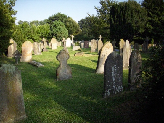
| Memorials | : | 54 |
| Location | : | Staplehurst, Maidstone Borough, England |
| Coordinate | : | 51.1582160, 0.5527170 |
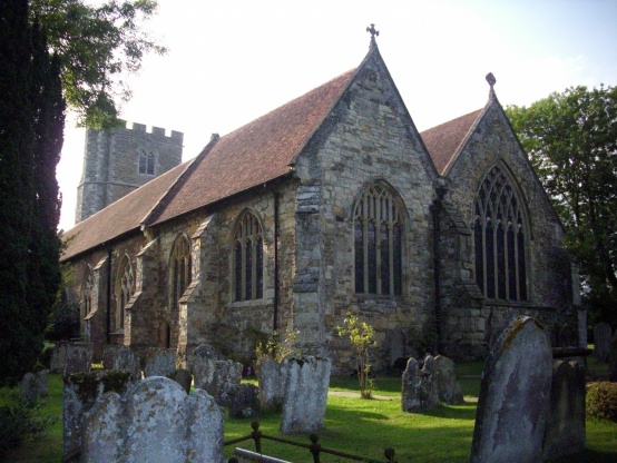
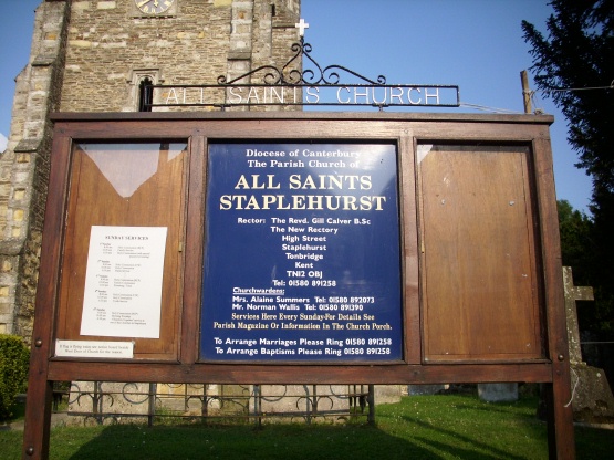
| Description | : | All Saints Church in the village of Staplehurst, Kent is an Anglican parish church dating from the 12th century. Additional building work occurred in the 13th century through to the 15th century. It was sadly over-restored in 1853. There is a large enclosed rectangular churchyard surrounding the church with extensions to the east and south-east. There are some fine 18th century gravestones and table tombs to the south of the church. |
frequently asked questions (FAQ):
-
Where is All Saints Church?
All Saints Church is located at High Street Staplehurst, Maidstone Borough ,Kent , TN12 0AXEngland.
-
All Saints Church cemetery's updated grave count on graveviews.com?
53 memorials
-
Where are the coordinates of the All Saints Church?
Latitude: 51.1582160
Longitude: 0.5527170
Nearby Cemetories:
1. Marian Martyrs Memorial
Staplehurst, Maidstone Borough, England
Coordinate: 51.1649780, 0.5523900
2. Frittenden Burial Gound
Frittenden, Tunbridge Wells Borough, England
Coordinate: 51.1428480, 0.5870820
3. St. Mary's Churchyard
Frittenden, Tunbridge Wells Borough, England
Coordinate: 51.1391190, 0.5904720
4. St. Michael and All Angels Churchyard
Marden, Maidstone Borough, England
Coordinate: 51.1743202, 0.4931720
5. Marden Congregational Church
Marden, Maidstone Borough, England
Coordinate: 51.1745670, 0.4897280
6. Headcorn Parish Burial Ground
Headcorn, Maidstone Borough, England
Coordinate: 51.1671257, 0.6204750
7. St. Peter and St. Paul Churchyard
Headcorn, Maidstone Borough, England
Coordinate: 51.1678543, 0.6203760
8. Headcorn Methodist Churchyard
Headcorn, Maidstone Borough, England
Coordinate: 51.1674940, 0.6205670
9. Headcorn War Memorial
Headcorn, Maidstone Borough, England
Coordinate: 51.1677480, 0.6212560
10. Headcorn Baptist Churchyard
Headcorn, Maidstone Borough, England
Coordinate: 51.1674156, 0.6247670
11. Sissinghurst Cemetery
Sissinghurst, Tunbridge Wells Borough, England
Coordinate: 51.1095310, 0.5629240
12. Marden Cemetery
Marden, Maidstone Borough, England
Coordinate: 51.1882744, 0.4894070
13. Ebeneezer Chapel
Biddenden, Ashford Borough, England
Coordinate: 51.1383320, 0.6416030
14. St Mary the Virgin Churchyard
Sutton Valence, Maidstone Borough, England
Coordinate: 51.2132540, 0.5897170
15. Sutton Valence War Memorial
Sutton Valence, Maidstone Borough, England
Coordinate: 51.2131810, 0.5911370
16. St. Michael's Churchyard
Chart Sutton, Maidstone Borough, England
Coordinate: 51.2154120, 0.5821570
17. St Dunstan's Churchyard
Cranbrook, Tunbridge Wells Borough, England
Coordinate: 51.0973030, 0.5363690
18. Cranbrook Cemetery
Cranbrook, Tunbridge Wells Borough, England
Coordinate: 51.0962250, 0.5541360
19. St. Peter's Churchyard
Boughton Monchelsea, Maidstone Borough, England
Coordinate: 51.2207560, 0.5348660
20. St David's Bridge Strict Baptist Chapel
Cranbrook, Tunbridge Wells Borough, England
Coordinate: 51.0953430, 0.5378980
21. St. Margaret's Churchyard
Collier Street, Maidstone Borough, England
Coordinate: 51.1877010, 0.4555280
22. All Saints Churchyard
Biddenden, Ashford Borough, England
Coordinate: 51.1150740, 0.6403990
23. St. Peter and St. Paul Churchyard
East Sutton, Maidstone Borough, England
Coordinate: 51.2159000, 0.6159000
24. St Nicholas' Churchyard
Linton, Maidstone Borough, England
Coordinate: 51.2235230, 0.5109550