
| Memorials | : | 1 |
| Location | : | Croydon, South Cambridgeshire District, England |
| Coordinate | : | 52.1290100, -0.0796720 |
| Description | : | Croydon is a village and civil parish in South Cambridgeshire, England. It is 10 miles (16 km) south-west of Cambridge and immediately west of the A1198 road (the Roman Ermine Street). The site of the deserted medieval village of Clopton is in Croydon parish, which was formerly known as Croydon-cum-Clopton. |
frequently asked questions (FAQ):
-
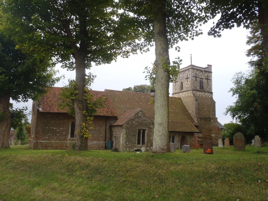
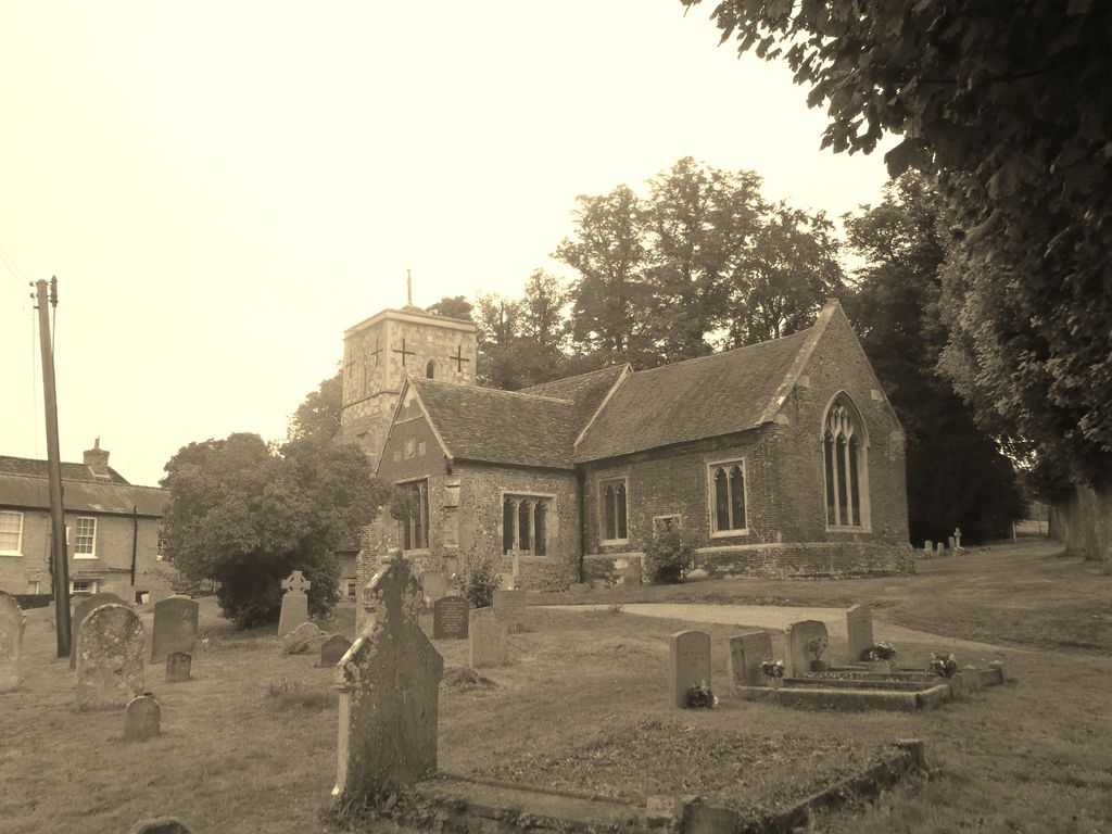
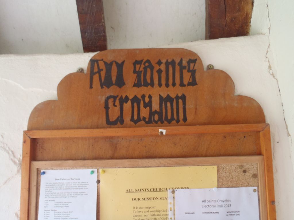
Where is All Saints Churchyard?
All Saints Churchyard is located at Church Lane Croydon, South Cambridgeshire District ,Cambridgeshire ,England.
-
All Saints Churchyard cemetery's updated grave count on graveviews.com?
1 memorials
-
Where are the coordinates of the All Saints Churchyard?
Latitude: 52.1290100
Longitude: -0.0796720
Nearby Cemetories:
1. St Nicholas Churchyard
Arrington, South Cambridgeshire District, England
Coordinate: 52.1352130, -0.0652100
2. All Saints Churchyard
Wendy, South Cambridgeshire District, England
Coordinate: 52.1110400, -0.0703100
3. St. Denis Churchyard
East Hatley, South Cambridgeshire District, England
Coordinate: 52.1379956, -0.1233863
4. St George Church
Hatley St George, South Cambridgeshire District, England
Coordinate: 52.1437000, -0.1348000
5. Church of St. Mary The Virgin Cemetery
Whaddon, South Cambridgeshire District, England
Coordinate: 52.1012000, -0.0311000
6. THE CHURCH OF ST MARY THE VIRGIN
Whaddon, South Cambridgeshire District, England
Coordinate: 52.1012000, -0.0311000
7. St Michael and All Angels Churchyard
Abington Pigotts, South Cambridgeshire District, England
Coordinate: 52.0849450, -0.0976970
8. St. Peter and St. Paul Churchyard
Bassingbourn, South Cambridgeshire District, England
Coordinate: 52.0789460, -0.0598880
9. Bassingbourn-cum-Kneesworth Cemetery
Bassingbourn-cum-Kneesworth, South Cambridgeshire District, England
Coordinate: 52.0802380, -0.0488110
10. St Mary The Virgin
Longstowe, South Cambridgeshire District, England
Coordinate: 52.1815300, -0.0845300
11. St John the Baptist Churchyard
Cockayne Hatley, Central Bedfordshire Unitary Authority, England
Coordinate: 52.1308660, -0.1663740
12. Guilden Morden Burial Ground
Guilden Morden, South Cambridgeshire District, England
Coordinate: 52.0832700, -0.1311000
13. St Mary Churchyard
Great Eversden, South Cambridgeshire District, England
Coordinate: 52.1613300, -0.0036400
14. St. Mary's Churchyard
Guilden Morden, South Cambridgeshire District, England
Coordinate: 52.0806930, -0.1336810
15. All Saints & St Andrew Churchyard
Kingston, South Cambridgeshire District, England
Coordinate: 52.1806200, -0.0326300
16. Holy Trinity Churchyard
Meldreth, South Cambridgeshire District, England
Coordinate: 52.1024700, 0.0101600
17. St. Helena and St. Mary Churchyard
Bourn, South Cambridgeshire District, England
Coordinate: 52.1896940, -0.0639950
18. St Helen Churchyard
Little Eversden, South Cambridgeshire District, England
Coordinate: 52.1609000, 0.0083300
19. St Peter & St Paul Churchyard
Little Gransden, South Cambridgeshire District, England
Coordinate: 52.1801800, -0.1427200
20. St. Michael and All Angels
Caldecote, Huntingdonshire District, England
Coordinate: 52.1879970, -0.0308670
21. St Bartholomew Churchyard
Great Gransden, Huntingdonshire District, England
Coordinate: 52.1841660, -0.1425220
22. All Saints Churchyard
Eyeworth, Central Bedfordshire Unitary Authority, England
Coordinate: 52.0945940, -0.1770800
23. St Peter and St Paul
Steeple Morden, South Cambridgeshire District, England
Coordinate: 52.0655979, -0.1257247
24. St Andrew Churchyard
Toft, South Cambridgeshire District, England
Coordinate: 52.1834320, -0.0088580