
| Memorials | : | 0 |
| Location | : | Guilden Morden, South Cambridgeshire District, England |
| Coordinate | : | 52.0806930, -0.1336810 |
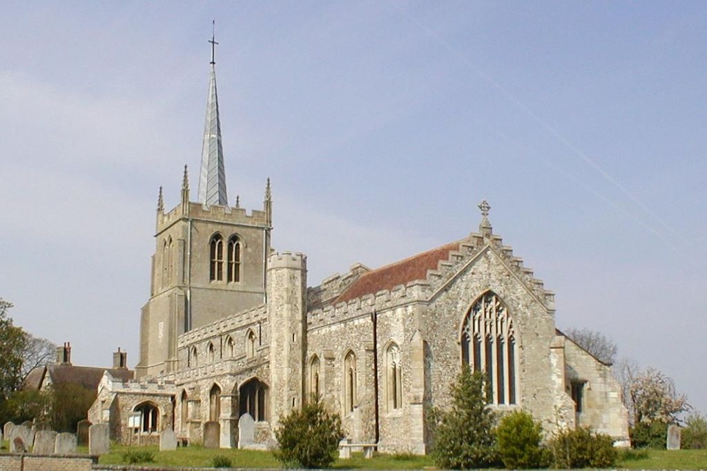
| Description | : | The Monumental Inscriptions in the graveyard of St. Mary's church 1617-1985, the cemetery 1897-1935 and the Congregational churchyard 1845-49, 1892 are recorded in the Cambridge Records Office and are available, on microfiche, from the Cambridgeshire Family History Society Publications list. |
frequently asked questions (FAQ):
-
Where is St. Mary's Churchyard?
St. Mary's Churchyard is located at Church Street Guilden Morden, South Cambridgeshire District ,Cambridgeshire , SG8 0JFEngland.
-
St. Mary's Churchyard cemetery's updated grave count on graveviews.com?
0 memorials
-
Where are the coordinates of the St. Mary's Churchyard?
Latitude: 52.0806930
Longitude: -0.1336810
Nearby Cemetories:
1. Guilden Morden Burial Ground
Guilden Morden, South Cambridgeshire District, England
Coordinate: 52.0832700, -0.1311000
2. St Peter and St Paul
Steeple Morden, South Cambridgeshire District, England
Coordinate: 52.0655979, -0.1257247
3. St Michael and All Angels Churchyard
Abington Pigotts, South Cambridgeshire District, England
Coordinate: 52.0849450, -0.0976970
4. All Saints Churchyard
Eyeworth, Central Bedfordshire Unitary Authority, England
Coordinate: 52.0945940, -0.1770800
5. St Mary Magdalene Churchyard
Dunton, Central Bedfordshire Unitary Authority, England
Coordinate: 52.0825200, -0.1955600
6. Dunton Cemetery
Dunton, Central Bedfordshire Unitary Authority, England
Coordinate: 52.0820490, -0.1982770
7. St. Peter and St. Paul Churchyard
Bassingbourn, South Cambridgeshire District, England
Coordinate: 52.0789460, -0.0598880
8. All Saints Churchyard
Wendy, South Cambridgeshire District, England
Coordinate: 52.1110400, -0.0703100
9. St Nicholas Churchyard
Hinxworth, North Hertfordshire District, England
Coordinate: 52.0476210, -0.1970460
10. Bassingbourn-cum-Kneesworth Cemetery
Bassingbourn-cum-Kneesworth, South Cambridgeshire District, England
Coordinate: 52.0802380, -0.0488110
11. St John the Baptist Churchyard
Cockayne Hatley, Central Bedfordshire Unitary Authority, England
Coordinate: 52.1308660, -0.1663740
12. St. Denis Churchyard
East Hatley, South Cambridgeshire District, England
Coordinate: 52.1379956, -0.1233863
13. All Saints Churchyard
Croydon, South Cambridgeshire District, England
Coordinate: 52.1290100, -0.0796720
14. St George Churchyard
Edworth, Central Bedfordshire Unitary Authority, England
Coordinate: 52.0510350, -0.2189810
15. All Saints Churchyard
Sutton, Central Bedfordshire Unitary Authority, England
Coordinate: 52.1126500, -0.2212200
16. St George Church
Hatley St George, South Cambridgeshire District, England
Coordinate: 52.1437000, -0.1348000
17. Potton Baptist Church (Defunct)
Potton, Central Bedfordshire Unitary Authority, England
Coordinate: 52.1242617, -0.2096524
18. St Mary Magdalene's Church
Caldecote, North Hertfordshire District, England
Coordinate: 52.0304700, -0.1989020
19. Church of St. Mary The Virgin Cemetery
Whaddon, South Cambridgeshire District, England
Coordinate: 52.1012000, -0.0311000
20. THE CHURCH OF ST MARY THE VIRGIN
Whaddon, South Cambridgeshire District, England
Coordinate: 52.1012000, -0.0311000
21. St Mary the Virgin Churchyard
Potton, Central Bedfordshire Unitary Authority, England
Coordinate: 52.1295800, -0.2066700
22. St. Vincent Churchyard
Newnham, North Hertfordshire District, England
Coordinate: 52.0229100, -0.1897200
23. St Nicholas Churchyard
Arrington, South Cambridgeshire District, England
Coordinate: 52.1352130, -0.0652100
24. Stratton Way Cemetery
Biggleswade, Central Bedfordshire Unitary Authority, England
Coordinate: 52.0919432, -0.2474864