
| Memorials | : | 4 |
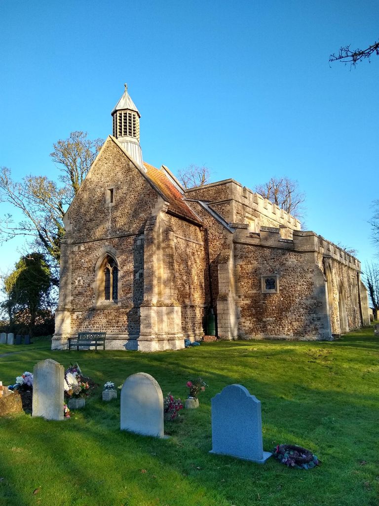
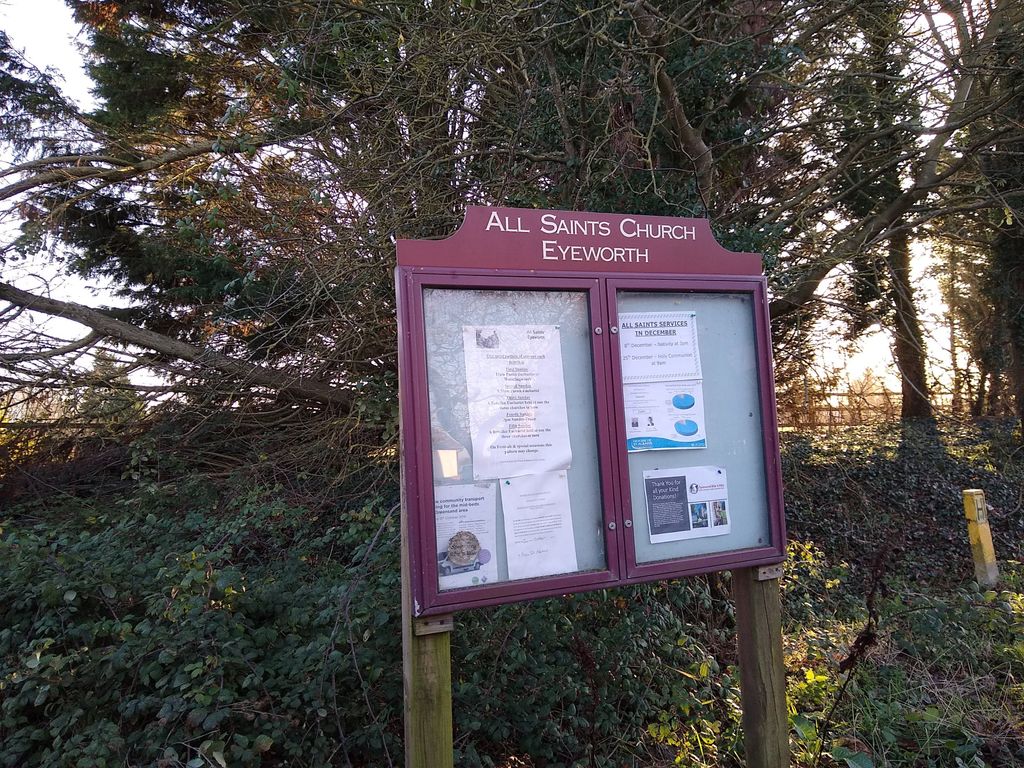
| Location | : | Eyeworth, Central Bedfordshire Unitary Authority, England |
| Coordinate | : | 52.0945940, -0.1770800 |
frequently asked questions (FAQ):
-
Where is All Saints Churchyard?
All Saints Churchyard is located at Eyeworth, Central Bedfordshire Unitary Authority ,Bedfordshire ,England.
-
All Saints Churchyard cemetery's updated grave count on graveviews.com?
4 memorials
-
Where are the coordinates of the All Saints Churchyard?
Latitude: 52.0945940
Longitude: -0.1770800
Nearby Cemetories:
1. St Mary Magdalene Churchyard
Dunton, Central Bedfordshire Unitary Authority, England
Coordinate: 52.0825200, -0.1955600
2. Dunton Cemetery
Dunton, Central Bedfordshire Unitary Authority, England
Coordinate: 52.0820490, -0.1982770
3. St. Mary's Churchyard
Guilden Morden, South Cambridgeshire District, England
Coordinate: 52.0806930, -0.1336810
4. Guilden Morden Burial Ground
Guilden Morden, South Cambridgeshire District, England
Coordinate: 52.0832700, -0.1311000
5. All Saints Churchyard
Sutton, Central Bedfordshire Unitary Authority, England
Coordinate: 52.1126500, -0.2212200
6. Potton Baptist Church (Defunct)
Potton, Central Bedfordshire Unitary Authority, England
Coordinate: 52.1242617, -0.2096524
7. St John the Baptist Churchyard
Cockayne Hatley, Central Bedfordshire Unitary Authority, England
Coordinate: 52.1308660, -0.1663740
8. St Mary the Virgin Churchyard
Potton, Central Bedfordshire Unitary Authority, England
Coordinate: 52.1295800, -0.2066700
9. St Peter and St Paul
Steeple Morden, South Cambridgeshire District, England
Coordinate: 52.0655979, -0.1257247
10. Stratton Way Cemetery
Biggleswade, Central Bedfordshire Unitary Authority, England
Coordinate: 52.0919432, -0.2474864
11. Drove Road Cemetery
Biggleswade, Central Bedfordshire Unitary Authority, England
Coordinate: 52.0895000, -0.2527300
12. St Nicholas Churchyard
Hinxworth, North Hertfordshire District, England
Coordinate: 52.0476210, -0.1970460
13. St Michael and All Angels Churchyard
Abington Pigotts, South Cambridgeshire District, England
Coordinate: 52.0849450, -0.0976970
14. St George Churchyard
Edworth, Central Bedfordshire Unitary Authority, England
Coordinate: 52.0510350, -0.2189810
15. St. Denis Churchyard
East Hatley, South Cambridgeshire District, England
Coordinate: 52.1379956, -0.1233863
16. St Andrew Churchyard
Biggleswade, Central Bedfordshire Unitary Authority, England
Coordinate: 52.0875360, -0.2666970
17. St George Church
Hatley St George, South Cambridgeshire District, England
Coordinate: 52.1437000, -0.1348000
18. St Mary the Virgin Churchyard
Gamlingay, South Cambridgeshire District, England
Coordinate: 52.1549840, -0.1872690
19. Langford Cemetery
Langford, Central Bedfordshire Unitary Authority, England
Coordinate: 52.0640000, -0.2710830
20. St Mary Magdalene's Church
Caldecote, North Hertfordshire District, England
Coordinate: 52.0304700, -0.1989020
21. All Saints Churchyard
Wendy, South Cambridgeshire District, England
Coordinate: 52.1110400, -0.0703100
22. St Andrew Churchyard
Langford, Central Bedfordshire Unitary Authority, England
Coordinate: 52.0583270, -0.2721350
23. All Saints Churchyard
Croydon, South Cambridgeshire District, England
Coordinate: 52.1290100, -0.0796720
24. Sandy Cemetery
Sandy, Central Bedfordshire Unitary Authority, England
Coordinate: 52.1245500, -0.2783300