
| Memorials | : | 0 |
| Location | : | East Winch, Kings Lynn and West Norfolk Borough, England |
| Coordinate | : | 52.7175790, 0.5025340 |
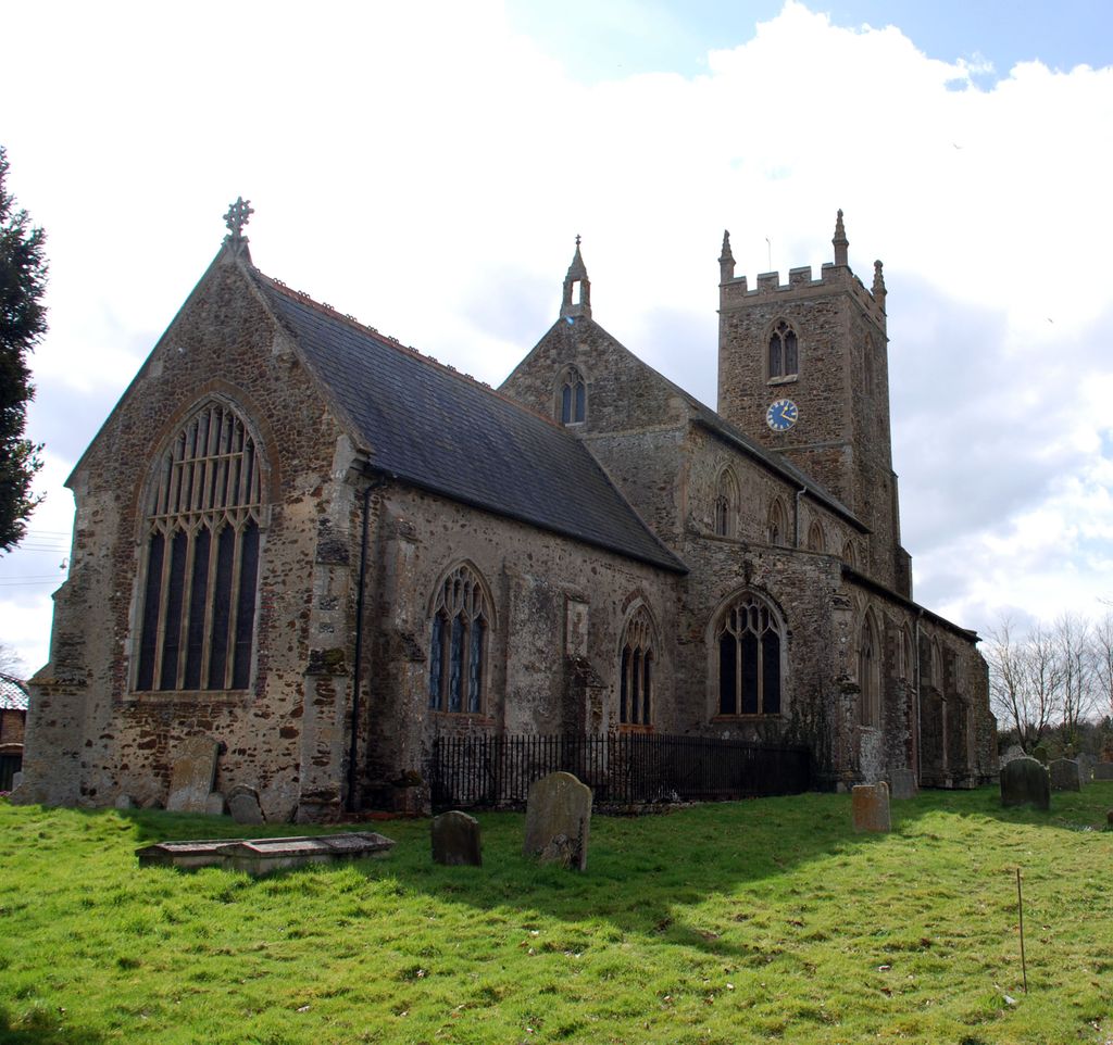
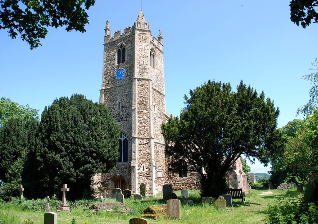
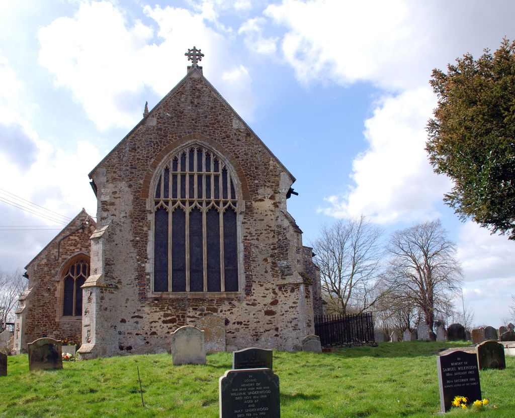
| Description | : | EAST WINCH is a village and parish and station on the Lynn and Dereham Branch railway, 5} miles south-east- by-east from Lynn, in the Western division of the county, hundred and union of Freebridge, Lynn county court district, rural deanery of Lynn and archdeaconry and diocese of Norwich, situated on the Swaffham road. The church of AU Saints is a fine lofty and ancient structure in the Perpendicular style, situated on high ground, having chancel, nave, aisles and a square tower containing 1 bell; it was re-roofed and thoroughly restored in 1S75, and an organ chamber built at the south-east... Read More |
frequently asked questions (FAQ):
-
Where is All Saints Churchyard?
All Saints Churchyard is located at Church Lane East Winch, Kings Lynn and West Norfolk Borough ,Norfolk , PE32 1NQEngland.
-
All Saints Churchyard cemetery's updated grave count on graveviews.com?
0 memorials
-
Where are the coordinates of the All Saints Churchyard?
Latitude: 52.7175790
Longitude: 0.5025340
Nearby Cemetories:
1. All Saints Churchyard
Ashwicken, Kings Lynn and West Norfolk Borough, England
Coordinate: 52.7404620, 0.5146680
2. St Cecilia's Churchyard
West Bilney, Kings Lynn and West Norfolk Borough, England
Coordinate: 52.7079810, 0.5395750
3. Blackborough Priory
Middleton, Kings Lynn and West Norfolk Borough, England
Coordinate: 52.6989000, 0.4749000
4. St Mary's Churchyard
Middleton, Kings Lynn and West Norfolk Borough, England
Coordinate: 52.7162502, 0.4595386
5. St. Mary Magdalene Churchyard
Pentney, Kings Lynn and West Norfolk Borough, England
Coordinate: 52.6950490, 0.5449550
6. Pentney Priory
Pentney, Kings Lynn and West Norfolk Borough, England
Coordinate: 52.6803890, 0.5143830
7. All Saints Churchyard
North Runcton, Kings Lynn and West Norfolk Borough, England
Coordinate: 52.7155370, 0.4360180
8. Mintlyn Crematorium
Bawsey, Kings Lynn and West Norfolk Borough, England
Coordinate: 52.7521490, 0.4577190
9. St Nicholas Churchyard
Gayton, Kings Lynn and West Norfolk Borough, England
Coordinate: 52.7435700, 0.5615600
10. Saint Mary Churchyard
East Walton, Kings Lynn and West Norfolk Borough, England
Coordinate: 52.7146600, 0.5787130
11. St. Mary's Churchyard
Gayton Thorpe, Kings Lynn and West Norfolk Borough, England
Coordinate: 52.7362310, 0.5832080
12. Marham Cemetery
Marham, Kings Lynn and West Norfolk Borough, England
Coordinate: 52.6622260, 0.5287110
13. Saint Botolphs Churchyard
Grimston, Kings Lynn and West Norfolk Borough, England
Coordinate: 52.7671870, 0.5509690
14. All Saints Churchyard
Narborough, Breckland Borough, England
Coordinate: 52.6861790, 0.5825420
15. St. Botolph's Churchyard
Tottenhill, Kings Lynn and West Norfolk Borough, England
Coordinate: 52.6706000, 0.4433000
16. Gayton Road Cemetery
Kings Lynn, Kings Lynn and West Norfolk Borough, England
Coordinate: 52.7566760, 0.4272420
17. Holy Trinity Churchyard
Marham, Kings Lynn and West Norfolk Borough, England
Coordinate: 52.6583800, 0.5236900
18. Shouldham Priory
Shouldham, Kings Lynn and West Norfolk Borough, England
Coordinate: 52.6576070, 0.4836220
19. St Faith Churchyard
Kings Lynn, Kings Lynn and West Norfolk Borough, England
Coordinate: 52.7564300, 0.4232500
20. St Faith's churchyard
Gaywood, Kings Lynn and West Norfolk Borough, England
Coordinate: 52.7563330, 0.4229360
21. King's Lynn Cemetery
Kings Lynn, Kings Lynn and West Norfolk Borough, England
Coordinate: 52.7565800, 0.4230400
22. Hardwick Road Cemetery
Kings Lynn, Kings Lynn and West Norfolk Borough, England
Coordinate: 52.7434580, 0.4046340
23. All Saints Churchyard
Roydon, Kings Lynn and West Norfolk Borough, England
Coordinate: 52.7839110, 0.5176340
24. All Saints Churchyard
Shouldham, Kings Lynn and West Norfolk Borough, England
Coordinate: 52.6515690, 0.4837640