
| Memorials | : | 202 |
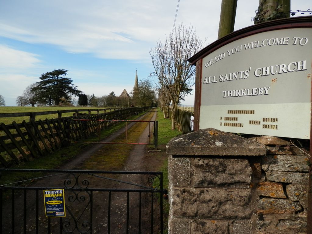
| Location | : | Great Thirkleby, Hambleton District, England |
| Coordinate | : | 54.2020800, -1.2762700 |
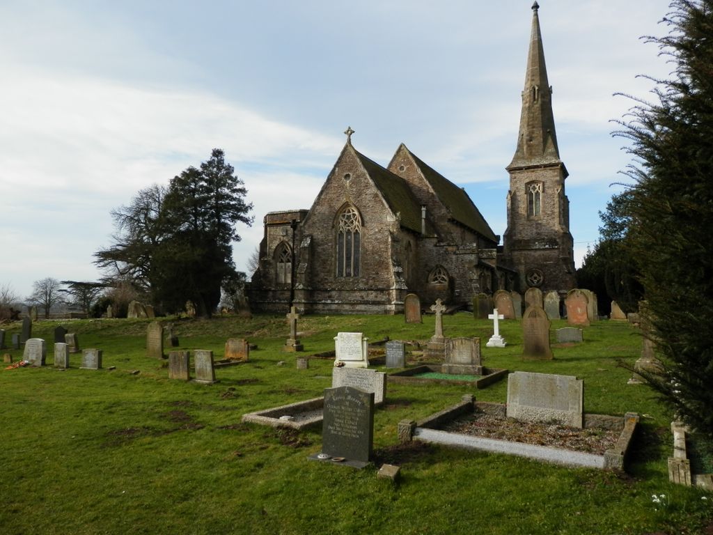
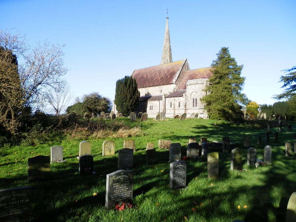
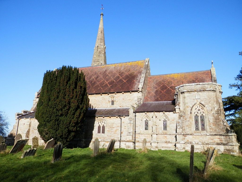
| Description | : | All Saints’ Church is a Grade II* listed building. It was designed by the Victorian architect Edward Buckton Lamb and was built in 1851 by Lady Frankland-Russell of Thirkleby Park, in memory of her husband, on the site of a previous church. The previous church was rebuilt in 1722 on the site of the original 12th century building. The burial vault of the earlier church was retained, but the fine pews were moved to the church of St Andrew's at Blubberhouses (another Frankland-Russell estate church also designed by E.B. Lamb). There are several Frankland memorials and other monumental inscriptions in the... Read More |
frequently asked questions (FAQ):
-
Where is All Saints Churchyard?
All Saints Churchyard is located at Thirkleby High and Low with Osgodby Great Thirkleby, Hambleton District ,North Yorkshire , YO7 2AUEngland.
-
All Saints Churchyard cemetery's updated grave count on graveviews.com?
202 memorials
-
Where are the coordinates of the All Saints Churchyard?
Latitude: 54.2020800
Longitude: -1.2762700
Nearby Cemetories:
1. St Mary Churchyard
Bagby, Hambleton District, England
Coordinate: 54.2192130, -1.2907820
2. St Cuthbert Churchyard
Sessay, Hambleton District, England
Coordinate: 54.1662400, -1.2906070
3. St Mary Churchyard
Kilburn, Hambleton District, England
Coordinate: 54.2102360, -1.2138820
4. St Mary Magdalene Churchyard
Thormanby, Hambleton District, England
Coordinate: 54.1678900, -1.2420600
5. St John the Evangelist Churchyard
Dalton, Hambleton District, England
Coordinate: 54.1806400, -1.3341500
6. St Oswald Churchyard
Sowerby, Hambleton District, England
Coordinate: 54.2261950, -1.3404430
7. Husthwaite Cemetery
Husthwaite, Hambleton District, England
Coordinate: 54.1684400, -1.2142000
8. Wesleyan Methodist Burial Ground
Thirsk, Hambleton District, England
Coordinate: 54.2350990, -1.3408244
9. Friends Burial Ground
Thirsk, Hambleton District, England
Coordinate: 54.2336160, -1.3444510
10. St Nicholas Churchyard
Husthwaite, Hambleton District, England
Coordinate: 54.1692000, -1.2075900
11. St. Mary's Churchyard
Thirsk, Hambleton District, England
Coordinate: 54.2349200, -1.3454900
12. Thirsk Cemetery
Thirsk, Hambleton District, England
Coordinate: 54.2356140, -1.3493790
13. St Felix Churchyard
Felixkirk, Hambleton District, England
Coordinate: 54.2564000, -1.2832000
14. St. Michael's Churchyard
Coxwold, Hambleton District, England
Coordinate: 54.1878500, -1.1847120
15. St Wilfrid Churchyard
South Kilvington, Hambleton District, England
Coordinate: 54.2499690, -1.3481640
16. Newburgh Priory
Coxwold, Hambleton District, England
Coordinate: 54.1811000, -1.1731000
17. St. Mary and All Saints Churchyard
Cundall, Harrogate Borough, England
Coordinate: 54.1518340, -1.3542490
18. Topcliffe Cemetery
Topcliffe, Hambleton District, England
Coordinate: 54.1774200, -1.3846100
19. Byland Abbey
Coxwold, Hambleton District, England
Coordinate: 54.2034480, -1.1589660
20. St Columba Churchyard
Topcliffe, Hambleton District, England
Coordinate: 54.1785070, -1.3892590
21. St Mary the Virgin Churchyard
Raskelf, Hambleton District, England
Coordinate: 54.1305760, -1.2520440
22. Holy Trinity Churchyard
Boltby, Hambleton District, England
Coordinate: 54.2732340, -1.2480700
23. St Lawrence Churchyard
Carlton Miniott, Hambleton District, England
Coordinate: 54.2232500, -1.3958700
24. St Michael Churchyard
Cold Kirby, Ryedale District, England
Coordinate: 54.2534580, -1.1827120