
| Memorials | : | 1 |
| Location | : | Thirsk, Hambleton District, England |
| Coordinate | : | 54.2336160, -1.3444510 |
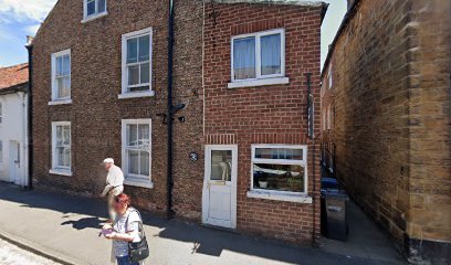
| Description | : | The burial ground at Thirsk has been restored, along with the historic Meeting House in Kirkgate. It retains its identity with headstones laid out and stood along the walls, and also serves as a garden. With the agreement of the members, ashes of those associated with the Meeting may be scattered on the ground. |
frequently asked questions (FAQ):
-
Where is Friends Burial Ground?
Friends Burial Ground is located at Kirkgate Thirsk, Hambleton District ,North Yorkshire , YO7 1PLEngland.
-
Friends Burial Ground cemetery's updated grave count on graveviews.com?
1 memorials
-
Where are the coordinates of the Friends Burial Ground?
Latitude: 54.2336160
Longitude: -1.3444510
Nearby Cemetories:
1. St. Mary's Churchyard
Thirsk, Hambleton District, England
Coordinate: 54.2349200, -1.3454900
2. Wesleyan Methodist Burial Ground
Thirsk, Hambleton District, England
Coordinate: 54.2350990, -1.3408244
3. Thirsk Cemetery
Thirsk, Hambleton District, England
Coordinate: 54.2356140, -1.3493790
4. St Oswald Churchyard
Sowerby, Hambleton District, England
Coordinate: 54.2261950, -1.3404430
5. St Wilfrid Churchyard
South Kilvington, Hambleton District, England
Coordinate: 54.2499690, -1.3481640
6. St Lawrence Churchyard
Carlton Miniott, Hambleton District, England
Coordinate: 54.2232500, -1.3958700
7. St Mary Churchyard
Bagby, Hambleton District, England
Coordinate: 54.2192130, -1.2907820
8. St Leonard Churchyard
Thornton-le-Street, Hambleton District, England
Coordinate: 54.2700040, -1.3653200
9. St Leonard Church Cemetery
Sandhutton, Hambleton District, England
Coordinate: 54.2325700, -1.4110600
10. St Leonard Churchyard
Sandhutton, Hambleton District, England
Coordinate: 54.2326000, -1.4121600
11. St Felix Churchyard
Felixkirk, Hambleton District, England
Coordinate: 54.2564000, -1.2832000
12. All Saints Churchyard
Great Thirkleby, Hambleton District, England
Coordinate: 54.2020800, -1.2762700
13. St John the Baptist Churchyard
Kirby Wiske, Hambleton District, England
Coordinate: 54.2576320, -1.4238510
14. St John the Evangelist Churchyard
Dalton, Hambleton District, England
Coordinate: 54.1806400, -1.3341500
15. St. Wilfrid's Churchyard
Kirby Knowle, Hambleton District, England
Coordinate: 54.2788910, -1.2823040
16. St John Churchyard
Skipton-on-Swale, Hambleton District, England
Coordinate: 54.2130000, -1.4379000
17. Topcliffe Cemetery
Topcliffe, Hambleton District, England
Coordinate: 54.1774200, -1.3846100
18. St Columba Churchyard
Topcliffe, Hambleton District, England
Coordinate: 54.1785070, -1.3892590
19. St. Barnabas Church Cemetery
Thornton-le-Moor, Hambleton District, England
Coordinate: 54.2874720, -1.4011833
20. Holy Trinity Churchyard
Boltby, Hambleton District, England
Coordinate: 54.2732340, -1.2480700
21. St Andrew Churchyard
South Otterington, Hambleton District, England
Coordinate: 54.2823100, -1.4311300
22. St James Churchyard
Baldersby, Harrogate Borough, England
Coordinate: 54.1867500, -1.4405600
23. St Cuthbert Churchyard
Sessay, Hambleton District, England
Coordinate: 54.1662400, -1.2906070
24. All Saints Churchyard
Pickhill, Hambleton District, England
Coordinate: 54.2470500, -1.4700700