
| Memorials | : | 0 |
| Location | : | Coxwold, Hambleton District, England |
| Coordinate | : | 54.1811000, -1.1731000 |
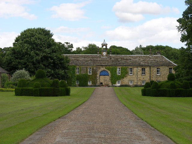
| Description | : | Augustinian priory was founded on lands originally granted by William the Conqueror to Robert de Mowbray. Roger de Mowbray established the Priory in 1145. |
frequently asked questions (FAQ):
-
Where is Newburgh Priory?
Newburgh Priory is located at Coxwold, Hambleton District ,North Yorkshire , YO61 4ASEngland.
-
Newburgh Priory cemetery's updated grave count on graveviews.com?
0 memorials
-
Where are the coordinates of the Newburgh Priory?
Latitude: 54.1811000
Longitude: -1.1731000
Nearby Cemetories:
1. St. Michael's Churchyard
Coxwold, Hambleton District, England
Coordinate: 54.1878500, -1.1847120
2. St Nicholas Churchyard
Husthwaite, Hambleton District, England
Coordinate: 54.1692000, -1.2075900
3. Byland Abbey
Coxwold, Hambleton District, England
Coordinate: 54.2034480, -1.1589660
4. Husthwaite Cemetery
Husthwaite, Hambleton District, England
Coordinate: 54.1684400, -1.2142000
5. Ampleforth Friends Burial Ground
Ampleforth, Ryedale District, England
Coordinate: 54.2023420, -1.1213330
6. St Mary Churchyard
Kilburn, Hambleton District, England
Coordinate: 54.2102360, -1.2138820
7. St Mary Magdalene Churchyard
Thormanby, Hambleton District, England
Coordinate: 54.1678900, -1.2420600
8. St Hilda Churchyard
Ampleforth, Ryedale District, England
Coordinate: 54.2000630, -1.1075590
9. Holy Trinity Churchyard
Yearsley, Hambleton District, England
Coordinate: 54.1619100, -1.1052300
10. Our Lady & St Benedict RC Churchyard
Ampleforth, Ryedale District, England
Coordinate: 54.2009700, -1.1055400
11. St Cuthbert Churchyard
Crayke, Hambleton District, England
Coordinate: 54.1285740, -1.1441370
12. Ampleforth Abbey
Ampleforth, Ryedale District, England
Coordinate: 54.2019630, -1.0838000
13. Ampleforth Abbey - Monk's Wood
Ampleforth, Ryedale District, England
Coordinate: 54.2028689, -1.0841344
14. St John the Baptist and All Saints Churchyard
Easingwold, Hambleton District, England
Coordinate: 54.1235320, -1.1973170
15. All Saints Churchyard
Great Thirkleby, Hambleton District, England
Coordinate: 54.2020800, -1.2762700
16. Saint Mary’s Churchyard
Scawton, Ryedale District, England
Coordinate: 54.2451000, -1.1591000
17. All Saints Churchyard
Brandsby, Hambleton District, England
Coordinate: 54.1397200, -1.0853500
18. Holy Cross Churchyard
Gilling East, Ryedale District, England
Coordinate: 54.1841290, -1.0580460
19. St Mary the Virgin Churchyard
Raskelf, Hambleton District, England
Coordinate: 54.1305760, -1.2520440
20. Gilling New Churchyard
Gilling East, Ryedale District, England
Coordinate: 54.1856070, -1.0559535
21. St Cuthbert Churchyard
Sessay, Hambleton District, England
Coordinate: 54.1662400, -1.2906070
22. St Michael Churchyard
Cold Kirby, Ryedale District, England
Coordinate: 54.2534580, -1.1827120
23. St Oswald Churchyard
Oswaldkirk, Ryedale District, England
Coordinate: 54.2022340, -1.0495510
24. St Mary Churchyard
Bagby, Hambleton District, England
Coordinate: 54.2192130, -1.2907820