
| Memorials | : | 3 |
| Location | : | Thormanby, Hambleton District, England |
| Coordinate | : | 54.1678900, -1.2420600 |
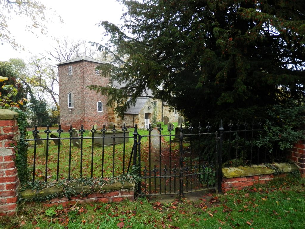
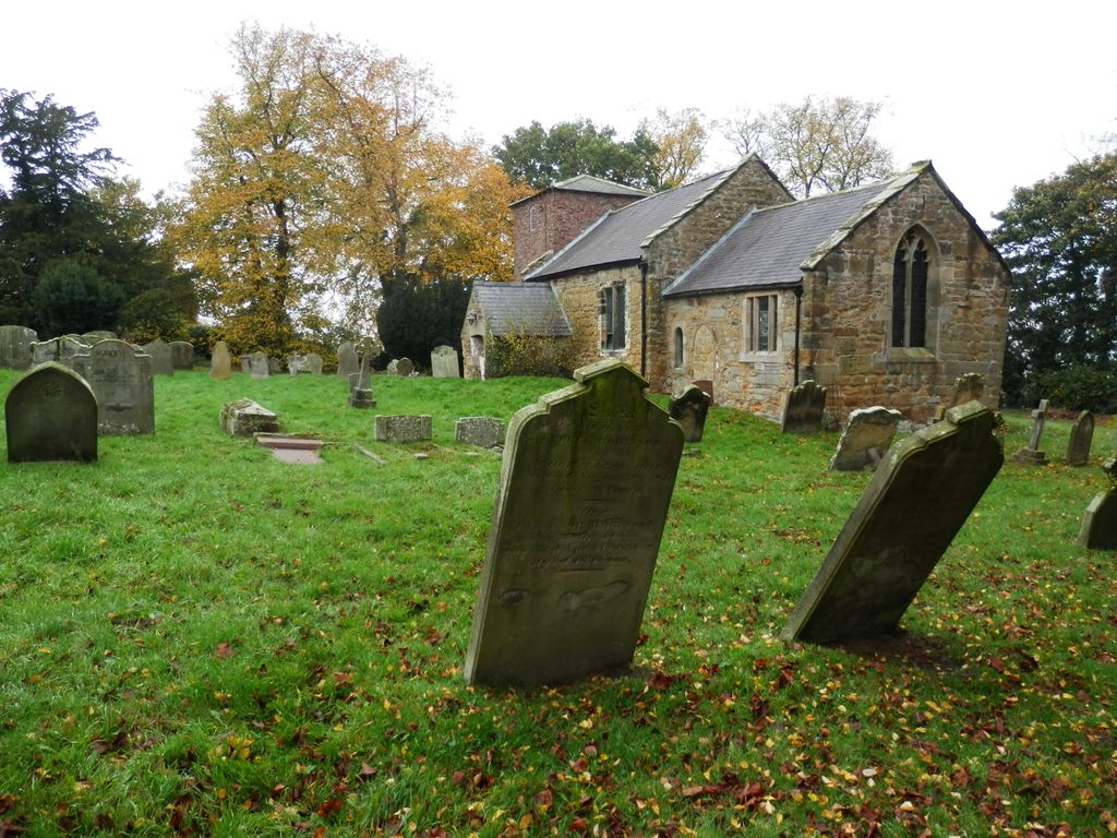
| Description | : | Thormanby is a village and civil parish in Hambleton district of North Yorkshire, England. It lies on the A19 approximately half-way between Easingwold and Thirsk and about 14 miles (23 km) south east of the county town of Northallerton. The church of St Mary Magdalene is a Grade II* listed building. It was built in the 12th century and has been subject to frequent changes up to 1955. The church stands a short distance east of the village on Church Lane. Older headstones in the small churchyard are mostly to the South and South East; more recent ones to the North East. |
frequently asked questions (FAQ):
-
Where is St Mary Magdalene Churchyard?
St Mary Magdalene Churchyard is located at Church Lane Thormanby, Hambleton District ,North Yorkshire , YO61 4NNEngland.
-
St Mary Magdalene Churchyard cemetery's updated grave count on graveviews.com?
3 memorials
-
Where are the coordinates of the St Mary Magdalene Churchyard?
Latitude: 54.1678900
Longitude: -1.2420600

Nearby Cemetories:
1. Husthwaite Cemetery
Husthwaite, Hambleton District, England
Coordinate: 54.1684400, -1.2142000
2. St Nicholas Churchyard
Husthwaite, Hambleton District, England
Coordinate: 54.1692000, -1.2075900
3. St Cuthbert Churchyard
Sessay, Hambleton District, England
Coordinate: 54.1662400, -1.2906070
4. St Mary the Virgin Churchyard
Raskelf, Hambleton District, England
Coordinate: 54.1305760, -1.2520440
5. St. Michael's Churchyard
Coxwold, Hambleton District, England
Coordinate: 54.1878500, -1.1847120
6. All Saints Churchyard
Great Thirkleby, Hambleton District, England
Coordinate: 54.2020800, -1.2762700
7. Newburgh Priory
Coxwold, Hambleton District, England
Coordinate: 54.1811000, -1.1731000
8. St Mary Churchyard
Kilburn, Hambleton District, England
Coordinate: 54.2102360, -1.2138820
9. St John the Baptist and All Saints Churchyard
Easingwold, Hambleton District, England
Coordinate: 54.1235320, -1.1973170
10. St John the Evangelist Churchyard
Dalton, Hambleton District, England
Coordinate: 54.1806400, -1.3341500
11. St Mary Churchyard
Bagby, Hambleton District, England
Coordinate: 54.2192130, -1.2907820
12. Byland Abbey
Coxwold, Hambleton District, England
Coordinate: 54.2034480, -1.1589660
13. St. Mary and All Saints Churchyard
Cundall, Harrogate Borough, England
Coordinate: 54.1518340, -1.3542490
14. St Peter Churchyard
Brafferton, Hambleton District, England
Coordinate: 54.1252600, -1.3337300
15. St Cuthbert Churchyard
Crayke, Hambleton District, England
Coordinate: 54.1285740, -1.1441370
16. Ampleforth Friends Burial Ground
Ampleforth, Ryedale District, England
Coordinate: 54.2023420, -1.1213330
17. Holy Trinity Churchyard
Yearsley, Hambleton District, England
Coordinate: 54.1619100, -1.1052300
18. St Oswald Churchyard
Sowerby, Hambleton District, England
Coordinate: 54.2261950, -1.3404430
19. Topcliffe Cemetery
Topcliffe, Hambleton District, England
Coordinate: 54.1774200, -1.3846100
20. St Hilda Churchyard
Ampleforth, Ryedale District, England
Coordinate: 54.2000630, -1.1075590
21. St Mary Churchyard
Alne, Hambleton District, England
Coordinate: 54.0814400, -1.2438800
22. Our Lady & St Benedict RC Churchyard
Ampleforth, Ryedale District, England
Coordinate: 54.2009700, -1.1055400
23. St Columba Churchyard
Topcliffe, Hambleton District, England
Coordinate: 54.1785070, -1.3892590
24. Wesleyan Methodist Burial Ground
Thirsk, Hambleton District, England
Coordinate: 54.2350990, -1.3408244